Bijanbari
| Bijanbari | |
|---|---|
| Town | |
 Bijanbari Location in West Bengal, India | |
| Coordinates: 27°02′N 88°07′E / 27.04°N 88.11°ECoordinates: 27°02′N 88°07′E / 27.04°N 88.11°E | |
| Country |
|
| State | West Bengal |
| District | Darjeeling |
| Elevation | 760 m (2,490 ft) |
| Languages | |
| • Official | Nepali, English |
| Time zone | IST (UTC+5:30) |
| Lok Sabha constituency | Darjeeling |
| Vidhan Sabha constituency | Darjeeling |
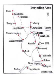
Bijanbari is a small town lying to the east of Darjeeling in the state of West Bengal, India.
Geography
Bijanbari lies in a valley at an altitude of 760 m above sea level. The Little Rangeet River (Chota Rangeet) flows near this town.It came to limelight because of give away of bridge over Rangeet River on 22 Oct 2011. 33 People died and several injured.
Administration
Bijanbari is the headquarters of the Darjeeling Pulbazar development block. The nearest police station is at Pulbazar.
Agriculture
Agriculture is the main industry in Bijanbari and the surrounding areas. The valley produces potatoes, cardamom, rice, maize, millets, peas, beans, squash, cauliflower, cabbages, tomatoes and oranges.
Education
Bijanbari has three private schools and a government-run school up to the 12th standard. A government degree college was started in October 1995.
Government School - Vidyasagar Higher Secondary School.
Private Schools - Little Rangit English School, Vidya Jyoti Academy and SAPTARSHI ACADEMY.

| ||||||||||||||||||||||||||||||||