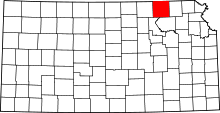
Bigelow, Kansas
Bigelow was a town in Marshall County, Kansas. It was located six and a half miles southwest of Frankfort. It was founded in 1881[2] and named for General Alfred Bigelow.[3] It was known for its limestone quarries and peaked in population in 1910 at 200.[4] The post office closed in 1960 and the town was demolished during the construction of Tuttle Creek Lake. All that remains is a historical marker at the intersection of 17th and Zenith Roads and Antioch Cemetery.
References
- ↑ "US Board on Geographic Names". United States Geological Survey. 2007-10-25. Retrieved 2008-01-31.
- ↑ Blackmar, Frank Wilson (1912). Kansas: A Cyclopedia of State History, Embracing Events, Institutions, Industries, Counties, Cities, Towns, Prominent Persons, Etc. Standard Publishing Company. p. 180.
- ↑ Foster, Emma Elizabeth Calderhead (1917). History of Marshall County, Kansas: Its People, Industries, and Institutions. B.F. Bowen. p. 162.
- ↑ Faded Dreams: More Ghost Towns of Kansas by Daniel Fitzgerald. University Press of Kansas. Lawrence, Kansas. 1994

