Bidhwan
| Bidhwan बिधवाण or बिधवान | |
|---|---|
| Village | |
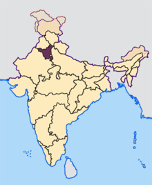
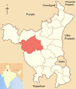
 Bidhwan Location in Haryana, India | |
| Coordinates: 28°40′38″N 75°50′15″E / 28.67722°N 75.83750°ECoordinates: 28°40′38″N 75°50′15″E / 28.67722°N 75.83750°E | |
| Country |
|
| State | Haryana |
| District | Bhiwani |
| Founded by | Binja Bishnoi. |
| Named for | Binja |
| Elevation | 210 m (690 ft) |
| Population (2011) | |
| • Total | 2,868 |
| Languages | |
| • Official | Hindi |
| Time zone | IST (UTC+5:30) |
| PIN | 127046[1] |
Bidhwan (Hindi: बिधवाण or बिधवान ) is a village and administrative unit with a democratically elected panchayat samiti (local council) in the Siwani Tehsil of Bhiwani District under Bhiwani-Mahendragarh Lok Sabha constituency and Hisar Division of the Haryana state.[2]
It is situated 53 kilometres (33 mi) from Hisar on the Hisar-Rajgarh road and 55 kilometres (34 mi) from Bhiwani. Location map of Bidhwan is here.
History
Jaglan Zaildar (90 villages) and Jaglan Lambardar
Bidhwan is seat of the former Jaglan Zail that was headed by the Zaildar from influential Jaglan clan who during the British Raj ruled over 90 revenue villages of Princely state called Loharu State. Descendents of whom still live in the village and still hold the position of Lambardar.
Nearby archaeological sites
Nearby Indus Valley Civilization archaeological sites are Banawali, Lohari Ragho, Masudpur, Rakhigarhi, Siswal all with Hissar district as well as Burj and Bhirrana and Kunal and Balu in Fatehabad[3] and Mitathal and Naurangabad in Bhiwani district. Another archaeological site is Agroha Mound.
Administration
Currently, Bidhwan is under Bhiwani Zilla Panchayat and has its own unreserved Gram Panchayat under Gram Panchayat Smiti code 244115[2]and 2011 census village code 061301 and village name Bidhwan (113).[4] As of August 2013, Balbir Singh is the Sarpanch of the Gram Panchayat Smiti.[5] There is a Patwari (government land record officer), an ADO (Agriculture Development Officer),a Rural Health Officer (RHO), and an Anganbadi Worker based at Bidhwan.[6]
Government schemes
Bidhwan is covered by the rural housing development plan called Priyadarshini Awas Yojna,[7][8] rural electrification plan called Rajiv Gandhi Grameen Vidyutikaran Yojna,[9] rural employment plan called National Rural Employment Guarantee Act (NREGA)[10] and rural employment plan called Mahatma Gandhi National Rural Employment Guarantee Act (MANEGRA).[11]
Demographics

Religions in Bidhwan as of 2011.
| Category | Population |
|---|---|
| Number of Household | 750 |
| Total Population | 4,500 |
| Scheduled Caste | 229 |
| Literate Population | 2,016 |
As per a 2010 official report,[12] Bidhwan has 750 households with a total population of 4500, with 229 Scheduled Caste inhabitants, with 2016 literate residents and 1890 cell-phone connections. The residents are Hindu.
Jat gotras
The following Jat gotras are found in the village.
Other gotras
- Bhardwaj - a Brahman gotra
- Goyal - a Baniya/vaishya gotra
- Jangra - a Khati gotra
- Nimal - a Harijan gotra
Education
Bidhwan has a Government High School[13] as well as a private school called AVN Middle School.
There are three universities at Hisar (55 km) and additional educational institutes at Hisar and Bhiwani (53 km).
Transportation
Bidhwan is well connected by the paved bitumen road. It lies from 7 km Jhumpa Khurd, 16 km Bahal, 19 km Siwani, 27 Rajgarh (Rajasthan), 31 Kairu, 53 km Hissar, 55 km Hansi, 47 km Pilani, 53 km from Bhiwani, and 58 km from Bhiwani, 165 km Delhi and 284 km from state capital Chandigarh.[14]
Train connectivity
Nearest train stations are 7 km Jhumpa Khurd, 16 km Bahal, 19 km Siwani, 27 Rajgarh. Nearest major junctions are 53 km (33 mi) at Hisar, India city and 55 km at Bhiwani city.
Airport connectivity
Hisar Airport, the nearest functional airport and flying training club is 55 km (34 mi) away. Currently no commercial domestic or international flights from this airport. Nearest domestic and international airport is 165 km (103 mi) at Delhi.
Geography
Bidhwan is at the altitude of 210 m or 689 feet.[15] Bidhwan is mainly desert with scattered low sand dunes.[5] Bidhwan has water ponds for the cattle. The fields are irrigated by the Canal.
Climate and ecology
Climate
Main ecological issues are desertification, deforestation, encroachment and land grabbing of common Panchayat forest and grazing land called "bani".[5]
| Climate data for Hisar (1951–1980) | |||||||||||||
|---|---|---|---|---|---|---|---|---|---|---|---|---|---|
| Month | Jan | Feb | Mar | Apr | May | Jun | Jul | Aug | Sep | Oct | Nov | Dec | Year |
| Average high °C (°F) | 21.4 (70.5) |
24.7 (76.5) |
30.5 (86.9) |
36.8 (98.2) |
40.7 (105.3) |
41.0 (105.8) |
37.0 (98.6) |
35.1 (95.2) |
35.4 (95.7) |
34.3 (93.7) |
29.1 (84.4) |
23.5 (74.3) |
32.5 (90.5) |
| Average low °C (°F) | 05.5 (41.9) |
08.3 (46.9) |
13.7 (56.7) |
19.4 (66.9) |
24.2 (75.6) |
27.7 (81.9) |
27.0 (80.6) |
26.0 (78.8) |
23.7 (74.7) |
17.8 (64) |
11.0 (51.8) |
06.5 (43.7) |
17.6 (63.7) |
| Average rainfall mm (inches) | 013.4 (0.528) |
015.5 (0.61) |
012.1 (0.476) |
005.6 (0.22) |
020.3 (0.799) |
042.9 (1.689) |
140.7 (5.539) |
146.9 (5.783) |
065.0 (2.559) |
014.8 (0.583) |
006.1 (0.24) |
007.3 (0.287) |
490.6 (19.313) |
| Avg. rainy days (≥ 1.0 mm) | 1.1 | 1.2 | 1.3 | 0.6 | 1.3 | 3.0 | 6.9 | 7.5 | 3.5 | 0.9 | 0.5 | 0.7 | 28.5 |
| Source: India Meteorological Department[16] | |||||||||||||
Fauna
Animals and birds of various species are found including Sparrow, large Indian Parakeet, Parrot, Crow, Rat, Rabbit, nilgai, Pied Crested Cuckoo, Koel, Pheasant, kingfisher, Bulbul and Indian Magpie Robin.[5]
Gallery
-
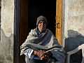
Late Chairman Subedar Ch. Surat Singh Jaglan - national sports Gold Medal winner
-
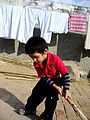
Jat child playing in the village
-

Jat children at a home in the village
-
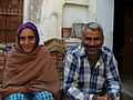
Jat couple from the village
-

Family from the village
See also
References
- ↑ India Pincodes
- ↑ 2.0 2.1 Panchayats of Siwani, Bhiwani, Haryana. Retrieved 2010-09-22.
- ↑ Archaeology report. University of Cambridge. Retrieved 2010-09-22.
- ↑ Haryana Panchayats
- ↑ 5.0 5.1 5.2 5.3 Haryana Panchayat. haryanapanchayat. Retrieved 2010-09-22.
- ↑ Child Welfare, Harayana
- ↑ Priyadarshini Awas Yojna Benificiary list
- ↑ Rural Housing
- ↑ Rural electrification
- ↑ NREGA report
- ↑ MANEGRA report
- ↑ Bidhwan village info
- ↑ Bidhwan Govt High School
- ↑ Pincodes of India
- ↑ Villages of India
- ↑ "Climatological table of Hisar, India". India Meteorological Department. Retrieved 19 April 2012.
External links
| Wikimedia Commons has media related to Bidhwan. |
- Haryana Government e-Services
- Bhiwani District Website
- e-Disha e-services
- Government of India e-services
| ||||||||||||||||||||||||||||||||||||||||||||||||||||||||||||||
| ||||||||||||||||||||||||||
| ||||||||||||||