Bhulbhule
| Bhulbhule भुल्भुले sagar village | |
|---|---|
| Village development committee | |
 Bhulbhule Location in Nepal | |
| Coordinates: 28°17′24″N 84°22′19″E / 28.290°N 84.372°ECoordinates: 28°17′24″N 84°22′19″E / 28.290°N 84.372°E | |
| Country |
|
| Zone | Gandaki Zone |
| District | Lamjung District |
| Elevation | 840 m (2,760 ft) |
| Population (1991) | |
| • Total | 3,079 |
| Time zone | Nepal Time (UTC+5:45) |
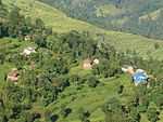
Bhulbhule is a village development committee in Lamjung District in the Gandaki Zone of northern-central Nepal. At the time of the 1991 Nepal census it had a population of 3079 people living in 626 individual households.[1]
References
- ↑ "Nepal Census 2001", Nepal's Village Development Committees (Digital Himalaya), retrieved 15 November 2009.