Bhopal district
This article is about the district.
For its eponymous headquarters, see
Bhopal.
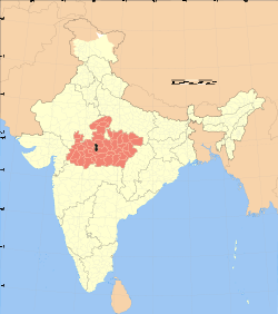
Bhopal District is a district of Madhya Pradesh state in central India. The city of Bhopal serves as its administrative headquarters. The district is part of Bhopal Division.
Demographics
According to the 2011 census Bhopal District has a population of 23,68,145,[3] roughly equal to the nation of Latvia[4] or the US state of New Mexico.[5] This gives it a ranking of 189th in India (out of a total of 640).[3] The district has a population density of 854 inhabitants per square kilometre (2,210/sq mi) .[3] Its population growth rate over the decade 2001-2011 was 28.46%.[3] Bhopal has a sex ratio of 911 females for every 1000 males,[3] and a literacy rate of 82.26%.[3]
The district has an area of 2,772 km². According to the provisional data of the 2011 census, population of the district is 23,68,145 (12,39,378 males and 11,28,767 females) with a sex ratio of 911 females per 1000 males. Population density is 854/km²[1] Total literacy rate is 82.3% (male 87.4% and female 76.6%).[2]
Geography
Bhopal District is bounded by the districts of Guna to the north, Vidisha to the northeast, Raisen to the east and southeast, Sehore to the southwest and west, and Rajgarh to the northwest.
The city of Bhopal lies in the southern part of the district, and the majority of the population resides within Bhopal municipality. The town of Berasia lies in the northern part of the district.
Climate
| Bhopal
|
|---|
| Climate chart (explanation) |
|---|
| J | F | M | A | M | J | J | A | S | O | N | D |
|
|
|
|
|
|
|
|
|
|
|
|
| Average max. and min. temperatures in °C |
| Precipitation totals in mm | | Source: IMD |
|
| Imperial conversion |
|---|
| J | F | M | A | M | J | J | A | S | O | N | D |
|
|
|
|
|
|
|
|
|
|
|
|
| Average max. and min. temperatures in °F |
| Precipitation totals in inches |
|
References
- ↑ 1.0 1.1 1.2 "Distribution of population, sex ratio, density and decadal growth rate of population - State and District : 2011". Office of The Registrar General & Census Commissioner, Government of India. Retrieved 18 July 2011.
- ↑ 2.0 2.1 "Total Population, child population in the age group 0-6,literates and literacy rates by sex: 2011". Office of The Registrar General & Census Commissioner, Government of India. Retrieved 18 July 2011.
- ↑ 3.0 3.1 3.2 3.3 3.4 3.5 "District Census 2011". Census2011.co.in. 2011. Retrieved 2011-09-30.
- ↑ US Directorate of Intelligence. "Country Comparison:Population". Retrieved 2011-10-01.
Latvia
22,04,708
July 2011 est.
- ↑ "2010 Resident Population Data". U. S. Census Bureau. Retrieved 2011-09-30.
New Mexico - 2,059,179
External links
|
|---|
| | | | State symbols | |
|---|
| | Governance | |
|---|
| | Divisions |
- Bhopal
- Morena
- Gwalior
- Indore
- Jabalpur
- Hoshangabad
- Rewa
- Sagar
- Shahdol
- Ujjain
|
|---|
| | Districts | |
|---|
| | Major cities | |
|---|
|
Coordinates: 23°16′00″N 77°24′00″E / 23.2667°N 77.4°E / 23.2667; 77.4