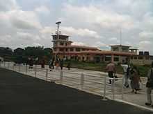
Bhadrapur Airport
| Bhadrapur Airport Chandragadhi Airport | |||||||||||
|---|---|---|---|---|---|---|---|---|---|---|---|
 | |||||||||||
 Bhadrapur | |||||||||||
| Summary | |||||||||||
| Airport type | Public | ||||||||||
| Operator | Government | ||||||||||
| Serves | Bhadrapur / Chandragadhi, Nepal | ||||||||||
| Elevation AMSL | 300 ft / 91 m | ||||||||||
| Coordinates | 26°34′14″N 088°04′46″E / 26.57056°N 88.07944°E | ||||||||||
| Runways | |||||||||||
| |||||||||||
Bhadrapur Airport (IATA: BDP, ICAO: VNCG), also known as Chandragadhi Airport,[1] is an airport serving Bhadrapur and Chandragadhi,[2] both towns in the Jhapa district in the Mechi zone in Nepal.
Facilities
The airport is at 300 feet (91 m) elevation. It has one runway designated 10/28 with an asphalt surface measuring 1,209 by 29 metres (3,967 ft × 95 ft).[1]
The airport is about 3 hours by road from Darjeeling via the Pashupatinagar-Ilam route. There are border formalities at Pashupatinagar.
The airport is capable to handle aircraft from the Nepalese Army Air Service.
Airlines and destinations
| Airlines | Destinations |
|---|---|
| Buddha Air | Kathmandu [3] |
| Yeti Airlines | Kathmandu[4] |
References
- ↑ 1.0 1.1 1.2 Airport information for VNCG from DAFIF (effective October 2006)
- ↑ 2.0 2.1 Airport information for Chandragadhi / Bhadrapur, Nepal (VNCG / BDP) at Great Circle Mapper. Source: DAFIF (effective Oct. 2006).
- ↑ "Flying Schedule". Buddha Air.
- ↑ "Scheduled flights". Yeti Airlines. Retrieved 6 June 2010.
BUDDHA AIR(ATR72)
See Also

A busy hour at Bhadrapur airport