Bethanga, Victoria
| Bethanga Victoria | |
|---|---|
|
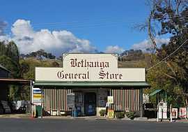
General store | |
 Bethanga Location in Shire of Towong, Victoria | |
| Coordinates | 36°07′S 147°06′E / 36.117°S 147.100°ECoordinates: 36°07′S 147°06′E / 36.117°S 147.100°E |
| Population | 589 (2006 census)[1] |
| Postcode(s) | 3691 |
| Location |
|
| LGA(s) | Shire of Towong |
| State electorate(s) | Benambra |
| Federal Division(s) | Indi |
Bethanga is a town in north-eastern Victoria, Australia in the Shire of Towong local government area, 390 kilometres (242 mi) from the state capital, Melbourne. At the 2006 census, Bethanga had a population of 589.[1]
History
Mining prior to 1876
Prior to 1876 gold mining in the Bethanga district occurred to the north of the town, known as the 'Talgarno diggings' . Alluvial gold fields were worked at Ruby Creek, Gold Creek and Jarvis Creek. The opening of the Bethanga goldfields began with the discovery of a gold-bearing quartz reef on New Years Day 1876. The 'Gift' mine site is located south east of Kurrajong Gap lookout at the entrance to Bethanga township.
Mining 1876 - 1910
Bethanga was established as a result of the discovery of gold. Gold was first reported in the Bethanga area in 1852, but it was not until 1876 that the discovery of a reef led to the development of the Bethanga goldfields.
The Great Eastern Copper Smelting Works was opened in 1878,
The Post Office opened on 22 July 1876, was renamed Granya in 1879 when a new office named Bethanga opened nearby which closed in 1952. The Bethanga Lower office was renamed Bethanga in 1984.[2]
Due to the nature of the gold-bearing quartz reef, the gold was difficult to extract and the discovery of copper led to a change in focus. It was not until the early 1890s that an efficient technique for extracting the gold from the ore was discovered, and once again gold became the primary focus, with copper a by-product. Bethanga was removed from the list of goldfields in 1912, however some mining activity has taken place since.[3]
Geology and geomorphology
The Bethanga township is located in the Lachlan orogen. Compression and folding of Ordovician sediments during the Benambram orogeny, resulted in the creation of the gneisses and schists found in the Bethanga area. Bethanga gneisses are found on the hilltops and ridges around the Bethanga area. Auriferous quartz reefs which occur through the gneiss were mined over a period from 1875 to about 1911.
The town today
The town is located close to Lake Hume, attracting both retired people and commuters to nearby Albury-Wodonga.
Facilities in Bethanga include a combined general store/cafe/take away food store, sports ground, hotel/pub (The Court House Hotel although the court house is long gone), primary school and three churches.
There is also a (limited hours) police station [4] and a local volunteer CFA depot (Hume Region, District 24. [5]
Golfers play at the Bethanga and District Golf Club (a seasonal club open only April to September) on Bethanga-Tallangatta Road.[6] [7]
References
- ↑ 1.0 1.1 Australian Bureau of Statistics (25 October 2007). "Bethanga (State Suburb)". 2006 Census QuickStats. Retrieved 24 March 2010.
- ↑ Premier Postal History. "Post Office List". Retrieved 2008-04-11.
- ↑ "Bethanga Goldfield" (PDF). Heritage Victoria. Archived from the original (PDF) on 2007-09-04. Retrieved 2007-06-17.
- ↑ http://www.police.vic.gov.au/content.asp?Document_ID=345
- ↑ "Bethanga". Towong Shire Council. Retrieved 2007-06-17.
- ↑ Golf Select. "Bethanga and District". Retrieved 2009-05-11.
- ↑ http://golfer.com.au/directory/bethanga-and-district-golf-club-victoria/1427
External links
![]() Media related to Bethanga, Victoria at Wikimedia Commons
Media related to Bethanga, Victoria at Wikimedia Commons
| ||||||