Berriwillock
| Berriwillock Victoria | |||||||||||||
|---|---|---|---|---|---|---|---|---|---|---|---|---|---|
|
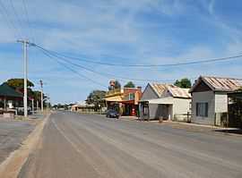
Taverner Street, the main street of Berriwillock | |||||||||||||
 Berriwillock | |||||||||||||
| Coordinates | 35°38′0″S 143°00′0″E / 35.63333°S 143.00000°ECoordinates: 35°38′0″S 143°00′0″E / 35.63333°S 143.00000°E | ||||||||||||
| Population | 352 (2006)[1] | ||||||||||||
| Postcode(s) | 3531 | ||||||||||||
| Elevation | 83 m (272 ft) | ||||||||||||
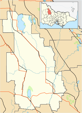
| Location |
| ||||||||||||
| LGA(s) | Shire of Buloke | ||||||||||||
| |||||||||||||
Berriwillock is a town in the Mallee region in the north-west of the Australian state of Victoria. Berriwillock is 332 kilometres (206 mi) north-west of the state capital, Melbourne. Nearby towns include Boigbeat (about 11 kilometres (6.8 mi) north west and Culgoa 11 kilometres (6.8 mi) south east.
Berriwillock is 80 kilometres (50 mi) due west of the Murray River and is a vibrant grain producing community.
Berriwillock Post Office opened on 16 April 1894 shortly after the arrival of the railway.[2]
Golfers play at the Berriwillock Golf Club.[3]
See also
References
- ↑ Australian Bureau of Statistics (25 October 2007). "Berriwillock (State Suburb)". 2006 Census QuickStats. Retrieved 2007-10-01.
- ↑ Premier Postal History. "Post Office List". Retrieved 2008-04-11.
- ↑ Golf Select, Berriwillock, retrieved 2009-05-11
External links
![]() Media related to Berriwillock at Wikimedia Commons
Media related to Berriwillock at Wikimedia Commons
| ||||||