Beresford County

Beresford
New South Wales

Location in New South Wales
Lands administrative divisions around Beresford:
Cowley Murray Murray
Wallace Beresford Dampier
Wallace Wellesley Auckland

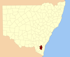
Beresford County is one of the 141 Cadastral divisions of New South Wales. It contains Cooma and Bredbo. Part of the Murrumbidgee River forms the boundary in the north-west, and a separate part of the river forms part of the western boundary.

Beresford County was named in honour of Viscount William Carr Beresford (1768-1854).[1]

Parishes within this county

A full list of parishes found within this county; their current LGA and mapping coordinates to the approximate centre of each location is as follows:

Parish LGA Coordinates
Abercrombie Cooma-Monaro Shire 36°01′54″S 149°15′04″E / 36.03167°S 149.25111°E
Big Badja Cooma-Monaro Shire 36°02′54″S 149°32′04″E / 36.04833°S 149.53444°E
Billilingra Cooma-Monaro Shire 36°00′54″S 149°09′04″E / 36.01500°S 149.15111°E
Binjura Cooma-Monaro Shire 36°11′54″S 149°06′04″E / 36.19833°S 149.10111°E
Bransby Cooma-Monaro Shire 35°55′54″S 149°09′04″E / 35.93167°S 149.15111°E
Bredbo Cooma-Monaro Shire 35°59′54″S 149°00′04″E / 35.99833°S 149.00111°E
Brest Cooma-Monaro Shire 35°57′54″S 148°56′04″E / 35.96500°S 148.93444°E
Bulgundramine Cooma-Monaro Shire 36°25′54″S 149°16′04″E / 36.43167°S 149.26778°E
Bullanamang Cooma-Monaro Shire 35°56′54″S 149°05′04″E / 35.94833°S 149.08444°E
Bunyan Cooma-Monaro Shire 36°16′54″S 149°11′04″E / 36.28167°S 149.18444°E
Callaghan Cooma-Monaro Shire 36°03′54″S 149°12′04″E / 36.06500°S 149.20111°E
Clifford Cooma-Monaro Shire 36°05′54″S 149°14′04″E / 36.09833°S 149.23444°E
Colinton Cooma-Monaro Shire 35°50′54″S 149°12′04″E / 35.84833°S 149.20111°E
Coolringdon Snowy River Shire 36°13′54″S 148°58′04″E / 36.23167°S 148.96778°E
Cooma Snowy River Shire 36°14′54″S 149°07′04″E / 36.24833°S 149.11778°E
Cosgrove Cooma-Monaro Shire 35°59′54″S 149°00′04″E / 35.99833°S 149.00111°E
Dangelong Cooma-Monaro Shire 36°17′54″S 149°16′04″E / 36.29833°S 149.26778°E
Duncan Cooma-Monaro Shire 35°54′54″S 148°50′04″E / 35.91500°S 148.83444°E
Flinders Cooma-Monaro Shire 35°56′54″S 149°00′04″E / 35.94833°S 149.00111°E
Gladstone Cooma-Monaro Shire 36°19′54″S 149°10′04″E / 36.33167°S 149.16778°E
Good Good Cooma-Monaro Shire 36°02′54″S 149°27′04″E / 36.04833°S 149.45111°E
Gungoandra Cooma-Monaro Shire 35°53′54″S 149°11′04″E / 35.89833°S 149.18444°E
Hill Cooma-Monaro Shire 35°55′54″S 149°28′04″E / 35.93167°S 149.46778°E
Holland Cooma-Monaro Shire 35°46′54″S 149°22′04″E / 35.78167°S 149.36778°E
Jillimatong Snowy River Shire 36°17′54″S 148°59′04″E / 36.29833°S 148.98444°E
Kybeyan Cooma-Monaro Shire 36°22′54″S 149°27′04″E / 36.38167°S 149.45111°E
Kydra Cooma-Monaro Shire 36°27′54″S 149°25′04″E / 36.46500°S 149.41778°E
Lucas Cooma-Monaro Shire 36°15′54″S 149°24′04″E / 36.26500°S 149.40111°E
Michelago Cooma-Monaro Shire 35°47′54″S 149°10′04″E / 35.79833°S 149.16778°E
Milford Cooma-Monaro Shire 35°49′54″S 149°22′04″E / 35.83167°S 149.36778°E
Montagu Cooma-Monaro Shire 36°15′54″S 149°16′04″E / 36.26500°S 149.26778°E
Murrumbucca Snowy River Shire 36°03′54″S 148°59′04″E / 36.06500°S 148.98444°E
Numeralla Cooma-Monaro Shire 36°10′54″S 149°16′04″E / 36.18167°S 149.26778°E
Onslow Cooma-Monaro Shire 35°48′54″S 149°17′04″E / 35.81500°S 149.28444°E
Palmerston Cooma-Monaro Shire 36°22′54″S 149°27′04″E / 36.38167°S 149.45111°E
Rivers Cooma-Monaro Shire 36°17′54″S 149°21′04″E / 36.29833°S 149.35111°E
Rose Valley Cooma-Monaro Shire 36°07′54″S 149°23′04″E / 36.13167°S 149.38444°E
Rowland Cooma-Monaro Shire 35°55′54″S 149°23′04″E / 35.93167°S 149.38444°E
Sherlock Cooma-Monaro Shire 35°49′54″S 149°27′04″E / 35.83167°S 149.45111°E
Stannard Cooma-Monaro Shire 36°00′54″S 149°21′04″E / 36.01500°S 149.35111°E
The Brothers Snowy River Shire 36°19′54″S 149°07′04″E / 36.33167°S 149.11778°E
Throsby Cooma-Monaro Shire 36°23′54″S 149°21′04″E / 36.39833°S 149.35111°E
Tinderry Cooma-Monaro Shire 35°45′54″S 149°15′04″E / 35.76500°S 149.25111°E
Undoo Cooma-Monaro Shire 36°09′54″S 149°28′04″E / 36.16500°S 149.46778°E
Wangrah Cooma-Monaro Shire 35°52′54″S 149°19′04″E / 35.88167°S 149.31778°E
Winifred Cooma-Monaro Shire 36°30′54″S 149°24′04″E / 36.51500°S 149.40111°E
Wise Cooma-Monaro Shire 35°40′54″S 149°20′04″E / 35.68167°S 149.33444°E
Woolumla Cooma-Monaro Shire 36°05′54″S 149°09′04″E / 36.09833°S 149.15111°E
York Cooma-Monaro Shire 36°02′10″S 149°05′29″E / 36.03611°S 149.09139°E

References

  1. "Beresford County". Geographical Names Register (GNR) of NSW. Geographical Names Board of New South Wales.