Benton Township, Andrew County, Missouri
| Benton Township, Missouri | |
|---|---|
| Township | |
 | |
| Coordinates: 40°04′26″N 094°50′44″W / 40.07389°N 94.84556°WCoordinates: 40°04′26″N 094°50′44″W / 40.07389°N 94.84556°W | |
| Country | United States |
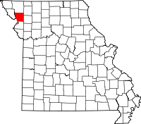
| State | Missouri |
| County | Andrew |
| Area | |
| • Total | 49.97 sq mi (129.43 km2) |
| • Land | 49.61 sq mi (128.49 km2) |
| • Water | 0.36 sq mi (0.94 km2) 0.73% |
| Elevation[1] | 935 ft (285 m) |
| Population (2010) | |
| • Total | 1,020 |
| • Density | 20/sq mi (7.9/km2) |
| FIPS code | 29-04564[2] |
| GNIS feature ID | 0766220 |
Benton Township is one of ten townships in Andrew County, Missouri, United States. As of the 2010 census, its population was 1,020.[3]
Geography
Benton Township covers an area of 50.0 square miles (129.4 km2) and contains two incorporated settlements: Bolckow and Rosendale.
The streams of Kellog Branch, Lower Neely Branch, Riggin Branch, Upper Neely Branch and White Cloud Creek run through this township.
Transportation
Benton Township contains one airport, Furst Landing Strip.
References
- ↑ "US Board on Geographic Names". United States Geological Survey. 2007-10-25. Retrieved 2008-01-31.
- ↑ "American FactFinder". United States Census Bureau. Retrieved 2008-01-31.
- ↑ "Geographic Identifiers: 2010 Demographic Profile Data (G001): Benton township, Andrew County, Missouri". U.S. Census Bureau, American Factfinder. Retrieved June 20, 2013.
External links
| |||||||||||||||||||||||||