Benguet
| Benguet | |||
|---|---|---|---|
| Province | |||
| Province of Benguet | |||
| |||
| Nickname(s): Salad Bowl of the Philippines[1][2] | |||
 Location within the Philippines | |||
 Political map of Benguet | |||
| Coordinates: 16°30′N 120°40′E / 16.500°N 120.667°ECoordinates: 16°30′N 120°40′E / 16.500°N 120.667°E | |||
| Country |
| ||
| Region | Cordillera Administrative Region (CAR) | ||
| Founded | June 16, 1966 | ||
| Capital | La Trinidad | ||
| Government | |||
| • Type | Province of the Philippines | ||
| • Governor | Nestor Fongwan (NUP) | ||
| • Vice Governor | Nelson Dangwa (LP) | ||
| Area[3] | |||
| • Total | 2,769.08 km2 (1,069.15 sq mi) | ||
| Area rank | 49th out of 80 | ||
| Excludes independent city | |||
| Population (2010)[4] | |||
| • Total | 403,944 | ||
| • Rank | 63rd out of 80 | ||
| • Density | 150/km2 (380/sq mi) | ||
| • Density rank | 53rd out of 80 | ||
| Excludes independent city | |||
| Divisions | |||
| • Independent cities | 1 | ||
| • Component cities | 0 | ||
| • Municipalities | 13 | ||
| • Barangays |
140 including independent cities: 269 | ||
| • Districts |
Lone district of Benguet including independent cities: Lone district of Baguio City | ||
| Time zone | PHT (UTC+8) | ||
| ZIP code | 2600 – 2614 | ||
| Dialing code | 74 | ||
| ISO 3166 code | PH-BEN | ||
| Spoken languages | Kankana-ey, Ibaloi , Pangasinan, Kalanguya, Bontoc, Ilocano, Tagalog, English | ||
| Website |
benguet | ||

Benguet (Tagalog pronunciation: [beŋˈɡet]; Ibaloi: Probinsya ne Benguet; Ilocano: Probinsya ti Benguet; Filipino: Lalawigan ng Benguet), is a landlocked province of the Philippines located in the southern tip of the Cordillera Administrative Region in the island of Luzon. Its capital is La Trinidad.
The highland province is known as the "Salad Bowl of the Philippines" because of its huge production of upland vegetables.[1][2][5]
Located in the interior of Benguet is the highly urbanized city of Baguio, which is independent of the province.
History
The mountainous area now covered by Benguet has been settled for millennia by several peoples collectively known as the Igorots. Two of these groups, the Ibaloi and the Kankanaey, are dominant ethnolinguistic groups of the area. In the pre-conquest period, these tribes enjoyed flourishing trade with lowland groups immediately to their west and south, such as the Ilocano and the Pangasinense.
Spanish period
At the beginning of the Spanish Era, colonisers heard of the rich gold mines in the mountains, attempted to colonize the highlands, but failed. In 1572, Juan de Salcedo led a small expedition into the southern part of Benguet, but the natives forced them to retreat.[5] The first major expedition into the mountains occurred in 1620, when Spanish explorers went into the La Trinidad Valley and briefly controlled some Igorot gold mines, and later abandoned after a few years.
In the 1800s, Spanish colonizers made more serious attempts such as expeditions under Col. Guillermo Galvey[6]:280 and succeeded in establishing a presence in the La Trinidad Valley, named after Galvey's wife.[5]
This area later became a district of the new province of La Union in 1846. Eight years later, in 1854, Benguet became a separate comandancia politico-militar. Parts of the present province were established as component territories of other comandancias such as Lepanto and Amburayan.[5]
American period
When the Americans took control of the Philippines, they established local civil governments in many parts of the country. American civilian government was established in Benguet on November 23, 1900 by virtue of Act No. 48, with Canadian journalist H.P. Whitmarsh appointed as the province's first governor.[7]
| Township | Abolished? | Notes | Township | Abolished? | Notes |
|---|---|---|---|---|---|
| Adaoay | Yes | Currently a barangay of Kabayan | Itogon | No | |
| Ambuklao | Yes | Currently a barangay of Bokod | Kabayan | No | |
| Ampusongan | Yes | Currently a barangay of Bakun | Kapangan | No | |
| Atok | No | Kibungan | No | ||
| Baguio | Yes | Converted into a chartered city in 1909* | La Trinidad | No | |
| Balakbak | Yes | Currently a barangay of Kapangan | Loo | Yes | Currently a barangay of Buguias |
| Bokod | No | Palina | Yes | Currently a barangay of Kibungan | |
| Buguias | No | Sablan | No | ||
| Daclan | Yes | Currently a barangay of Bokod | Tublay | No | |
| Galiano | Yes | ||||
*When Baguio was converted into a chartered city in 1909, barrio Tuba was separated from the city and incorporated into the township of Twin Peaks.[9]
The Americans then established Mountain Province on August 18, 1908, with the enactment of Act No. 1876. Benguet, along with Amburayan, Apayao, Bontoc, Ifugao, Kalinga, and Lepanto, became sub-provinces of this new province.[5][10] Later on, the township of Baguio was abolished upon its conversion into a chartered city in 1909. Then in 1920, Benguet absorbed the sub-provinces of Amburayan and Lepanto.[5]
In the 1930s, mining companies started operating in the gold deposits in the province. This brought jobs, and many lowlanders migrated to Benguet, especially in towns surrounding the mines, such as Itogon, Mankayan and Tuba.[7]
World War II
During World War II, Igorot guerrillas and the combined Filipino and American forces fought Japanese soldiers during the final days of the war in 1945.
Post-war Era
On June 18, 1966, the huge Mountain Province was split into four provinces with the enactment of Republic Act No. 4695. The four provinces were Benguet, Mountain Province, Kalinga-Apayao and Ifugao.[5][11][12] Benguet became one of the provinces of the Ilocos Region. On July 15, 1987, the Cordillera Administrative Region was established by President Corazon Aquino thru Executive Order 220, and Benguet was made one of its provinces.[5][13][14]
Geography
Physical

Situated within the Cordillera mountains, Benguet is dominantly mountainous. Mount Pulag, the highest in Luzon is located within Kabayan.
The mountains are the source of several springs and creeks that converge to form several rivers, the major ones which include the Agno, Amburayan, Bued, Bakun, Balili and the Asin. Some of these run through river valleys or gorges.
Several natural lakes, although small in size are found within the hinterlands. The largest are the "Four Lakes" in Kabayan; Lake Bulalacao, Lake Datep-ngapso, Lake Incolos and Lake Tabeyo.
Administrative
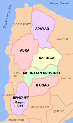
The province is bordered by Mountain Province and Ifugao on the northeast, Nueva Vizcaya on the southeast, Pangasinan on the south, La Union on the west, and Ilocos Sur on the northwest.
Municipalities
Benguet is subdivided into 13 municipalities, all of which belong to a lone legislative district.[15]
The highly urbanized city of Baguio, although independent from Benguet, is located in the interior of the province, surrounded by the municipalities of La Trinidad, Itogon, Sablan and Tuba. The city used to be part of the province but became independent when the city's charter was enacted in 1909. It is informally considered as part of Benguet, especially in census data,[3] but has a separate legislative district from that of the province.

| Seal | Municipality or city |
Land area (km2)[15] |
Population (2010)[16] |
Pop. density (per km2) |
No. of barangays |
ZIP code | Income class[15] |
Location |
|---|---|---|---|---|---|---|---|---|
| |
||||||||
 | Atok | 214.99 | 19,242 | 89.5 | 8 | 2612 | 4th | |
 | Baguio City | 57.51 | 318,676 | 5541.2 | 129 | 2600 | 1st | |
 | Bakun | 286.91 | 13,587 | 47.4 | 7 | 2610 | 3rd | |
 | Bokod | 274.96 | 12,648 | 46 | 10 | 2605 | 4th | |
 | Buguias | 175.88 | 39,271 | 223.3 | 14 | 2607 | 3rd | |
 | Itogon | 449.73 | 55,960 | 124.4 | 9 | 2604 | 1st | |
 | Kabayan | 242.69 | 13,588 | 56 | 13 | 2606 | 4th | |
 | Kapangan | 164.39 | 20,084 | 122.2 | 15 | 2613 | 4th | |
 | Kibungan | 254.86 | 16,850 | 66.1 | 7 | 2611 | 4th | |
 | La Trinidad † | 70.04 | 107,188 | 1530.4 | 16 | 2601 | 1st | |
 | Mankayan | 130.48 | 35,586 | 272.7 | 13 | 2608 | 1st | |
 | Sablan | 105.63 | 10,511 | 99.5 | 8 | 2614 | 5th | |
 | Tuba | 295.97 | 42,874 | 144.9 | 13 | 2603 | 1st | |
 | Tublay | 102.55 | 16,555 | 161.4 | 8 | 2615 | 5th | |
 | Benguet Total | 2,769.08 | 403,944 | 145.9 | 140 | 2601 – 2614 | 2nd[A] | |
| including Baguio City | 2,826.6 | 722,620 | 255.6 | 269 | 2600 – 2614 |
Barangays
The 13 municipalities of the province comprise a total of 140 barangays, with Pico in La Trinidad as the most populous in 2010, and Anchokey in Kabayan as the least.[16]
Demographics
| Population census of Benguet | ||
|---|---|---|
| Year | Pop. | ±% p.a. |
| 1990 | 302,715 | — |
| 1995 | 313,833 | +0.68% |
| 2000 | 330,129 | +1.09% |
| 2007 | 372,533 | +1.68% |
| 2010 | 403,944 | +2.99% |
| Source: National Statistics Office[4] | ||
In the May 2000 census, Benguet had a total population of 330,129. This figure is up by 16,296 from 313,833 persons recorded in the 1995 census, giving an annual growth rate of 1.09% during the 5-year period—much, much lower than the national average of 2.43%. The province registered at 63,123 households, an increase of 4,588 households over the 1990 figure. This gave an average household size of 5.2 persons, a little higher than the national average of 4.99.
At the 2010 census, the population excluding the independent Baguio City was 403,944, which makes it the most populous province in the region. If Baguio City is included, the population is 772,620.[4]
Inhabitants
The native inhabitants of Benguet province comprise three ethnic groups. Kankanaeys dominate the northwestern municipalities of the province, Ibalois are concentrated on the southeast, and Kalanguyas are mostly found in the east.[5][17][18] Migrants from lowland provinces have fused with the local populace to form a melting pot in some areas.[12][18][19]
According to the 2000 Philippine census, Kankanaeys comprised 43% of the entire provincial household population at the time, while 29.2% were identified as Ibalois. Resident lowland ethnic groups included Ilocano at 13.4%, Ikalahan at 3.7% and Tagalog at 2.4%.[20]
Languages
Benguet residents generally speak their own languages in addition to Ilocano, Tagalog, and English, which are used for trade and commerce. The Ibaloi tribe speak Ibaloy, which is similar to Pangasinan, while the Kankanaey have their eponymous language, which is related to the Bontoc language.
The SIL Ethnologue database classifies the languages under the South-Central Cordilleran branch. Nabaloy (named in the database as Ibaloi) is part of the Southern Cordilleran branch which also includes Pangasinense. The Kankanaey language is under the Central Cordilleran branch, which also includes Bontoc and Ifugao.
Economy

Agriculture, mining, and tourism are the major industries in Benguet. Because of its temperate climate and high altitude, Benguet is an ideal place for producing vegetables. Benguet is often called the Salad Bowl of the Philippines.[2][5][18] The La Trinidad Vegetable Trading Post in the municipality of La Trinidad serves as the hub of vegetable trading in the province, attracting farmers, merchants and traders from the local community and the Philippines' different provinces. [21] Major crops produced include potatoes, Baguio beans, peas, strawberries, cabbage, broccoli, cauliflower, lettuce, and carrots.[5][22]
Horticulture and floriculture are practiced in the province.[23] The province supplies flowers to the different municipalities, including Baguio City. [24] [25] Apisang (scientific name: Pittosporum resiniferum), a plant endemic to the Philippines, is grown in the municipalities of Kapangan and Kibungan as a potential alternative source of fuel and energy, rivaling the jatropha biofuel plant.[26][27]
Other agricultural-related activities are monggo processing, fruit preservation, peanut brittle manufacturing, broom making and basket weaving.[5][28]
The province suffers from crop damage resulting from seasonal frost during the cold months of December to March, especially in high-altitude towns such as Atok, Buguias, Mankayan and Kibungan.[29][30] On February 2007, Benguet suffered crop damage due to freezing temperatures in the area, reaching as low as 7 Celsius and even lower in some areas, and important crops like cabbages were damaged.[31]
Mining is a major industry in Benguet, which is one of the country's leading gold producers.[5] The Benguet Corporation, the first and oldest mining company in the Philippines has been extracting gold, copper and chromite in Itogon since August 12, 1903.[32] [33]

Other mineral deposits are silver, copper, pyrite, and limestone. Silver smithing is a large industry in Benguet, and many entrepreneurs sell silver works at lower prices in Baguio City, compared to Manila. In 2006 alone revenues from mining reached a stunning four billion pesos, and yet this figure comes from just two-Lepanto Consolidated Mining Corporation and Philex Mines- of the many mining firms operating in the province. Nevertheless, the province's mining vigor has never translated into better quality of life of the Benguet people, simply because a bulk of the mining firm's taxes are not paid directly to the province. The two mining corporations, like many others around the country, have principal offices in the City of Makati, a set-up that makes Makati the prime mining tax beneficiary.
The presence of Baguio City in Benguet draws many tourists from the lowlands. Often, people who go to Baguio also explore the province, especially the strawberry and vegetable plantations in La Trinidad. Accommodations is sparse in the province of Benguet this is why many tourists opt to stay at different Hotels in Baguio City whereby Baguio City will be their starting point to their Benguet adventure (See also the Tourist Attractions section below.)
Education
Universities
- The Benguet State University (BSU) is the only university in the province, with its Main Campus at La Trinidad. It has eight colleges, two academic institutes, and a graduate school. The university has two satellite campuses in two municipalities; the Buguias Campus at Loo, Buguias, and the Bokod Campus at Ambangeg, Bokod.[34]
- Aside from BSU, the independent chartered city of Baguio hosts a number of higher education institutions. These universities and colleges attract students from across the Philippines.
Colleges
| College | Municipality |
|---|---|
| King's College of the Philippines | La Trinidad |
| Cordillera Career Development College | La Trinidad |
| Philippine Nazarene College | La Trinidad |
| Philippine College of Ministry | La Trinidad |
| BVS Colleges | La Trinidad |
| Advocates Academic College | La Trinidad |
High Schools
The Cordillera Regional Science High School is located in La Trinidad. The Benguet National High School has several annexes distributed in the capital town of La Trinidad.
Tourist attractions
The province is a major tourist destination in the country,[1] with most of its tourist spots centered on culture and nature.[35] Baguio City's location within the province provides a boost to the tourism industry of the province.[36] Interesting places in the province include Kennon Road, Binga Dam, strawberry and flower farms in La Trinidad, the Ambuklao Dam in Bokod, and the Palina and Naguey rice terraces in Atok.
Tuba and Tublay hot springs are usually flocked by local tourists from the neighboring provinces. Vegetable terraces can be seen along the Halsema Highway, especially during the growing season, while the mist-covered "Man-asok" River is another destination. Kabayan is known for its centuries-old mummies, while Buguias is visited for its hot springs and the Apo Anno.
References
- ↑ 1.0 1.1 1.2 1.3 "Facts & Figures: Benguet Province". Philippine Statistics Authority - National Statistical Coordination Board - Cordillera Administrative Region. Retrieved 9 October 2014.
- ↑ 2.0 2.1 2.2 "Cordillera Autonomous Region". It's More Fun in the Philippines. Retrieved 17 September 2014.
- ↑ 3.0 3.1 3.2 "List of Provinces". PSGC Interactive. Makati City, Philippines: National Statistical Coordination Board. Retrieved 12 August 2013.
- ↑ 4.0 4.1 4.2 "Population and Annual Growth Rates for The Philippines and Its Regions, Provinces, and Highly Urbanized Cities" (PDF). 2010 Census and Housing Population. National Statistics Office. Retrieved 12 June 2013.
- ↑ 5.0 5.1 5.2 5.3 5.4 5.5 5.6 5.7 5.8 5.9 5.10 5.11 5.12 Lancion, Jr., Conrado M.; de Guzman, Rey (cartography) (1995). "The Provinces". Fast Facts about Philippine Provinces (The 2000 Millenium ed.). Makati, Metro Manila: Tahanan Books. p. 38. ISBN 971-630-037-9. Retrieved 16 January 2015.
- ↑ Kane, S.E., 1933, Thirty Years with the Philippine Head-Hunters, New York: Grosset & Dunlap
- ↑ 7.0 7.1 "Municipality of La Trinidad, Benguet". DILG-CAR. Retrieved 18 September 2014.
- ↑ "History: Benguet Province". Province of Benguet (official website). Retrieved 9 October 2014.
- ↑ "LGU-Pugo-History". Provincial Government of La Union (official website). Retrieved 3 October 2014.
(Note: Pugo was part of the municipal district of Benguet Province until February 4, 1920)
- ↑ "Act No. 1876". PhilippineLaw.info. 18 August 1908. Retrieved 9 October 2014.
- ↑ "Republic Act No. 4695: An Act Creating the Provinces of Benguet, Mountain Province, Ifugao and Kalinga-Apayao". Chan Robles Virtual Law Library. Retrieved 18 September 2014.
- ↑ 12.0 12.1 "Benguet History". Province of Benguet (Official Website). Retrieved 17 September 2014.
- ↑ "Regional Profile: Cordillera Administrative Region (CAR)". CountrySTAT Philippines. Retrieved 18 September 2014.
- ↑ "The Cordillera Administrative Region (CAR)". Department of Agriculture. Retrieved 18 September 2014.
- ↑ 15.0 15.1 15.2 "Province: Benguet". Philippine Statistics Authority - National Statistical Coordination Board. Retrieved 24 January 2015.
- ↑ 16.0 16.1 "2010 Census of Population and Housing: Population Counts - Cordillera Administrative Region" (PDF). National Statistics Office (Philippines), April 4, 2012. Retrieved 16 November 2014.
- ↑ "About Benguet Province, Philippines". IslandsWeb Online Services. Retrieved 17 September 2014.
- ↑ 18.0 18.1 18.2 "Facts & Figures: Benguet Province". National Commission for Culture and the Arts. Retrieved 17 September 2014.
- ↑ "The Cordillera: Its Land and People". Cordillera Peoples Alliance. Retrieved 17 September 2014.
- ↑ "Benguet: Dependency Ratio Down by Four Persons". Philippine Statistics Authority: National Statistics Office. 26 April 2002. Retrieved 17 September 2014.
- ↑ Angela E. Obnial (December 2005). "La Trinidad veggie trading post revisited". Bureau of Agricultural Research Chronicle. Bureau of Agricultural Research. Retrieved 17 September 2014.
- ↑ "Province of Benguet: Fast Facts". Province of Benguet website. Retrieved 17 September 2014.
- ↑ Comanda, Zaldy (15 February 2014). "Benguet grows Holland tulips". Manila Bulletin. Retrieved 17 September 2014.
- ↑ "Benguet farmers harvest of tons of fresh flowers for All Saints Day". InterAksyon.com. Philippines News Agency. 29 October 2013. Retrieved 17 September 2014.
- ↑ Catajan, Ma. Elena (17 January 2013). "Benguet flowers ready for Panagbenga". Sun.Star Publishing, Inc. Retrieved 17 September 2014.
- ↑ Dumlao, Artemio (23 August 2009). "Tree for alternative fuel found in Cordillera". The Philippine Star. Retrieved 17 September 2014.
- ↑ "Benguet finds oil treasure in ‘petroleum nut’". Philippine Daily Inquirer. 2 July 2009. Retrieved 17 September 2014.
- ↑ "The Pasalubong Map: Luzon". Choose Philippines. 14 April 2014. Retrieved 17 September 2014.
- ↑ Catajan, Maria Elena (2 January 2014). "Frost affects towns". Sun.Star Baguio. Retrieved 17 September 2014.
- ↑ Quitasol, Kimberlie (3 January 2014). "Frost descends on Benguet farms". Philippine Daily Inquirer. Retrieved 17 September 2014.
- ↑ Palangchao, Harley (2 February 2007). "Benguet Farmers Lose Crops to Frost". The Manila Times. Retrieved 17 September 2014.
- ↑ "Benguet Corporation: Corporate Profile" (PDF). Retrieved 18 November 2014.
- ↑ "Benguet Corp". Bloomberg. Retrieved 17 September 2014.
- ↑ "Colleges, Institutes, & Campuses". Benguet State University. Retrieved 17 September 2014.
- ↑ Aro, Susan (3 June 2014). "Benguet tourism sites mostly culture, nature-based". Sun.Star Baguio. Philippine Information Agency. Retrieved 9 October 2014.
- ↑ Catajan, Maria Elena (7 April 2014). "Benguet tourist arrivals peak". Sun.Star Baguio. Retrieved 9 October 2014.
External links
| Wikimedia Commons has media related to Benguet. |
 |
Ilocos Sur | Mountain Province | | |
| La Union | |
Ifugao Nueva Vizcaya | ||
| ||||
| | ||||
| Pangasinan |
| ||||||||||||||||||
| ||||||||||||||||||||||||||||||||||


| |||||||||||||||||||||||||||||||||||||||||||||