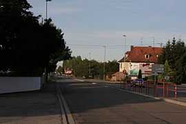
Benfeld
| Benfeld Banfald | ||
|---|---|---|
 | ||
| ||
 Benfeld | ||
|
Location within Alsace region  Benfeld | ||
| Coordinates: 48°22′N 8°00′E / 48.37°N 8.00°ECoordinates: 48°22′N 8°00′E / 48.37°N 8.00°E | ||
| Country | France | |
| Region | Alsace | |
| Department | Bas-Rhin | |
| Arrondissement | Sélestat-Erstein | |
| Canton | Benfeld | |
| Government | ||
| • Mayor (2012–2014) | Jacky Wolfarth | |
| Area1 | 7.79 km2 (3.01 sq mi) | |
| Population (2006)2 | 5,350 | |
| • Density | 690/km2 (1,800/sq mi) | |
| INSEE/Postal code | 67028 / 67230 | |
| Dialling codes | 0388 | |
| Elevation |
155–162 m (509–531 ft) (avg. 160 m or 520 ft) | |
|
1 French Land Register data, which excludes lakes, ponds, glaciers > 1 km² (0.386 sq mi or 247 acres) and river estuaries. 2 Population without double counting: residents of multiple communes (e.g., students and military personnel) only counted once. | ||

Benfeld (French pronunciation: [bɛnfɛld]; Alsatian: Banfald [ˈbanfalt]) is a commune in the Bas-Rhin department in Alsace in northeastern France.
Population
| Historical population | ||
|---|---|---|
| Year | Pop. | ±% |
| 1793 | 1,309 | — |
| 1800 | 1,220 | −6.8% |
| 1806 | 1,188 | −2.6% |
| 1821 | 1,794 | +51.0% |
| 1831 | 2,230 | +24.3% |
| 1836 | 2,555 | +14.6% |
| 1841 | 2,688 | +5.2% |
| 1846 | 2,807 | +4.4% |
| 1851 | 3,001 | +6.9% |
| 1856 | 2,926 | −2.5% |
| 1861 | 2,745 | −6.2% |
| 1866 | 2,757 | +0.4% |
| 1871 | 2,603 | −5.6% |
| 1875 | 2,635 | +1.2% |
| 1880 | 2,797 | +6.1% |
| 1885 | 2,544 | −9.0% |
| 1890 | 2,324 | −8.6% |
| 1895 | 2,479 | +6.7% |
| 1900 | 2,388 | −3.7% |
| 1905 | 2,466 | +3.3% |
| 1910 | 2,640 | +7.1% |
| 1921 | 2,518 | −4.6% |
| 1926 | 2,655 | +5.4% |
| 1931 | 2,741 | +3.2% |
| 1936 | 2,838 | +3.5% |
| 1946 | 2,588 | −8.8% |
| 1954 | 2,886 | +11.5% |
| 1962 | 3,449 | +19.5% |
| 1968 | 3,441 | −0.2% |
| 1975 | 3,798 | +10.4% |
| 1982 | 4,451 | +17.2% |
| 1990 | 4,330 | −2.7% |
| 1999 | 4,878 | +12.7% |
| 2006 | 5,260 | +7.8% |
| 2009 | 5,660 | +7.6% |
Sights
The handsome 1846 synagogue survived the Nazi occupation.[1]
See also
References
| Wikimedia Commons has media related to Benfeld. |