Benbaun
| Benbaun | |
|---|---|
| Binn Bhán | |
 | |
| Elevation | 729 m (2,392 ft)[1] |
| Prominence | 684 m (2,244 ft)[1] |
| Listing | Marilyn, Hewitt, Irish County High Point |
| Translation | white mountain (Irish) |
| Location | |
 Benbaun Ireland | |
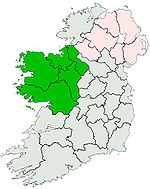
| Location | Galway, Republic of Ireland |
| Range | Twelve Bens |
| OSI/OSNI grid | L786539 |
| Coordinates | 53°31′16″N 9°49′52″W / 53.52111°N 9.83111°WCoordinates: 53°31′16″N 9°49′52″W / 53.52111°N 9.83111°W[1] |
| Topo map | OSi Discovery 37, 44 |
Benbaun (Irish: Binn Bhán) is a mountain in County Galway, Ireland, the highest of the Twelve Bens, and the highest peak in Galway. As the highest point in Galway, it is the 10th highest county peak in Ireland.
Conservation
The mountain, along with Twelve Bens range, is part of the Connemara National Park.
References
- ↑ 1.0 1.1 1.2 "Binn Bhán". MountainViews. Retrieved 2007-08-10.
See also
| |||||||||||||||||||||||||||||||||||||||||||||
| ||||||||||