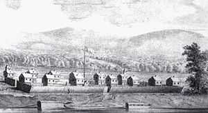
Belpre, Ohio
| Belpre, Ohio | |
|---|---|
| City | |
|
Belpre's oldest house, built in 1799 | |
| Motto: " Excellent Community Excellent People " | |
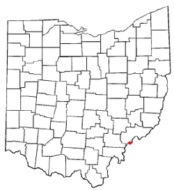 Location of Belpre, Ohio | |
| Coordinates: 39°16′49″N 81°35′6″W / 39.28028°N 81.58500°WCoordinates: 39°16′49″N 81°35′6″W / 39.28028°N 81.58500°W | |
| Country | United States |
| State | Ohio |
| County | Washington |
| Government | |
| • Mayor | Michael L. Lorentz (D)[1] |
| Area[2] | |
| • Total | 3.57 sq mi (9.25 km2) |
| • Land | 3.49 sq mi (9.04 km2) |
| • Water | 0.08 sq mi (0.21 km2) |
| Elevation[3] | 614 ft (187 m) |
| Population (2010)[4] | |
| • Total | 6,441 |
| • Estimate (2012[5]) | 6,430 |
| • Density | 1,845.6/sq mi (712.6/km2) |
| Time zone | Eastern (EST) (UTC-5) |
| • Summer (DST) | EDT (UTC-4) |
| ZIP code | 45714 |
| Area code(s) | 740 |
| FIPS code | 39-05424[6] |
| GNIS feature ID | 1077518[3] |
| Website | http://www.cityofbelpre.com/ |

Belpre is a city in Washington County, Ohio, United States, along the Ohio River. The name Belpre is derived from a contraction of "Belle Prairie" (French for "beautiful meadow"), which is the original name given to the valley by French trappers passing through the area prior to settlement.[7]
Part of the Parkersburg-Marietta-Vienna, WV-OH Metropolitan Statistical Area, it is located about 14 miles downriver from Marietta. In 1870 the Baltimore and Ohio Railroad completed the Parkersburg Bridge (CSX) across the river; at 7,140 feet (2,180 m), it was reportedly the longest in the world.
The population was 6,441 at the 2010 census. Belpre was the second United States settlement in the Northwest Territory after Marietta. The city is home to the first library established in the Territory. Its public school hired the first female schoolteacher in Ohio.
History
In 1845 railroad developers in 1845 founded the Belpre and Cincinnati Railroad, but the destination was changed to Marietta, with a corresponding name change in 1851. For a considerable time, travelers had to go by steamboat to connect between Marietta to Parkersburg, Virginia, which received service from the Baltimore and Ohio Railroad in 1857. This was shortly before the western part of the state seceded to form West Virginia in 1861. Belpre and Marietta were later connected by rail. Coal service is still active on this line.
From 1868-1870, the B&O built the Parkersburg Bridge (CSX) between West Virginia and Belpre, on its main line to St. Louis, Missouri. Designed by Jacob Linville, when completed in 1870, the bridge was reportedly the longest in the world at 7,140 feet (2,180 m).[8] This brought more trade to the town, provided for shipping Ohio coal to the East Coast, and improved access on both sides of the river.
Developing in a different pattern from the more industrial cities of eastern Ohio, Belpre reached its peak of population in 1970. It has had some loss since then, but is relatively stable compared to the former industrial cities, which have lost half their residents since peaks in 1940 and 1950.
The Steven Soderbergh film Bubble (2006), was filmed in Belpre and Parkersburg, West Virginia, using an all-local cast.
Geography
Belpre is located at 39°16′49″N 81°35′6″W / 39.28028°N 81.58500°W (39.280175, -81.585072).[9]
According to the United States Census Bureau, the city has a total area of 3.57 square miles (9.25 km2), of which 3.49 square miles (9.04 km2) is land and 0.08 square miles (0.21 km2) is water.[2]
Demographics
| Historical population | |||
|---|---|---|---|
| Census | Pop. | %± | |
| 1910 | 1,249 | — | |
| 1920 | 1,317 | 5.4% | |
| 1930 | 1,724 | 30.9% | |
| 1940 | 1,717 | −0.4% | |
| 1950 | 2,451 | 42.7% | |
| 1960 | 5,418 | 121.1% | |
| 1970 | 7,189 | 32.7% | |
| 1980 | 7,193 | 0.1% | |
| 1990 | 6,796 | −5.5% | |
| 2000 | 6,660 | −2.0% | |
| 2010 | 6,441 | −3.3% | |
| Est. 2012 | 6,430 | −0.2% | |
| Sources:[10][11][12][13][6][14] | |||
2010 census
As of the census[4] of 2010, there were 6,441 people, 3,053 households, and 1,788 families residing in the city. The population density was 1,845.6 inhabitants per square mile (712.6/km2). There were 3,351 housing units at an average density of 960.2 per square mile (370.7/km2). The racial makeup of the city was 94.7% White, 2.1% African American, 0.2% Native American, 0.4% Asian, 0.1% Pacific Islander, 0.2% from other races, and 2.3% from two or more races. Hispanic or Latino of any race were 0.8% of the population.
There were 3,053 households of which 24.1% had children under the age of 18 living with them, 41.6% were married couples living together, 13.4% had a female householder with no husband present, 3.6% had a male householder with no wife present, and 41.4% were non-families. 35.5% of all households were made up of individuals and 15.8% had someone living alone who was 65 years of age or older. The average household size was 2.11 and the average family size was 2.71.
The median age in the city was 44.7 years. 18.8% of residents were under the age of 18; 7.8% were between the ages of 18 and 24; 23.8% were from 25 to 44; 28.9% were from 45 to 64; and 20.7% were 65 years of age or older. The gender makeup of the city was 46.7% male and 53.3% female.
2000 census
As of the census[6] of 2000, there were 6,660 people, 3,058 households, and 1,923 families residing in the city. The population density was 1,889.6 people per square mile (730.5/km²). There were 3,283 housing units at an average density of 931.5 per square mile (360.1/km²). The racial makeup of the city was 96.01% White, 2.10% African American, 0.11% Native American, 0.42% Asian, 0.12% from other races, and 1.25% from two or more races. Hispanic or Latino of any race were 0.48% of the population.
There were 3,058 households out of which 25.2% had children under the age of 18 living with them, 47.9% were married couples living together, 11.4% had a female householder with no husband present, and 37.1% were non-families. 32.7% of all households were made up of individuals and 14.0% had someone living alone who was 65 years of age or older. The average household size was 2.18 and the average family size was 2.73.
In the city the population was spread out with 20.9% under the age of 18, 8.3% from 18 to 24, 26.4% from 25 to 44, 26.0% from 45 to 64, and 18.4% who were 65 years of age or older. The median age was 41 years. For every 100 females there were 84.1 males. For every 100 females age 18 and over, there were 80.1 males.
The median income for a household in the city was $29,603, and the median income for a family was $36,401. Males had a median income of $31,743 versus $21,789 for females. The per capita income for the city was $18,195. About 12.1% of families and 15.2% of the population were below the poverty line, including 26.7% of those under age 18 and 7.6% of those age 65 or over.
Climate
The climate in this area is characterized by relatively high temperatures and evenly distributed precipitation throughout the year. According to the Köppen Climate Classification system, Belpre has a Humid subtropical climate, abbreviated "Cfa" on climate maps.[15]
| Climate data for Belpre, Ohio | |||||||||||||
|---|---|---|---|---|---|---|---|---|---|---|---|---|---|
| Month | Jan | Feb | Mar | Apr | May | Jun | Jul | Aug | Sep | Oct | Nov | Dec | Year |
| Average high °C (°F) | 5 (41) |
7 (44) |
12 (53) |
18 (65) |
24 (75) |
28 (83) |
30 (86) |
29 (85) |
26 (79) |
19 (67) |
13 (55) |
7 (44) |
18.2 (64.8) |
| Average low °C (°F) | −4 (24) |
−4 (25) |
1 (33) |
6 (42) |
11 (52) |
16 (61) |
18 (65) |
17 (63) |
13 (56) |
7 (45) |
2 (35) |
−3 (27) |
6.7 (44) |
| Average precipitation cm (inches) | 8 (3) |
6.9 (2.7) |
9.1 (3.6) |
8.4 (3.3) |
9.7 (3.8) |
10.4 (4.1) |
11.2 (4.4) |
9.4 (3.7) |
7.4 (2.9) |
6.1 (2.4) |
7.1 (2.8) |
7.4 (2.9) |
101.1 (39.6) |
| Source: Weatherbase [16] | |||||||||||||
See also
- List of cities and towns along the Ohio River
References
- ↑ "Washington County Election Results". Retrieved 2008-03-22.
- ↑ 2.0 2.1 "US Gazetteer files 2010". United States Census Bureau. Retrieved 2013-01-06.
- ↑ 3.0 3.1 "US Board on Geographic Names". United States Geological Survey. 2007-10-25. Retrieved 2008-01-31.
- ↑ 4.0 4.1 "American FactFinder". United States Census Bureau. Retrieved 2013-01-06.
- ↑ "Population Estimates". United States Census Bureau. Retrieved 2013-06-17.
- ↑ 6.0 6.1 6.2 "American FactFinder". United States Census Bureau. Retrieved 2008-01-31.
- ↑ Kilbourn, John (1833). "The Ohio Gazetteer, Or a Topographical Dictionary". Scott and Wright. p. 91. Retrieved 12 December 2013.
- ↑ Baltimore & Ohio Railroad, Parkersburg Bridge, Ohio River, Parkersburg, Wood County, WV, Historic American Engineering Record, accessed 22 August 2012
- ↑ "US Gazetteer files: 2010, 2000, and 1990". United States Census Bureau. 2011-02-12. Retrieved 2011-04-23.
- ↑ "Population: Ohio". 1910 U.S. Census. U.S. Census Bureau. Retrieved 28 November 2013.
- ↑ "Population: Ohio". 1930 US Census. U.S. Census Bureau. Retrieved 28 November 2013.
- ↑ "Number of Inhabitants: Ohio". 18th Census of the United States. U.S. Census Bureau. Retrieved 22 November 2013.
- ↑ "Ohio: Population and Housing Unit Counts". U.S. Census Bureau. Retrieved 22 November 2013.
- ↑ "Incorporated Places and Minor Civil Divisions Datasets: Subcounty Population Estimates: April 1, 2010 to July 1, 2012". U.S. Census Bureau. Retrieved 25 November 2013.
- ↑ Climate Summary for Belpre
- ↑ "Weatherbase.com". Weatherbase. 2013. Retrieved on September 13, 2013.
| |||||||||||||||||||||||||||||
