Belleville (Paris Métro)
 | ||||||||||||||||
| Location |
1, boul. de la Villette (two) 2, boul. de la Villette 4, boul. de la Villette 79, boul. de Belleville 130, boul. de Belleville 10th arrondissement of Paris Île-de-France France | |||||||||||||||
| Coordinates | 48°52′19″N 2°22′37″E / 48.872083°N 2.376947°ECoordinates: 48°52′19″N 2°22′37″E / 48.872083°N 2.376947°E | |||||||||||||||
| Other information | ||||||||||||||||
| Fare zone | 1 | |||||||||||||||
| History | ||||||||||||||||
| Opened | 31 January 1903 | |||||||||||||||
| Services | ||||||||||||||||
| ||||||||||||||||
| Location | ||||||||||||||||
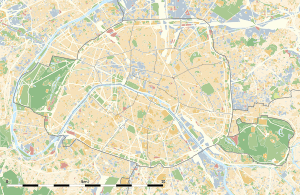
 Belleville Location within Paris | ||||||||||||||||
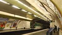
Belleville is a station on Paris Métro Line 2 and Line 11. The station is in the district of Belleville at the corner of the 10th, 11th, 19th and 20th arrondissements.
History

The former Barrière de Belleville, part of the Wall of the Farmers-General
The station was opened on 31 January 1903 as part of the extension of line 2 from Anvers to Bagnolet (now called Alexandre Dumas). The line 11 platforms opened as part of the original section of the line from Châtelet to Porte des Lilas on 28 April 1935. The station is named after the commune of Belleville that was annexed by Paris in 1860. It was the location of the Barrière de Belleville, a gate built for the collection of taxation as part of the Wall of the Farmers-General; the gate was built between 1784 and 1788 and demolished during the 19th century.
Station layout
| G | Street Level | Exit/Entrance |
| B1 | Mezzanine | to Exits/Entrances |
| B2 | ||
| Westbound | ← | |
| Eastbound | | |
| B3 | ||
| Southbound | ← | |
| Northbound | | |
Gallery
| Wikimedia Commons has media related to Belleville (Paris Metro). |
References
- Roland, Gérard (2003). Stations de métro. D’Abbesses à Wagram. Éditions Bonneton.
| Paris Métro | Line 2 | |
|---|---|---|
| Paris Métro | Line 11 | |
|---|---|---|

