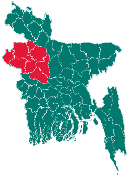
Belkuchi Upazila
| Belkuchi বেলকুচি | |
|---|---|
| Upazila | |
 Belkuchi Location in Bangladesh | |
| Coordinates: 24°17.5′N 89°42′E / 24.2917°N 89.700°ECoordinates: 24°17.5′N 89°42′E / 24.2917°N 89.700°E | |
| Country |
|
| Division | Rajshahi Division |
| District | Sirajganj District |
| Area | |
| • Total | 164.31 km2 (63.44 sq mi) |
| Population (1991) | |
| • Total | 245,164 |
| • Density | 1,492/km2 (3,860/sq mi) |
| Time zone | BST (UTC+6) |
| Website | Official Map of Belkuchi |
Belkuchi (Bengali: বেলকুচি) is an Upazila of Sirajganj District in the Division of Rajshahi, Bangladesh. It is famous for handloom cottage industries and Shohagpur Hutt.
Geography
Belkuchi is located at 24°17′30″N 89°42′00″E / 24.2917°N 89.7000°E . It has 42413 units of house hold and total area 164.31 km². Belkuchi has a very plain land. Belkuchi also has two main rivers flown over its geo plane. jamuna and Hurasagar are the two main rivers. Chandni Beel is an imortant boby.
Demographics
As of the 2011 Bangladesh census, Belkuchi has a population of 352835. Males constitute 179738 of the population, and females 173097. This Upazila's eighteen up population is 116311. Belkuchi has an average literacy rate of 33.6% (7+ years), and the national average of 32.4% literate.[1]
Administrative
Belkuchi has 6 Unions/Wards, 110 Mauzas/Mahallas, and 132 villages.
See also
References
- ↑ "Population Census Wing, BBS.". Archived from the original on 2005-03-27. Retrieved November 10, 2006.
| |||||||||||||||||||||||||||||||||||||||||
