Belfast, New York
| Belfast, New York | |
|---|---|
| Town | |
 | |
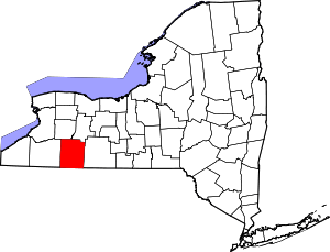
 Belfast Location within the state of New York | |
| Coordinates: 42°20′N 78°7′W / 42.333°N 78.117°W | |
| Country | United States |
| State | New York |
| County | Allegany |
| Established | 1824 |
| Renamed | 1825 |
| Government | |
| • Type | Town Council |
| • Town Supervisor | David DeRock (R) |
| • Town Council |
Members' List
|
| Area | |
| • Total | 36.5 sq mi (94.6 km2) |
| • Land | 36.2 sq mi (93.9 km2) |
| • Water | 0.3 sq mi (0.7 km2) |
| Elevation | 1,808 ft (551 m) |
| Population (2010) | |
| • Total | 1,663 |
| • Density | 46/sq mi (18/km2) |
| Time zone | Eastern (EST) (UTC-5) |
| • Summer (DST) | EDT (UTC-4) |
| ZIP code | 14711 |
| Area code(s) | 585 |
| FIPS code | 36-05573 |
| GNIS feature ID | 0978720 |
Belfast (/ˈbɛl.fæst/ or /bəlˈfɑːst/) is a town in Allegany County, New York, United States. The population was 1,663 at the 2010 census. It was named after the city of Belfast in Northern Ireland.
History
The first settlers had arrived by 1804.
The town of Belfast was established in 1824 as the town of Orrinsburgh from part of the town of Caneadea. The name was changed to Belfast in 1825 due to the large amount of settlers in the area of Irish descent. The hamlet of Belfast was established as a "mill town" with water power from the Genesee River, which runs across the town. In 1831, the size of the town increased by adding more territory from Caneadea.
The Genesee Valley Canal was completed around 1853 and stimulated the growth of the hamlet Belfast, which was later served by three railroads. The canal warehouse known as Rail and Titsworth Canal Warehouse was listed on the National Register of Historic Places in 2000.[1]
Some trouble arose in the mid-19th century when the increasing English population of the town caused concern for many of the Irish residents. After some initial conflicts, many of the Irish residents moved across to the far side of the river, but were not placated, instead choosing to occasionally enter into the English section and cause trouble; this was met with similar action by the English settlers. Although most of these clashes were minor, a larger conflict occurred from 1846–1847, when a food shortage in the area raised tensions. This was quelled eventually by New York State militia groups. A sawmill and grist mill were set up by David Sanford in 1809. They were briefly taken control of by the Irish faction in 1847 before the state militia intervened.
In 1889, John L. Sullivan- one of the world's first sports superstars - came to Belfast to train for the last bare knuckle boxing championship with Belfast resident William Muldoon for what was arguably the most important fight of Sullivan's career. Training headquarters were set up in two barns owned by Muldoon. Using training techniques that were way ahead of his time, the trainer got Sullivan into the best shape of his life. Facing Jake Kilrain in Richburg, Mississippi that August, the fight went 72 rounds before Sullivan was declared the winner. In 2009, the training barns - which were virtually untouched for more than 120 years - were opened as the world's only Bare Knuckle Boxing Hall of Fame.
Sandstone for grindstones was quarried in the late 1870s above the mouth of White Creek at Rockville.
In the 1980s an Amish community settled in the town and made their living with farming, sawmilling and furniture making.
Since the 1970s, several pirate radio stations have used the Belfast post office as a mail drop to receive letters from listeners.
Geography
According to the United States Census Bureau, the town has a total area of 36.5 square miles (95 km2), of which, 36.2 square miles (94 km2) of it is land and 0.3 square miles (0.78 km2) of it (0.77%) is water.
The Genesee River flows northward through the northeast corner of the town and is partly paralleled by New York State Route 19, which intersects County Road 26 in Belfast hamlet.
Demographics
As of the census[2] of 2000, there were 1,714 people, 651 households, and 417 families residing in the town. The population density was 47.3 people per square mile (18.3/km²). There were 945 housing units at an average density of 26.1 per square mile (10.1/km²). The racial makeup of the town was 98.31% White, 0.06% African American, 0.35% Native American, 0.06% Asian, 0.23% from other races, and 0.99% from two or more races. Hispanic or Latino of any race were 0.41% of the population.
There were 651 households out of which 33.9% had children under the age of 18 living with them, 50.8% were married couples living together, 9.8% had a female householder with no husband present, and 35.8% were non-families. 32.0% of all households were made up of individuals and 16.7% had someone living alone who was 65 years of age or older. The average household size was 2.63 and the average family size was 3.34.
In the town the population was spread out with 31.7% under the age of 18, 7.1% from 18 to 24, 25.7% from 25 to 44, 22.8% from 45 to 64, and 12.8% who were 65 years of age or older. The median age was 35 years. For every 100 females there were 99.1 males. For every 100 females age 18 and over, there were 91.0 males.
The median income for a household in the town was $30,909, and the median income for a family was $40,000. Males had a median income of $31,473 versus $21,971 for females. The per capita income for the town was $15,803. About 11.8% of families and 19.4% of the population were below the poverty line, including 26.9% of those under age 18 and 12.9% of those age 65 or over.
Notable people
- William Muldoon, Greco-Roman Wrestling Champion, physical culturist and the first chairman of the New York State Athletic Commission
- Jesse Peterson, industrialist
Communities and locations in Belfast
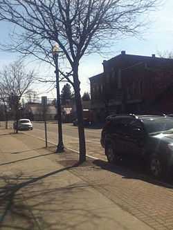
- Belfast – A hamlet located on Route 19 and the west bank of the Genesee River.
- Black Creek – A stream that joins the Genesee River north of Belfast hamlet.
- Genesee River – An important river in Western New York that empties into Lake Ontario.
- Marshall – A location in the northwest corner of the town.
- Rockville – A hamlet in the western part of the town by the Black Creek.
- Transit Bridge – A former location in the town.
References
- ↑ "National Register Information System". National Register of Historic Places. National Park Service. 2009-03-13.
- ↑ "American FactFinder". United States Census Bureau. Retrieved 2008-01-31.
External links
| |||||||||||||||||||||||||||||||||