Behchoko
| Behchoko Behchokǫ̀ Rae-Edzo | ||
|---|---|---|
| Tłı̨chǫ Community Government | ||
|
Behchoko, gas and groceries | ||
| ||
 Behchoko | ||
| Coordinates: 62°48′09″N 116°02′47″W / 62.80250°N 116.04639°WCoordinates: 62°48′09″N 116°02′47″W / 62.80250°N 116.04639°W | ||
| Country | Canada | |
| Territory | Northwest Territories | |
| Region | North Slave Region | |
| Constituency | Monfwi | |
| Census division | Region 3 | |
| Tlicho Community Government | 4 August 2005[1] | |
| Government | ||
| • Chief | Clifford Daniels | |
| • Senior Administrative Officer | Violet Camsell-Blondin | |
| • MLA | Jackson Lafferty | |
| Area[2] | ||
| • Land | 75.17 km2 (29.02 sq mi) | |
| Elevation | 179 m (587 ft) | |
| Population (2011)[2] | ||
| • Total | 1,926 | |
| • Density | 25.6/km2 (66/sq mi) | |
| Time zone | Mountain (MST) (UTC−7) | |
| • Summer (DST) | MDT (UTC−6) | |
| Canadian Postal code | X0E 0Y0 | |
| Area code(s) | 867 | |
| Telephone exchange | 292, 371, 392 | |
| - Living cost | 127.5A | |
| - Food price index | 135.1B | |
|
Sources: Department of Municipal and Community Affairs,[3] Prince of Wales Northern Heritage Centre,[4] Canada Flight Supplement[5] ^A 2009 figure based on Edmonton = 100[6] ^B 2010 figure based on Yellowknife = 100[6] | ||
Behchokǫ̀ ([bɛ́ht͡ʃʰókʰõ̀] or [bɛ́ht͡sʰókʰõ̀] (from the Tłı̨chǫ meaning "Behcho's place"), officially the Tłı̨chǫ Community Government of Behchokǫ̀,[7] is a community in the North Slave Region of the Northwest Territories, Canada. Behchokǫ̀ is located on the Yellowknife Highway (Great Slave Highway), on the northwest tip of Great Slave Lake, approximately 80 km (50 mi) northwest of Yellowknife.
History
The North Arm of Great Slave Lake is the traditional territory of the Tłı̨chǫ Dene (Dogrib), a northern Dene (formerly called Athapaskan) group. Explorer Samuel Hearne was the first European to encounter Dogrib-speaking people while crossing the barren lands north of Great Slave Lake in 1772. Later, in 1789, trader Alexander Mackenzie traveled by canoe very close to their territory while trading with Yellowknives Dene along the North Arm of the big lake.
The first trading post in this region was at the entrance of Yellowknife Bay, established in 1789 by the North West Company, a post known as Old Fort Providence. It was established for the benefit of both the Yellowknives and Dogrib Dene but it was not a significant trading centre and closed in 1823. Dogrib Dene were then required to enter into trade with Hudson's Bay Company posts on the south side of Great Slave Lake at Fort Resolution at the mouth of the Slave River. Historically, the Dogrib and the Yellowknives Dene have quarreled. By the 1830s, Edzo, the Dogrib leader and Akaitcho, the Yellowknives leader, made peace. Afterwards, the Dogrib's returned to their traditional hunting grounds.[8]
Fort Rae was first established on a prominent peninsula on the north shore of the North Arm of Great Slave Lake in 1852 as a wintering provision post for the Hudson's Bay Company. It was named for John Rae, who was among the explorers looking for remains of Sir John Franklin's expedition in the Arctic. It became an important trading post for the Dogrib Dene. In the early 20th century, free traders penetrated a monopoly previously held by the HBC. Ed Nagle and Jack Hislop opened a new trading post at the very northern tip of the North Arm where Marian Lake connects to Great Slave Lake. As this location was much closer to many of the Dene families living on the land, it became the area of choice for trade. The HBC abandoned the old Fort Rae and set up a post next to Hislop and Nagle.[9]
As the community grew alongside increased services such as a mission-run hospital and church, the government viewed the topography of Fort Rae as unsuitable for expansion. In the 1950s there was concern about runoff from animal and human wastes contaminating sources of drinking water, and the government proposed constructing a new settlement on more favourable terrain. The community became known as Edzo and was located on the west side of the Frank Channel opposite Fort Rae. Most of the Dene families refused to move from their community so that Rae and Edzo (Rae-Edzo) became two separate communities although administered together.[10]
The name Rae-Edzo was changed 4 August 2005 to Behchokǫ̀. The biggest names in Tłı̨chǫ (Tli Cho) history are Edzo, Bruneau, and Monfwi. All men were Dogrib chiefs at important periods in their cultural history; Edzo signed the peace pact with the Yellowknives Dene in the 1820s, Jimmy Bruneau was a long-standing chief in the 20th century, and Monfwi signed Treaty 11 with the Canadian Government in 1921 and created the Tłı̨chǫ annual assembly in 1932.
Demographics
According to the 2011 Census the population was 1,926,[2] an increase of 1.7% over the 2006 Census. According the 2006 Census the Aboriginal population was made up of 1,770 North American Indians, 30 Métis people and 10 Inuit.[11] In 2012 the Government of the Northwest Territories reported that the population was 2,174 with an average yearly growth rate of 1.9 from 2001.[6]
| Historical population | ||||||||||||||||||||||||||||||||||||||||||||||||||||||||||
|---|---|---|---|---|---|---|---|---|---|---|---|---|---|---|---|---|---|---|---|---|---|---|---|---|---|---|---|---|---|---|---|---|---|---|---|---|---|---|---|---|---|---|---|---|---|---|---|---|---|---|---|---|---|---|---|---|---|---|
|
| |||||||||||||||||||||||||||||||||||||||||||||||||||||||||
| Sources: NWT Bureau of Statistics (2001 - 2012)[6] | ||||||||||||||||||||||||||||||||||||||||||||||||||||||||||
First Nations
One of the four Tłı̨chǫ communities, it is the largest Dene community in Canada.[12] Behchokǫ̀ was the site of the signing of the Tłı̨chǫ land claim agreement that brought about the Tłı̨chǫ Government.[13]
Gallery
-

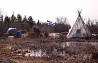
Boreal forest near Rae Edzo - Behchoko
-

Rae Edzo - Behchoko, camp on the banks of Great Slave Lake
-

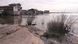
Rae Edzo - Behchoko, banks of Great Slave Lake
See also
References
- ↑ "Tlicho Community Government Act, S.N.W.T. 2004, c.7" (PDF) (PDF). Government of the Northwest Territories. August 4, 2005. pp. 16–17 and 20. Retrieved January 12, 2014.
- ↑ 2.0 2.1 2.2 Behchokò, CG Northwest Territories (Census subdivision)
- ↑ "NWT Communities - Behchoko". Government of the Northwest Territories: Department of Municipal and Community Affairs. Retrieved 2014-01-21.
- ↑ Prince of Wales Northern Heritage Centre - official names
- ↑ Canada Flight Supplement. Effective 0901Z 24 July 2014 to 0901Z 18 September 2014
- ↑ 6.0 6.1 6.2 6.3 Behchoko - Statistical Profile at the GNWT
- ↑ Differences in Community Government Structures
- ↑ Communities Economic Reference Library; Department of Industry, Tourism and Investment. pg 181.(2006).
- ↑ Zinovich, Jordan. “Battling the Bay: The Turn of the Century Adventures of Fur Trader Ed Nagle.” Edmonton: Lone Pine Publishing, 1992.
- ↑ Grainge, Jack. “The Changing North: Recollections of an early environmentalist.” Edmonton: Canadian Circumpolar Institute Press, 1999.
- ↑ 2006 Aboriginal Population Profile
- ↑ Behchokǫ̀ at the Tłı̨chǫ First Nations site
- ↑ Government of the NWT news release on land claims signing
Further reading
- Northwest Territories, and BHP Billiton Diamonds Inc. Communities and Diamonds Socio-Economic Impacts in the Communities of: Behchokǫ̀, Gameti, Whati, Wekweeti, Detah, Ndilo, Lutsel K'e, and Yellowknife : 2005 Annual Report of the Government of the Northwest Territories Under the BHP Billiton, Diavik and De Beers Socio-Economic Agreements. [Yellowknife]: Govt. of the Northwest Territories, 2006.
| ||||||||||||||||||||||||||||||||||||||||||||||||||||||||||||||||||||||||||||||||||||||||||
