Beecher Island
|
Beecher Island Battleground | |
 | |
|
Beecher Island in 1917: the south channel of the Arickaree River has been closed, owing to the sifting sands of the stream. The Battle of Beecher Island monument is visible in the distance. | |
 | |
| Nearest city | Wray, Colorado |
|---|---|
| Coordinates | 39°52′13″N 102°11′13″W / 39.87028°N 102.18694°WCoordinates: 39°52′13″N 102°11′13″W / 39.87028°N 102.18694°W |
| Area | 240 acres (97 ha) |
| Built | 1868 |
| Governing body | Private |
| NRHP Reference # |
76000569 [1] |
| Added to NRHP | October 29, 1976 |
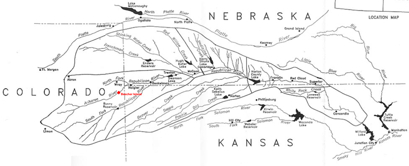
Beecher Island is a sandbar located along the lower course of the Arikaree River, a tributary of the North Fork of the Republican River near Wray in Yuma County, Colorado. The site is notable for having been the scene of an 1868 armed conflict between elements of the United States Army and several of the Plains Indian tribes. The island was named for Lt. Fredrick Henry Beecher of the 3rd Infantry (nephew of Henry Ward Beecher and veteran of the Battle of Gettysburg), one of the heroes of the engagement who was killed during what became known as the Battle of Beecher Island. The "island" and the courses of the river have been modified by several floods since 1868.
Historic designations
- National Register of Historic Places #NPS–76000569 — "Beecher Island Battleground Memorial" site
- Colorado State Register Property
References
- ↑ "National Register Information System". National Register of Historic Places. National Park Service. 2009-03-13.
External links

A map of the Republican River and its tributaries, with the location of Beecher Island highlighted in red.