Bee County, Texas
| Bee County, Texas | |
|---|---|
 The Bee County Courthouse in Beeville was built in 1913. | |
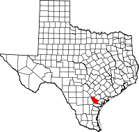 Location in the state of Texas | |
 Texas's location in the U.S. | |
| Founded | December 8, 1857 |
| Named for | Barnard E. Bee, Sr. |
| Seat | Beeville |
| Largest city | Beeville |
| Area | |
| • Total | 880 sq mi (2,279 km2) |
| • Land | 880 sq mi (2,279 km2) |
| • Water | 0.1 sq mi (0 km2), 0.01% |
| Population | |
| • (2010) | 31,861 |
| • Density | 36/sq mi (14/km²) |
| Congressional district | 34th |
| Time zone | Central: UTC-6/-5 |
| Website |
co |
Bee County is a county located in the U.S. state of Texas. As of the 2010 census, the population was 31,861.[1] Its county seat is Beeville.[2] The county was founded December 8, 1857 and is named for Barnard E. Bee, Sr., a secretary of state of the Republic of Texas.
The Beeville, TX Micropolitan Statistical Area includes all of Bee County.
History
On December 8, 1857, Bee County was formed from portions of San Patricio, Goliad, Refugio, Live Oak, and Karnes counties. The first Spanish grant in the area was made to Carlos Martínez in 1789. The first permanent settlers, Jeremiah O'Tool, his sons Martin and Michael, and James O'Reilly, sailed from Ireland in 1826. Bee County, named for Barnard E. Bee Sr., was established shortly after the settlement of the Cart War, which originated ten miles east of the site of Beeville.
Bee County Courthouse
The Bee County Courthouse was designed by the architect William Charles Stephenson, originally from Buffalo, New York. The original courthouse, completed in 1912, cost $72,000. He also sculpted the "Justice Is Blind" monument (In his own words, an "Enlightened Justice") that tops the Courthouse; he intentionally chose the "non-blindfolded" concept. The structure uses the Chicago window style of a glass pane flanked by two narrow ones. It is classical with the grand portico having Corinthian columns at the entry.[3]
Stephenson also designed the Rialto Theater in Beeville, now used for special occasion, not the running of films, which is located close to the Joe Barnhart Library. He helped construct the death mask of U.S. President William McKinley, who was assassinated in Buffalo in 1901. Stephenson also designed the courthouse in McMullen County, Texas and many other buildings, grand homes, schools, churches, and commercial buildings in and around Beeville.[3]
Geography
According to the U.S. Census Bureau, the county has a total area of 880 square miles (2,300 km2), of which 880 square miles (2,300 km2) is land and 0.1 square miles (0.26 km2) (0.01%) is water.[4] The Aransas River forms in Bee County, southwest of Beeville and north of Skidmore.
Major highways
-
 U.S. Highway 59
 The future route of Interstate 69W is planned to follow the current route of U.S. 59 in most places.
-
 U.S. Highway 181
 -
 State Highway 72
 -
 State Highway 202
 -
 State Highway 359
 -
 Farm to Market Road 673
 -
 Farm to Market Road 799
 -
 Farm to Market Road 833
Adjacent counties
- Karnes County (north)
- Goliad County (northeast)
- Refugio County (east)
- San Patricio County (southeast)
- Live Oak County (west)
Demographics
| Historical population | |||
|---|---|---|---|
| Census | Pop. | %± | |
| 1860 | 910 | — | |
| 1870 | 1,082 | 18.9% | |
| 1880 | 2,298 | 112.4% | |
| 1890 | 3,720 | 61.9% | |
| 1900 | 7,720 | 107.5% | |
| 1910 | 12,090 | 56.6% | |
| 1920 | 12,137 | 0.4% | |
| 1930 | 15,721 | 29.5% | |
| 1940 | 16,481 | 4.8% | |
| 1950 | 18,174 | 10.3% | |
| 1960 | 23,755 | 30.7% | |
| 1970 | 22,737 | −4.3% | |
| 1980 | 26,030 | 14.5% | |
| 1990 | 25,135 | −3.4% | |
| 2000 | 32,359 | 28.7% | |
| 2010 | 31,861 | −1.5% | |
| Est. 2014 | 32,863 | 3.1% | |
As of the 2010 United States Census, there were 31,861 people residing in the county. 78.8% were White, 8.1% Black or African American, 0.6% Asian, 0.5% Native American, 0.1% Pacific Islander, 9.7% of some other race and 2.3% of two or more races. 56.2% were Hispanic or Latino (of any race).
As of the census[7] of 2000, there were 32,359 people, 9,061 households, and 6,578 families residing in the county. The population density was 37 people per square mile (14/km²). There were 10,939 housing units at an average density of 12 per square mile (5/km²). The racial makeup of the county was 67.85% White, 9.90% Black or African American, 0.42% Native American, 0.51% Asian, 0.03% Pacific Islander, 19.15% from other races, and 2.13% from two or more races. 53.93% of the population were Hispanic or Latino of any race.
There were 9,061 households out of which 37.80% had children under the age of 18 living with them, 52.90% were married couples living together, 14.80% had a female householder with no husband present, and 27.40% were non-families. 23.70% of all households were made up of individuals and 9.90% had someone living alone who was 65 years of age or older. The average household size was 2.74 and the average family size was 3.25.
In the county, the population was spread out with 23.40% under the age of 18, 13.30% from 18 to 24, 35.40% from 25 to 44, 17.80% from 45 to 64, and 10.20% who were 65 years of age or older. The median age was 32 years. For every 100 females there were 148.40 males. For every 100 females age 18 and over, there were 164.90 males.
The median income for a household in the county was $28,392, and the median income for a family was $32,967. Males had a median income of $26,473 versus $20,666 for females. The per capita income for the county was $10,625. About 19.70% of families and 24.00% of the population were below the poverty line, including 33.80% of those under age 18 and 18.30% of those age 65 or over.
Government and infrastructure
The Texas Department of Criminal Justice operates the Correctional Institutions Division Region IV Office on the grounds of Chase Field Naval Air Station in unincorporated Bee County.[8] In addition Garza East Unit and Garza West Unit, transfer facilities, are co-located on the grounds of the naval air station,[9][10] and the McConnell Unit is also in an unincorporated area in Bee County.[11] The Beeville Distribution Center is on the grounds of the air station.[12]
Education

The following school districts serve Bee County:
- Beeville Independent School District
- Mathis Independent School District (partial)
- Pawnee Independent School District (partial, K-8)
- Pettus Independent School District (partial)
- Refugio Independent School District (partial)
- Skidmore-Tynan Independent School District (partial)
- Three Rivers Independent School District (partial)
The following post-secondary institutions serve Bee County (and the surrounding area):
Communities

See also
References
- ↑ 1.0 1.1 "State & County QuickFacts". United States Census Bureau. Retrieved December 8, 2013.
- ↑ "Find a County". National Association of Counties. Retrieved 2011-06-07.
- ↑ 3.0 3.1 Historical Marker, Bee County Courthouse, Beeville, Texas
- ↑ "2010 Census Gazetteer Files". United States Census Bureau. August 22, 2012. Retrieved April 19, 2015.
- ↑ "U.S. Decennial Census". United States Census Bureau. Retrieved April 19, 2015.
- ↑ "Texas Almanac: Population History of Counties from 1850–2010" (PDF). Texas Almanac. Retrieved April 19, 2015.
- ↑ "American FactFinder". United States Census Bureau. Retrieved 2011-05-14.
- ↑ "Correctional Institutions Division Region IV Director's Office." Texas Department of Criminal Justice. Retrieved on May 21, 2010.
- ↑ "Garza East Unit." Texas Department of Criminal Justice. Retrieved on May 21, 2010.
- ↑ "Garza West Unit." Texas Department of Criminal Justice. Retrieved on May 21, 2010.
- ↑ "McConnell Unit." Texas Department of Criminal Justice. Retrieved on May 21, 2010.
- ↑ "Beeville Distribution Center." Texas Department of Criminal Justice. Retrieved on May 22, 2010.
External links
- Bee County government
- Bee County in Handbook of Texas Online at the University of Texas.
- Historic Bee County materials, hosted by the Portal to Texas History.
- Beeville History
- "Bee County Profile" from the Texas Association of Counties
 |
Karnes County | Goliad County | | |
| Live Oak County | |
Refugio County | ||
| ||||
| | ||||
| San Patricio County |
| |||||||||||||||||||||
| ||||||||||||||||||||||||||