Bayport Aerodrome
| Bayport Aerodrome | |||||||||||||||||||||
|---|---|---|---|---|---|---|---|---|---|---|---|---|---|---|---|---|---|---|---|---|---|
|
Bayport Aerodrome Entrance. | |||||||||||||||||||||
| IATA: none – ICAO: none – FAA LID: 23N | |||||||||||||||||||||
| Summary | |||||||||||||||||||||
| Airport type | Public/Antique | ||||||||||||||||||||
| Owner | Town of Islip | ||||||||||||||||||||
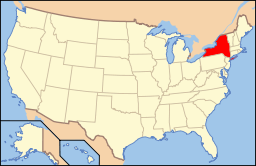
| Location | Bayport, New York | ||||||||||||||||||||
| Elevation AMSL | 41 ft / 12(estimated) m | ||||||||||||||||||||
| Coordinates | 40°45′30.3″N 73°03′13.4″W / 40.758417°N 73.053722°WCoordinates: 40°45′30.3″N 73°03′13.4″W / 40.758417°N 73.053722°W | ||||||||||||||||||||
| Website | Bayport Aerodrome Society | ||||||||||||||||||||
| Runways | |||||||||||||||||||||
| |||||||||||||||||||||
| |||||||||||||||||||||
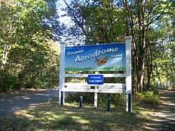
Bayport Aerodrome (FAA LID: 23N) (formerly known as Davis Field) is a historic rural airport one mile northwest of Bayport, New York. The airport has a grass runway and is owned and operated by the Town of Islip. It is home to a non-profit organization that specializes in antique airplanes, known as the Bayport Aerodrome Society, which was established in 1972.
Bayport Aerodrome is not used for commercial aviation, such as the nearby Long Island MacArthur Airport. The airport has been listed on the National Register of Historic Places as a national historic district since January 22, 2008.[1][2]
References
- ↑ 1.0 1.1 "National Register Information System". National Register of Historic Places. National Park Service. 2009-03-13.
- ↑ Virginia L. Bartos (September 2007). "National Register of Historic Places Registration: Davis Field". New York State Office of Parks, Recreation and Historic Preservation. Retrieved 2010-02-20. See also: "Accompanying seven photos".
External links
- Bayport Aerodrome Society (Official site)
- New York State DOT Airport Diagram
- Resources for this airport:
- AirNav airport information for 23N
- FlightAware airport information and live flight tracker
- SkyVector aeronautical chart for 23N
| |||||||||||||||||||||||||