Bayons
| Bayons | ||
|---|---|---|
|
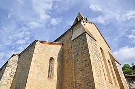
The church in Bayons | ||
| ||
 Bayons | ||
|
Location within Provence-A.-C.d'A. region 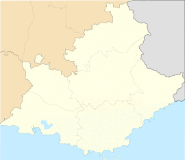 Bayons | ||
| Coordinates: 44°20′23″N 6°09′51″E / 44.3397°N 6.1642°ECoordinates: 44°20′23″N 6°09′51″E / 44.3397°N 6.1642°E | ||
| Country | France | |
| Region | Provence-Alpes-Côte d'Azur | |
| Department | Alpes-de-Haute-Provence | |
| Arrondissement | Forcalquier | |
| Canton | Turriers | |
| Government | ||
| • Mayor (2008–2014) | Bernard Daumas | |
| Area1 | 125.75 km2 (48.55 sq mi) | |
| Population (2008)2 | 253 | |
| • Density | 2.0/km2 (5.2/sq mi) | |
| INSEE/Postal code | 04023 / 04250 | |
| Elevation |
749–2,111 m (2,457–6,926 ft) (avg. 870 m or 2,850 ft) | |
|
1 French Land Register data, which excludes lakes, ponds, glaciers > 1 km² (0.386 sq mi or 247 acres) and river estuaries. 2 Population without double counting: residents of multiple communes (e.g., students and military personnel) only counted once. | ||

Bayons (Baion in Occitan) is a commune in the Alpes-de-Haute-Provence department in southeastern France.
Geography
The surrounding communes of Bayons are Turriers, Bellaffaire, Clamensane, Saint-Martin-lès-Seyne, Selonnet, Barles, Authon, Valavoire, Le Caire and Faucon-du-Caire.
Bayons is situated in a vast amphitheatre, surrounded by high mountains, and where the Sasse flows, exiting through a narrow clue. The communes joined to Bayons in 1974 are located in parallel valleys, perpendicular to the Sasse and downstream from Bayons, except Astoin.
Population
| Historical population | ||
|---|---|---|
| Year | Pop. | ±% |
| 1765 | 686 | — |
| 1793 | 748 | +9.0% |
| 1800 | 772 | +3.2% |
| 1806 | 705 | −8.7% |
| 1821 | 729 | +3.4% |
| 1831 | 804 | +10.3% |
| 1836 | 876 | +9.0% |
| 1841 | 854 | −2.5% |
| 1846 | 908 | +6.3% |
| 1851 | 793 | −12.7% |
| 1856 | 685 | −13.6% |
| 1861 | 678 | −1.0% |
| 1866 | 719 | +6.0% |
| 1872 | 681 | −5.3% |
| 1876 | 660 | −3.1% |
| 1881 | 629 | −4.7% |
| 1886 | 619 | −1.6% |
| 1891 | 602 | −2.7% |
| 1896 | 567 | −5.8% |
| 1901 | 540 | −4.8% |
| 1906 | 501 | −7.2% |
| 1911 | 461 | −8.0% |
| 1921 | 420 | −8.9% |
| 1926 | 433 | +3.1% |
| 1931 | 320 | −26.1% |
| 1936 | 269 | −15.9% |
| 1946 | 208 | −22.7% |
| 1954 | 183 | −12.0% |
| 1962 | 136 | −25.7% |
| 1968 | 128 | −5.9% |
| 1975 | 150 | +17.2% |
| 1982 | 138 | −8.0% |
| 1990 | 194 | +40.6% |
| 1999 | 198 | +2.1% |
| 2008 | 253 | +27.8% |
See also
References
| Wikimedia Commons has media related to Bayons. |