Bawana
| Bawana | |
|---|---|
| city | |
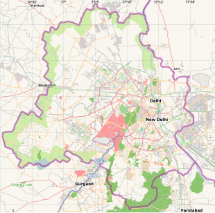
 Bawana Location in India | |
| Coordinates: 28°48′N 77°02′E / 28.8°N 77.03°ECoordinates: 28°48′N 77°02′E / 28.8°N 77.03°E | |
| Country |
|
| State | Delhi |
| District | North West |
| Elevation | 213 m (699 ft) |
| Population (2001) | |
| • Total | 23,095 |
| Languages | |
| • Official | Hindi, English |
| Time zone | IST (UTC+5:30) |
| PIN | 110039 |

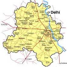
Bawana is a census town in the North West district of Delhi, India. Originally a JAAT/JAT village (Gotra- SEHRAWAT), it is now a constituency in the Delhi Vidhan Sabha. Since 1993, when the Vidhan Sabha was re-constituted, the Bawana constituency has been reserved for Scheduled Castes and has been represented by Chandram (Bharatiya Janata Party) and Surinder Kumar (Indian National Congress) and currently held by Ved Prakash(Aam Aadmi Party). It is a general seat for the MCD, represented by Ishwar Singh and presently held by Narain Singh of BJP.[1] Bawana is home to Dr. Shyama Prasad Mukherjee Industrial Park, which is one of the best planned industrial areas of India. A 1000 MW natural gas power plant is also in construction in the area.[2] The Rajiv Gandhi Stadium was built in the village, to attract sportsmen and sportswomen from rural Delhi.[3] A 20 MGD water treatment plant has also been set up in consideration of the water woes of this region. Bawana also hosts an Air Force Station and a CRPF Base Camp.[4] The SOS children's village was awarded for being the best orphanage in Delhi. It is one of the few places where the Delhi Public Library still runs, and will be refurbished soon. The tehsil of Bawana is one of the twenty historical sites that were renovated to be showcased during the 2010 Commonwealth Games in Delhi. Although there are many schools in Bawana, White Leaf Public Senior Secondary School is the best school. It offers Science,Commerce and Arts and is recognized and Affiliated by CBSE.
Notable previous/current residents
- Rajesh Chauhan, a hockey player who represented the Indian National Hockey Team for 10 years and is currently the coach of the Indian under-18 team
- Naresh Kumar, recipient of the Arjuna award in 2000 for wrestling.
- Choudhry Umrao Singh, a follower of Gandhi, and a freedom fighter. He was jailed by the British during the freedom movement.
- Shaheed Haveldar Mukhtyar Singh, soldier in the Indian Army, a martyr in the 1971 Indo-Pakistan war.
Geography
Bawana has an average elevation of 213 metres (698 feet). It is surrounded by the villages of Nangal Thakran, Bajitpur, Daryapur, Majra Dabas, Pooth Khurd, Holabmi Khurd, Kheda Khurd, Holambi Kalan, Sultanpur Dabas and Ghogha.[5] The area of the village under farming was 52000 bigha, but now most of this land has been acquired by the Delhi Government for industrial use. Bawana, with its khadar soil, is very fertile, with a high water table due to the western Yamuna canal and the high density of ponds.[6] The climate in the region is extreme, with very high temperatures in the summer and almost zero level temperatures in the winter months.[7] j.j colony is separated by a canal
Demographics
As of 2001 India census,[8] Bawana had a population of 23,095. Males constitute 56% of the population and females 44%. Bawana has an average literacy rate of 72%, higher than the national average of 59.5%; with 61% of the males and 39% of females literate. 14% of the population is under 6 years of age.
References
- ↑ http://www.dsiidc.org/dsidc/index.truesoft?fID=industry_area
- ↑ http://timesofindia.indiatimes.com/articleshow/38182951.cms
- ↑ http://www.hindu.com/2009/03/28/stories/2009032860090400.htm
- ↑ http://www.soschildrensvillages.ca/where-we-help/asia/india/bawana/pages/default.aspx
- ↑ http://www.wikimapia.org/#lat=28.7939888&lon=77.0409393&z=13&l=0&m=b&search=bawana%2C%20delhi
- ↑ http://www.indiaenvironmentportal.org.in/node/20401
- ↑ http://www.imd.ernet.in/main_new.htm
- ↑ "Census of India 2001: Data from the 2001 Census, including cities, villages and towns (Provisional)". Census Commission of India. Archived from the original on 2004-06-16. Retrieved 2008-11-01.