Bates County, Missouri
| Bates County, Missouri | |
|---|---|
 Bates County Courthouse in Butler | |
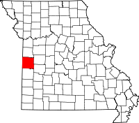 Location in the state of Missouri | |
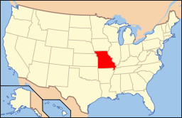 Missouri's location in the U.S. | |
| Founded | January 29, 1841[1] |
| Named for | Frederick Bates |
| Seat | Butler |
| Largest city | Butler |
| Area | |
| • Total | 851 sq mi (2,204 km2) |
| • Land | 837 sq mi (2,168 km2) |
| • Water | 15 sq mi (39 km2), 1.7% |
| Population | |
| • (2010) | 17,049 |
| • Density | 20/sq mi (8/km²) |
| Congressional district | 4th |
| Time zone | Central: UTC-6/-5 |
| Website |
www |
Bates County is a county located in the west central part of the U.S. state of Missouri. As of the 2010 U.S. Census, the population was 17,049.[2] Its county seat is Butler.[3] The county was organized in 1841 and named after Frederick Bates, the second Governor of Missouri.[4]
Bates County is part of the Kansas City, MO-KS Metropolitan Statistical Area.
Bates County was the only county in the United States to have endured total evacuation during the US Civil War, under Order No.11. It was also the setting for the first black Union soldiers to fight for their freedom during the Civil War. The First Kansas Colored Division fought at the Battle of Island Mound four miles North of present day Rich Hill, MO. A statue commemorating this event has been placed on the North lawn of the courthouse in Butler, MO. seven miles from the battle sight.
Geography
According to the U.S. Census Bureau, the county has a total area of 851 square miles (2,200 km2), of which 837 square miles (2,170 km2) is land and 15 square miles (39 km2) (1.7%) is water.[5]
Adjacent counties
- Cass County (north)
- Henry County (northeast)
- St. Clair County (southeast)
- Vernon County (south)
- Linn County, Kansas (west)
- Miami County, Kansas (northwest)
Major highways
.svg.png) Interstate 49
Interstate 49 U.S. Route 71
 Route 18
 Route 52
Demographics
| Historical population | |||
|---|---|---|---|
| Census | Pop. | %± | |
| 1850 | 3,669 | — | |
| 1860 | 7,215 | 96.6% | |
| 1870 | 15,960 | 121.2% | |
| 1880 | 25,381 | 59.0% | |
| 1890 | 32,223 | 27.0% | |
| 1900 | 30,141 | −6.5% | |
| 1910 | 25,869 | −14.2% | |
| 1920 | 23,933 | −7.5% | |
| 1930 | 22,068 | −7.8% | |
| 1940 | 19,531 | −11.5% | |
| 1950 | 17,534 | −10.2% | |
| 1960 | 15,905 | −9.3% | |
| 1970 | 15,468 | −2.7% | |
| 1980 | 15,873 | 2.6% | |
| 1990 | 15,025 | −5.3% | |
| 2000 | 16,653 | 10.8% | |
| 2010 | 17,049 | 2.4% | |
| Est. 2014 | 16,584 | −2.7% | |
As of the census[10] of 2000, there were 16,653 people, 6,511 households, and 4,557 families residing in the county. The population density was 20 people per square mile (8/km²). There were 7,247 housing units at an average density of 8 per square mile (3/km²). The racial makeup of the county was 97.33% White, 0.61% Black or African American, 0.59% Native American, 0.15% Asian, 0.01% Pacific Islander, 0.39% from other races, and 0.92% from two or more races. Approximately 1.07% of the population were Hispanic or Latino of any race.
There were 6,511 households out of which 32.30% had children under the age of 18 living with them, 58.80% were married couples living together, 7.60% had a female householder with no husband present, and 30.00% were non-families. 26.10% of all households were made up of individuals and 13.90% had someone living alone who was 65 years of age or older. The average household size was 2.51 and the average family size was 3.02.
In the county the population was spread out with 26.50% under the age of 18, 7.50% from 18 to 24, 26.00% from 25 to 44, 22.60% from 45 to 64, and 17.40% who were 65 years of age or older. The median age was 38 years. For every 100 females there were 95.20 males. For every 100 females age 18 and over, there were 91.50 males.
The median income for a household in the county was $30,731, and the median income for a family was $36,470. Males had a median income of $30,298 versus $19,772 for females. The per capita income for the county was $15,477. About 11.50% of families and 14.50% of the population were below the poverty line, including 18.30% of those under age 18 and 14.10% of those age 65 or over.
Education
Public schools
- Adrian R-III School District – Adrian
- Adrian Elementary School (PK-05)
- Adrian High School (06-12)
- Ballard R-II School District – Butler
- Ballard Elementary School (PK-06)
- Ballard High School (07-12)
- Butler R-V School District – Butler
- Butler Elementary School (K-06)
- Butler High School (07-12)
- Hume R-VIII School District – Hume
- Hume Elementary School (PK-05)
- Hume High School (06-12)
- Miami R-I School District – Amoret
- Miami Elementary School (K-06)
- Miami High School (07-12)
- Rich Hill R-IV School District – Rich Hill
- Rich Hill Elementary School (K-05)
- Rich Hill High School (06-12)
Private schools
- Zion Lutheran School – Rockville (02-09) – Lutheran
Politics
Local
| Bates County, Missouri | ||||
|---|---|---|---|---|
| Elected countywide officials | ||||
| Assessor | Roger Pruden | Democratic | ||
| Circuit Clerk | Diana L. Rich | Democratic | ||
| County Clerk | Marlene Wainscott | Democratic | ||
| Collector | Jimmy Platt | Democratic | ||
| Commissioner (Presiding) |
Donna Gregory | Democratic | ||
| Commissioner (District 1) |
Jim Scott | Democratic | ||
| Commissioner (District 2) |
±Larry Berry | Democratic | ||
| Coroner | Gary Schowengerdt | Democratic | ||
| Prosecuting Attorney | Hugh C. Jenkins | Democratic | ||
| Public Administrator | Sharon Cumpton | Democratic | ||
| Recorder | Lucille Mundey | Democratic | ||
| Sheriff | Chad Anderson | Democratic | ||
| Surveyor | W.C. “Bill” Lethcho | Democratic | ||
| Treasurer | Jimmy Platt | Democratic | ||
State
| Year | Republican | Democratic | Third Parties |
|---|---|---|---|
| 2012 | 45.46% 3,513 | 51.40% 3,972 | 3.14% 243 |
| 2008 | 41.75% 3,431 | 55.43% 4,555 | 2.82% 232 |
| 2004 | 53.22% 4,479 | 45.09% 3,795 | 1.69% 142 |
| 2000 | 48.88% 3,783 | 49.02% 3,794 | 2.10% 162 |
| 1996 | 34.70% 2,483 | 63.33% 4,531 | 1.97% 141 |
| 1992 | 42.06% 3,204 | 57.94% 4,414 | 0.00% 0 |
Bates County is divided into three legislative districts in the Missouri House of Representatives, all of which are held by Republicans.
- District 56 – Jack Bondon (R-Belton). Consists of unincorporated areas in the northwestern quadrant of the county south of Drexel.
- District 57 – Wanda Brown (R-Lincoln). Consists of unincorporated areas in the northern part of the county north of and surrounding Adrian.
- District 126 — Patricia Pike (R-Adrian). Consists of most of the entire county.
All of Bates County is a part of Missouri’s 31st Senatorial District in the Missouri Senate and is currently represented by Ed Emery (R-Lamar).
Federal
All of Bates County is included in Missouri’s 4th Congressional District and is currently represented by Vicky Hartzler (R-Harrisonville) in the U.S. House of Representatives.
| U.S. House of Representatives – Missouri’s 4th Congressional District - Bates County (2014) | |||||
|---|---|---|---|---|---|
| Party | Candidate | Votes | % | ±% | |
| Republican | Vicky J. Hartzler | 2,943 | 68.41 | ||
| Democratic | Nate Irvin | 1,088 | 25.29 | ||
| Libertarian | Herschel L. Young | 270 | 6.28 | ||
Political Culture
| Year | Republican | Democratic | Third Parties |
|---|---|---|---|
| 2012 | 58.35% 4,833 | 39.49% 3,271 | 2.15% 179 |
| 2008 | 64.60% 5,020 | 32.90% 2,557 | 2.50% 194 |
| 2004 | 59.11% 5,004 | 40.14% 3,398 | 0.75% 64 |
| 2000 | 54.48% 4,245 | 43.45% 3,386 | 2.07% 161 |
| 1996 | 40.69% 2,904 | 45.17% 3,224 | 14.14% 1,009 |
| 1992 | 32.33% 2,499 | 38.72% 2,993 | 28.95% 2,238 |
Missouri Presidential Preference Primary (2008)
- Former U.S. Senator Hillary Rodham Clinton (D-New York) received more votes, a total of 1,427, than any candidate from either party in Bates County during the 2008 presidential primary.
| Bates County, Missouri | ||
|---|---|---|
| 2008 Republican primary in Missouri | ||
| John McCain | 594 (37.71%) | |
| Mike Huckabee | 503 (31.94%) | |
| Mitt Romney | 368 (23.37%) | |
| Ron Paul | 71 (4.51%) | |
| Bates County, Missouri | ||
|---|---|---|
| 2008 Democratic primary in Missouri | ||
| Hillary Rodham Clinton | 1,427 (63.51%) | |
| Barack Obama | 676 (30.08%) | |
| John Edwards (withdrawn) | 106 (4.72%) | |
Communities
Cities
Villages
Unincorporated communities
Townships
Bates County is divided into 24 townships:
See also
- National Register of Historic Places listings in Bates County, Missouri
References
- ↑ "Bates County History". Bates County. Retrieved November 23, 2014.
- ↑ 2.0 2.1 "State & County QuickFacts". United States Census Bureau. Retrieved September 7, 2013.
- ↑ "Find a County". National Association of Counties. Retrieved 2011-06-07.
- ↑ Eaton, David Wolfe (1916). How Missouri Counties, Towns and Streams Were Named. The State Historical Society of Missouri. p. 208.
- ↑ "2010 Census Gazetteer Files". United States Census Bureau. August 22, 2012. Retrieved November 13, 2014.
- ↑ "U.S. Decennial Census". United States Census Bureau. Retrieved November 13, 2014.
- ↑ "Historical Census Browser". University of Virginia Library. Retrieved November 13, 2014.
- ↑ "Population of Counties by Decennial Census: 1900 to 1990". United States Census Bureau. Retrieved November 13, 2014.
- ↑ "Census 2000 PHC-T-4. Ranking Tables for Counties: 1990 and 2000" (PDF). United States Census Bureau. Retrieved November 13, 2014.
- ↑ "American FactFinder". United States Census Bureau. Retrieved 2011-05-14.
External links
- Bates County website
- Digitized 1930 Plat Book of Bates County from University of Missouri Division of Special Collections, Archives, and Rare Books
 |
Miami County, Kansas | Cass County | Henry County | |
| Linn County, Kansas | |
|||
| ||||
| | ||||
| Vernon County | St. Clair County |
| ||||||||||||||||||||||||

| |||||||||||||||||||||||||||||