Bassenthwaite
| Bassenthwaite | |
 Sun Inn |
|
 Bassenthwaite |
|
| Population | 412 (2001) |
|---|---|
| OS grid reference | NY2332 |
| Civil parish | Bassenthwaite |
| District | Allerdale |
| Shire county | Cumbria |
| Region | North West |
| Country | England |
| Sovereign state | United Kingdom |
| Police | Cumbria |
| Fire | Cumbria |
| Ambulance | North West |
| EU Parliament | North West England |
Coordinates: 54°40′48″N 3°11′46″W / 54.68°N 3.196°W
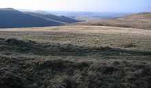
Bassenthwaite is a village and civil parish in the Borough of Allerdale in Cumbria, England. According to the 2001 census it had a population of 412.[1] The village is about 7 miles (11 km) east of Cockermouth, and is approximately 1 mile (1.6 km) from Bassenthwaite Lake. Containing just a single pub and no shops, it is largely an agricultural community, with two farms within the village itself, with a number of holiday homes. Boasting a Church of England Church (St John's)[2] on its outskirts, together with a tiny Methodist chapel, it contains many elements of the archetypal English village including a green, primary school and a stream running through it. Trafford Caravan Park is on Carlisle Road 6 miles (9.7 km) from the roundabout just outside Keswick. Bassenthwaite Village is at the foot of Skiddaw, one of the highest mountains in England at 3,054 feet (931 m). Robin Hood, Skiddaw, Ullock Pike, Longside Edge and Barf can be seen from the village.

Etymology
'Bassenthwaite' is "'Bastun's clearing', pers.[onal] n.[ame] plus 'þveit' 'clearing', also 'common', 'lake'. The 1st el[ement] is usually taken to be the Anglo-French nickname or surname 'Bastun', originally meaning 'stick', while the 2nd is ON 'þveit' 'clearing'. The lake, in early times known as 'Bastun's water', takes its name from the village." [3] (ON=Old Norse).
St Bega's church
The church of St Bega is in fields near the lake, some distance away from the village, and was built about 950AD. It is a grade II* listed building,[4] and is popular for weddings. It is the parish church of Bassenthwaite: St John's church was built later as a chapel of ease.[2] The St Bega's Way walking route was described in a booklet published to raise funds for the church in 2008.
References
- ↑ Office for National Statistics : Census 2001 : Parish Headcounts : Allerdale Retrieved 2009-11-22
- ↑ 2.0 2.1 "Bassenthwaite". The Binsey Team Ministry. Retrieved 27 March 2014.
- ↑ Whaley, Diana (2006). A dictionary of Lake District place-names. Nottingham: English Place-Name Society. pp. lx,423 p.20. ISBN 0904889726.
- ↑ Historic England. "Church of St Bega (1332957)". National Heritage List for England. Retrieved 27 March 2014
External links
 Media related to Bassenthwaite at Wikimedia Commons
- Cumbria County History Trust: Bassenthwaite (nb: provisional research only - see Talk page)