Barwani district
Coordinates: 22°01′29″N 74°55′05″E / 22.02485°N 74.91805°E
| Barwani district बड़वानी जिला | |
|---|---|
| District of Madhya Pradesh | |
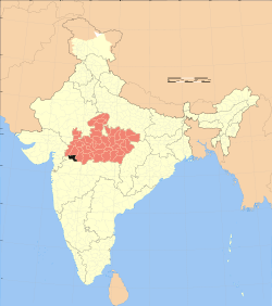 Location of Barwani district in Madhya Pradesh | |
| Country | India |
| State | Madhya Pradesh |
| Administrative division | Indore |
| Headquarters | Barwani |
| Area | |
| • Total | 3,665 km2 (1,415 sq mi) |
| Population (2011) | |
| • Total | 1,385,659 |
| • Density | 380/km2 (980/sq mi) |
| Demographics | |
| • Literacy | 50.23 per cent |
| • Sex ratio | 981 |
| Website | Official website |
Barwani district (Hindi: बड़वानी जिला) is one of the districts of Madhya Pradesh state of India. The administrative headquarters of the district is at Barwani. Barwani district has an area of 3665 km² and a population 1,081,039 (2001 census). The district lies in the southwestern corner of Madhya Pradesh; the Narmada River forms its northern boundary. The Satpura Range lies to its south. The district is bordered by Maharashtra state to the south, Gujarat state to the west, Dhar District to the north and Khargone District to the east.
History
After the merger of the princely state of Barwani with Union of India in 1948 CE, it became a part of West Nimar District of the newly formed Madhya Bharat state. Barwani district was created on 25 May 1998, when it was separated from West Nimar District / Khargone District.
Economy
In 2006 the Ministry of Panchayati Raj named Barwani one of the country's 250 most backward districts (out of a total of 640).[1] It is one of the 24 districts in Madhya Pradesh currently receiving funds from the Backward Regions Grant Fund Programme (BRGF).[1]
Divisions
The district consists 2 sub-divisions, Barwani and Sendhwa which are further divided into 8 tahsils, Barwani, Sendhwa, Pansemal, Warla[2] Niwali,[3][4] Thikri, Pati, Anjad and Rajpur and 7 developmental blocks, Barwani, Pati, Sendhawa, Pansemal, Niwali, Thikari and Rajpur. The 4 Vidhan Sabha constituencies in this district are Pansemal[Pansemal+Niwali], Barwani[Barwani+Pati], Sendhwa[sendhwa] and Rajpur[Rajpur+Anjad+Thikari+Balsamud].Barwani,Sendhawa, Pansemal and Rajpur assembly comstituencies are part of Khargone Lok Sabha constituency.
District has 417 panchayats and 646 villages, 576 revenue and 70 forest. Out of these villages, 560 are inhabited and 16 are un-inhabited. There 2 Municipalities In this district are Barwani and Sendhawa.
Sendhwa is a center of the cotton ginning industry. Other places of note include:
- Anjad, a town that houses the Veereshwar Mahadev, Gayatri Temple and Nagari Mata temples is the famous religious place of the town along with many cotton factory which gives employee to the thousand of local people, Sanjay Cotton Fiber is the most famous and largest Cotton Factory of the region .
- Bawangaja, an important Jain pilgrimage center lying 6 km from Barwani town. The world's tallest statue of the Jain Tirthankara (saint) Ajitnathji, is the pride of the town, which also contains as many as eleven 15th-century hindu temples. Kumbhakarna and Indrajeet were said to have attained Nirvana here.
- The ancient fort of Bhawar Garh (Borgarh) is located in the Satpuras, 16 km from Sendhawa.
- Beejasan is a temple of Goddess Beejasani (Durga), located 20 km south of Sendhawa.
Demographics
According to the 2011 census Barwani District has a population of 1,385,659,[5] roughly equal to the nation of Swaziland[6] or the US state of Hawaii.[7] This gives it a ranking of 354th in India (out of a total of 640).[5] The district has a population density of 256 inhabitants per square kilometre (660/sq mi) .[5] Its population growth rate over the decade 2001-2011 was 27.55%.[5] Barwani has a sex ratio of 981 females for every 1000 males,[5] and a literacy rate of 50.23%.[5]
Languages
Languages spoken include three mutually unintelligible Bareli languages: Bareli Palya, a Bhil language with approximately 10 000 speakers centred in Madhya Pradesh;[8] Bareli Pauri, with approximately 175 000 speakers, written in the Devanagari script;[9] and Bareli Rathwi, with approximately 64 000 speakers.[10] Other languages include Bhilali, with 1 150 000 speakers.[11]
References
- ↑ 1.0 1.1 Ministry of Panchayati Raj (8 September 2009). "A Note on the Backward Regions Grant Fund Programme" (PDF). National Institute of Rural Development. Retrieved 27 September 2011.
- ↑ Singh, Anuraag (25 January 2015). "MP man who made pistol for D-Company to kill Varun Gandhi arrested". The Times of India (25 January 2015) (The Times of India). TNN. Retrieved 16 February 2015.
- ↑ Sharma, Kapilesh (7 December 2014). "Two accused sent to jail, absconding engineer held". The Free Press Journal. Retrieved 25 March 2015.
- ↑ Ayub, Jamal (26 November 2012). "Now, English medium schools for tribals in Madhya Pradesh". The Times of India. TNN. Retrieved 25 March 2015.
- ↑ 5.0 5.1 5.2 5.3 5.4 5.5 "District Census 2011". Census2011.co.in. 2011. Retrieved 2011-09-30.
- ↑ US Directorate of Intelligence. "Country Comparison:Population". Retrieved 2011-10-01.
Swaziland 1,370,424
- ↑ "2010 Resident Population Data". U. S. Census Bureau. Retrieved 2011-09-30.
Hawaii 1,360,301
- ↑ M. Paul Lewis, ed. (2009). "Bareli, Palya: A language of India". Ethnologue: Languages of the World (16th edition ed.). Dallas, Texas: SIL International. Retrieved 2011-09-28.
- ↑ M. Paul Lewis, ed. (2009). "Bareli, Pauri: A language of India". Ethnologue: Languages of the World (16th edition ed.). Dallas, Texas: SIL International. Retrieved 2011-09-28.
- ↑ M. Paul Lewis, ed. (2009). "Bareli, Rathwi: A language of India". Ethnologue: Languages of the World (16th edition ed.). Dallas, Texas: SIL International. Retrieved 2011-09-28.
- ↑ M. Paul Lewis, ed. (2009). "Bhilali: A language of India". Ethnologue: Languages of the World (16th edition ed.). Dallas, Texas: SIL International. Retrieved 2011-09-30.
External links
| Wikisource has the text of the 1911 Encyclopædia Britannica article Barwani. |
- Barwani district official website
- List of places in Barwani
 |
Alirajpur district | Dhar district | | |
| Nandurbar district, Maharashtra | |
West Nimar district | ||
| ||||
| | ||||
| Dhule district, Maharashtra | Jalgaon district, Maharashtra |
| ||||||||||||||||||||||||||
| ||||||||||||||||||||||||||||||||||||||||||