Barton, Oxfordshire

Coordinates: 51°46′08″N 1°11′24″W / 51.769°N 1.190°W
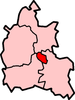
Barton is a suburb of Oxford, England on the city's eastern periphery. Barton is located just outside the Northern By-Pass Road, north of the junction with the A40 - Green Road Roundabout, Headington Roundabout, colloquially known as the Hamburger - leading to the M40 motorway and London.
The course of a Roman road between Dorchester on Thames and Alchester passes though the middle of Barton.
Barton Manor is a 17th-century listed building built of ashlar-faced Cotswold stone.
Oxford Crematorium is just north of Barton, opened in 1939 by the Oxford Crematorium Company.
The area has predominantly semi-detached, brick-built housing, though there are also significant quantities of pre-fabricated dwellings and small three or four storey flat and maisonette blocks. Much of the housing was originally constructed as social housing, and remains in Oxford City Council ownership.
A new swimming pool was recently built on the estate at the Bayswater School site.
The Barton Neighbourhood Centre provides a focal point for community activities. The Barton Community Association, which was founded over 60 years ago, is the main body representing the residents of Barton.
Barton has two schools: Bayards Hill Primary School and the Ormerod School, both in Waynflete Road.
External links
- Barton Swimming Pool
- Oxford History: Barton Manor
- Oxford History: Oxford Crematorium
- Facebook: Barton Past & Present
![]() Media related to Barton, Oxfordshire at Wikimedia Commons
Media related to Barton, Oxfordshire at Wikimedia Commons
| ||||||||||||||||||||||||||||||