Barrslievenaroy
| Barrslievenaroy | |
|---|---|
| Barr Sliabh na Raithe | |
 A small chapel near the foot of the mountain | |
| Elevation | 702 m (2,303 ft)[1][2] |
| Prominence | 644 m (2,113 ft)[1] |
| Listing | Hewitt, Marilyn |
| Location | |
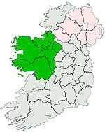
 Barrslievenaroy Location in Ireland | |
| Location | County Galway, Republic of Ireland |
| Range | Maumturks |
| OSI/OSNI grid | L888528 |
| Coordinates | 53°30′50″N 9°40′36″W / 53.513853°N 9.676749°WCoordinates: 53°30′50″N 9°40′36″W / 53.513853°N 9.676749°W |
Barrslievenaroy (from Irish: Barr Sliabh na Raithe / Barrshliabh na Ráthadh)[3][4] —also called Binn idir an Dá Log[2]— is a 702 m (2,303 ft) mountain in County Galway, Republic of Ireland. It is the highest of the Maumturks range, which lie within the Connemara region.[1]
See also
References
- ↑ 1.0 1.1 1.2 MountainViews.ie
- ↑ 2.0 2.1 Peakbagger
- ↑ Ordnance Survey Ireland - Online map viewer
- ↑ Placenames Database of Ireland
| |||||||||||||||||||||||||||||||||||||||||||||
| ||||||||||