Barroso, Minas Gerais
| Barroso | |||
|---|---|---|---|
| Municipality | |||
| Município de Barroso Municipality of Barroso | |||
.jpg) | |||
| |||
| Nickname(s): "Cidade do Cimento" (Cement City) | |||
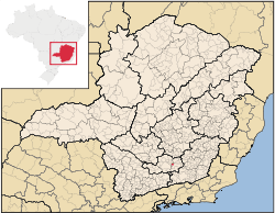 Location in the state of Minas Gerais | |||
 Barroso Location in Brazil | |||
| Coordinates: 21°11′13″S 43°58′33″W / 21.18694°S 43.97583°WCoordinates: 21°11′13″S 43°58′33″W / 21.18694°S 43.97583°W | |||
| Country |
| ||
| Region | Southeast | ||
| State |
| ||
| Founded | 17th Century | ||
| Incorporated (as city) | December 12, 1953 | ||
| Government | |||
| • Mayor | Eika Oka de Melo (Progressive Party (2013–2016)) | ||
| Area | |||
| • Total | 81.726 km2 (31.554 sq mi) | ||
| Elevation | 929 m (3,047 ft) | ||
| Population | |||
| • Total | 20,484 | ||
| Demonym | Barrosense | ||
| Time zone | BRT (UTC−3) | ||
| • Summer (DST) | BRST (UTC−2) | ||
| Postal Code | 36212-000 | ||
| Area code(s) | (+55) 32 | ||
| Website | http://www.barroso.mg.gov.br/ | ||


Barroso is a Brazilian municipality located in the south of the state of Minas Gerais. Its population as of 2007 was 19,353 people living in an area of 83 km². The elevation is 920 meters. The city belongs to the mesoregion of Campo das Vertentes and to the microregion of Barbacena. Important regional center, Barbacena, is located 27 km. to the east and is connected by MG-265.
See also
- List of municipalities in Minas Gerais