Barkal Upazila
| Barkal Barkal | |
|---|---|
| Upazila | |
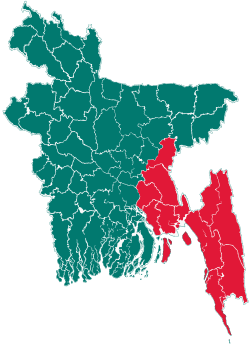
 Barkal Location in Bangladesh | |
| Coordinates: 22°44′N 92°21.5′E / 22.733°N 92.3583°ECoordinates: 22°44′N 92°21.5′E / 22.733°N 92.3583°E | |
| Country |
|
| Division | Chittagong Division |
| District | Rangamati District |
| Area | |
| • Total | 760.88 km2 (293.78 sq mi) |
| Population (1991) | |
| • Total | 28,839 |
| • Density | 38/km2 (100/sq mi) |
| Time zone | BST (UTC+6) |
| Website | Official Map of Barkal |
Barkal (Bengali: বরকল ) is an Upazila (Sub-district) of Rangamati District in the Division of Chittagong, Bangladesh.
Geography
Barkal is located at 22°44′00″N 92°21′30″E / 22.7333°N 92.3583°E . It has 4,782 households and a total area of 760.88 km².

Demographics
According to the 1991 Bangladesh census, Barkal has a population of 28,839. Males constitute 57.1% of the population, and females, 42.9%. The population aged 18 or over is 15,770. Barkal has an average literacy rate of 30.4% (7+ years), against the national average of 32.4%.[1]
Administration
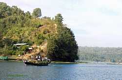
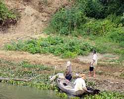
Barkal is comprised of 5 Unions/Wards, 29 Mauzas/Mahallas and 156 villages. Subolong Union is famous for its waterfalls and the natural beauty of the Kaptai lake. Barkal Sadar Union is situated on the bank of Karnafuli river. Other three unions being Bhusanchara, Aimachara and Borohorina.
See also
References
- ↑ "Population Census Wing, BBS.". Archived from the original on 2005-03-27. Retrieved November 10, 2006.
| |||||||||||||||||||||||||||||||||||||||||||||||||||||