Barisal Sadar Upazila
| Barisal Sadar বরিশাল সদর | |
|---|---|
| Upazila | |
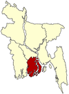
 Barisal Sadar Location in Bangladesh | |
| Coordinates: 22°42′N 90°22′E / 22.700°N 90.367°ECoordinates: 22°42′N 90°22′E / 22.700°N 90.367°E | |
| Country |
|
| Division | Barisal Division |
| District | Barisal District |
| Area | |
| • Total | 307.59 km2 (118.76 sq mi) |
| Population (1991) | |
| • Total | 414,281 |
| • Density | 1,347/km2 (3,490/sq mi) |
| Time zone | BST (UTC+6) |
| Website | Official Map of the Barisal Sadar Upazila |
Barisal Sadar (Bengali: বরিশাল সদর) is an Upazila of Barisal District in the Division of Barisal, Bangladesh.[1]
Geography
Barisal Sadar is located at 22°42′00″N 90°22′00″E / 22.7000°N 90.3667°E. It has 114,774 households and a total area of 324.41 km². [2]
Demographics
According to provisional results of the 2011 national census, the population of Barisal Sadar Upazila stands at 527,017. Males constitute 52.72% of the population, and females 47.28%. The population density is about 1625 people per km².
Administration
Barisal Sadar has 20 Unions/Wards, 189 Mauzas/Mahallas, and 128 villages.
See also
References
- ↑ Ushasi Eashika Khan (2012). "Barisal Sadar Upazila". In Sirajul Islam and Ahmed A. Jamal. Banglapedia: National Encyclopedia of Bangladesh (Second ed.). Asiatic Society of Bangladesh.
- ↑ "Bangladesh Bureau of Statistics Region Census 2011 page 17". Bangladesh Bureau of Statistics. Retrieved 2014-09-20.
| |||||||||||||||||||||||||||||||||