Banks Springs, Louisiana
| Banks Springs, Louisiana | |
|---|---|
| Census-designated place | |
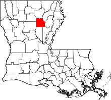
 Banks Springs Location within Louisiana | |
| Coordinates: 32°4′55″N 92°5′34″W / 32.08194°N 92.09278°WCoordinates: 32°4′55″N 92°5′34″W / 32.08194°N 92.09278°W | |
| Country |
|
| State |
|
| Parish | Caldwell |
| Area | |
| • Total | 8.1 km2 (3.1 sq mi) |
| • Land | 8.1 km2 (3.1 sq mi) |
| • Water | 0 km2 (0 sq mi) |
| Elevation | 60 m (200 ft) |
| Population (2010) | 1,192 |
| • Density | 146.8/km2 (380/sq mi) |
| Time zone | CST (UTC-6) |
| • Summer (DST) | CST (UTC-5) |
| ZIP Codes | 71418 |
| Area Code | 318 |
Banks Springs is an unincorporated community and census-designated place (CDP) in Caldwell Parish, Louisiana, United States. As of the 2010 census it had a population of 1,192.[1] It is located near the center of Caldwell Parish 2 miles (3 km) south of Columbia, the parish seat, and 2.5 miles (4.0 km) north of Grayson. The CDP includes the neighborhood of Columbia Heights.
U.S. Route 165 passes through the center of Banks Springs, leading north 34 miles (55 km) to Monroe and southwest 62 miles (100 km) to Alexandria.
References
- ↑ "Geographic Identifiers: 2010 Demographic Profile Data (G001): Banks Springs CDP, Louisiana". U.S. Census Bureau, American Factfinder. Retrieved August 18, 2014.
| |||||||||||||||||||||||||