Bangui, Ilocos Norte
| Bangui | ||
|---|---|---|
| Municipality | ||
|
The Bangui Wind Farm | ||
| ||
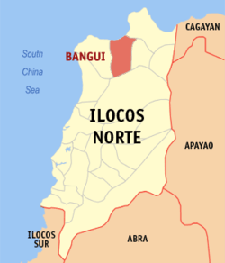 Map of Ilocos Norte showing the location of Bangui | ||
.svg.png) Bangui Location within the Philippines | ||
| Coordinates: 18°32′N 120°46′E / 18.533°N 120.767°ECoordinates: 18°32′N 120°46′E / 18.533°N 120.767°E | ||
| Country | Philippines | |
| Region | Ilocos (Region I) | |
| Province | Ilocos Norte | |
| District | 1st District | |
| Barangays | 14 | |
| Government[1] | ||
| • Mayor | Diosdado I. Garvida | |
| Area[2] | ||
| • Total | 112.98 km2 (43.62 sq mi) | |
| Population [3] | ||
| • Total | 15,025 | |
| • Density | 130/km2 (340/sq mi) | |
| Time zone | PST (UTC+8) | |
| ZIP code | 2920 | |
| Dialing code | 77 | |
| Income class | 4th class; rural | |


Bangui is a fourth class municipality in the province of Ilocos Norte, Philippines. According to the 2010 census, it has a population of 15,025 people.[3]
The first power generating windmill farm in Southeast Asia, commonly known as Bangui Wind Farm, is found in the municipality of Bangui.
The current mayor is Diosdado I. Garvida who was elected to the position for the first time in the May 2013 mid-term elections.
Barangays
Bangui is politically subdivided into 14 barangays.[2]
- Abaca
- Bacsil
- Banban
- Baruyen
- Dadaor
- Lanao
- Malasin
- Manayon
- Masikil
- Nagbalagan
- Payac
- San Lorenzo (Pob.)
- Taguiporo
- Utol
Demographics
| Population census of Bangui | ||
|---|---|---|
| Year | Pop. | ±% p.a. |
| 1990 | 12,921 | — |
| 1995 | 13,774 | +1.21% |
| 2000 | 14,327 | +0.85% |
| 2007 | 14,634 | +0.29% |
| 2010 | 15,025 | +0.96% |
| Source: National Statistics Office[3][4] | ||
Gallery
-

Bangui windmills
-

Vestas V82 wind turbines of the Bangui wind farm
Attractions
Bangui is well known,because of its Bangui Windmills.It is also the town's main attraction.But until 2013,Burgos and Caparispisan(Pagudpud) Windmills are built,yet many visitors stilli visit Bangui Windmills.Bangui Bay is also a beautiful tourist spot,yet not practical for swimming because of its deepness and water currents,but it is beautiful to view.There is also Abang Falls,that can be found in Brgy.Lanao,also a tourist spot.Bangui is also good for its beautiful view of mountains and rivers.
Places to Visit:
- Bangui Windmills
- Abang Falls
- Municipal Plaza
- Municipal Hall
- Bolo River(locally known Caramuangen River)
- Bangui Bay View Building
- Bangui's woodcraft windmills souvenir stores
- Bangui Public Market
See also
Climate
| Climate data for Bangui, Ilocos Norte | |||||||||||||
|---|---|---|---|---|---|---|---|---|---|---|---|---|---|
| Month | Jan | Feb | Mar | Apr | May | Jun | Jul | Aug | Sep | Oct | Nov | Dec | Year |
| Average high °C (°F) | 31 (88) |
32 (90) |
33 (91) |
34 (93) |
34 (93) |
34 (93) |
33 (91) |
32 (90) |
32 (90) |
33 (91) |
32 (90) |
31 (88) |
32.6 (90.7) |
| Average low °C (°F) | 19 (66) |
20 (68) |
21 (70) |
23 (73) |
24 (75) |
24 (75) |
24 (75) |
24 (75) |
24 (75) |
23 (73) |
22 (72) |
21 (70) |
22.4 (72.3) |
| Average rainfall mm (inches) | 6.2 (0.244) |
11.7 (0.461) |
10.1 (0.398) |
14 (0.55) |
192.7 (7.587) |
258.9 (10.193) |
470.9 (18.539) |
475.9 (18.736) |
405.7 (15.972) |
92.5 (3.642) |
44.8 (1.764) |
2 (0.08) |
1,985.4 (78.166) |
| Avg. rainy days | 3 | 2 | 2 | 2 | 12 | 15 | 20 | 20 | 17 | 10 | 6 | 3 | 112 |
| Source: World Weather Online[5] | |||||||||||||
References
- ↑ "Official City/Municipal 2013 Election Results". Intramuros, Manila, Philippines: Commission on Elections (COMELEC). 11 September 2013. Retrieved 3 October 2013.
- ↑ 2.0 2.1 "Province: ILOCOS NORTE". PSGC Interactive. Makati City, Philippines: National Statistical Coordination Board. Retrieved 3 October 2013.
- ↑ 3.0 3.1 3.2 "Total Population by Province, City, Municipality and Barangay: as of May 1, 2010". 2010 Census of Population and Housing. National Statistics Office. Retrieved 3 October 2013.
- ↑ "Province of Ilocos Norte". Municipality Population Data. LWUA Research Division. Retrieved 3 October 2013.
- ↑ "Bangui, Philippines: Average Temperatures and Rainfall". World Weather Online. Retrieved 15 September 2014.
External links
- http://banguitrending.com/
- GMANews_TV - Bangui wind farm ‘Green’ and profiting - GMA News and Public Affairs
- Pasyalan Ilocos Norte
- Philippine Standard Geographic Code
- Philippine Census Information
- Awesome Pagudpud: The Definitive Travel Guide
- Local Governance Performance Management System
 |
Bangui Bay (South China Sea) | Pagudpud | | |
| Burgos | |
Dumalneg | ||
| ||||
| | ||||
| Vintar |
| ||||||||||||||||||