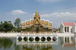
Bang Pa-in District
| Bang Pa-in บางปะอิน | |
|---|---|
| Amphoe | |
|
| |
 Amphoe location in Ayutthaya Province | |
| Coordinates: 14°13′39″N 100°34′32″E / 14.22750°N 100.57556°ECoordinates: 14°13′39″N 100°34′32″E / 14.22750°N 100.57556°E | |
| Country |
|
| Province | Ayutthaya |
| Tambon | 18 |
| Muban | 149 |
| Seat | Ban Len |
| Area | |
| • Total | 229.098 km2 (88.455 sq mi) |
| Population (2000) | |
| • Total | 73,630 |
| • Density | 320/km2 (830/sq mi) |
| Time zone | THA (UTC+7) |
| Postal code | 13160 |
| Geocode | 1406 |
Bang Pa-in (Thai: บางปะอิน; IPA: [bāːŋ pāʔīn]) is one of the 16 districts (amphoe) of Ayutthaya Province, central Thailand.
History
Bang Pa-in was established in the Ayutthaya era in the name Khwaeng U Thai. In Rattanakosin era Khwaeng U Thai was divided to be Khwaeng U Thai Noi and U Thai Yai. In 1910 Khwaeng U Thai Noi was changed status and renamed to Phra Ratchawang district. The district name was changed again to Bang Pa-in after the name of Bang Pa-in island in 1915.
Geography
Neighboring districts are (from the north clockwise) Phra Nakhon Si Ayutthaya, Uthai and Wang Noi of Ayutthaya Province, Khlong Luang of Pathum Thani Province, and Bang Sai of Ayutthaya again.
Administration
The district is subdivided into 18 subdistricts (tambon), which are further subdivided into 149 villages (muban). There are 9 municipal (thesaban) areas, and 9 Tambon administrative organizations (TAO).
| No. | Name | Thai | Villages |
|---|---|---|---|
| 1. | Ban Len | บ้านเลน | 12 |
| 2. | Chiang Rak Noi | เชียงรากน้อย | 12 |
| 3. | Ban Pho | บ้านโพ | 9 |
| 4. | Ban Krot | บ้านกรด | 11 |
| 5. | Bang Krasan | บางกระสั้น | 17 |
| 6. | Khlong Chik | คลองจิก | 8 |
| 7. | Ban Wa | บ้านหว้า | 7 |
| 8. | Wat Yom | วัดยม | 8 |
| 9. | Bang Pradaeng | บางประแดง | 9 |
| 10. | Sam Ruean | สามเรือน | 8 |
| 11. | Ko Koet | เกาะเกิด | 7 |
| 12. | Ban Phlap | บ้านพลับ | 5 |
| 13. | Ban Paeng | บ้านแป้ง | 4 |
| 14. | Khung Lan | คุ้งลาน | 5 |
| 15. | Taling Chan | ตลิ่งชัน | 6 |
| 16. | Ban Sang | บ้านสร้าง | 8 |
| 17. | Talat Kriap | ตลาดเกรียบ | 8 |
| 18. | Khanon Luang | ขนอนหลวง | 5 |
See also
External links
| Wikimedia Commons has media related to Bang Pa In. |
| Wikivoyage has a travel guide for Bang Pa-In. |
