Bang Bua Thong District
| Bang Bua Thong บางบัวทอง | |
|---|---|
| Amphoe | |
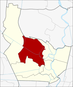 Amphoe location in Nonthaburi Province | |
| Coordinates: 13°58′7″N 100°24′20″E / 13.96861°N 100.40556°ECoordinates: 13°58′7″N 100°24′20″E / 13.96861°N 100.40556°E | |
| Country |
|
| Province | Nonthaburi |
| Seat | Lahan |
| Tambon | 8 |
| Muban | 73 (administrative) |
| Amphoe established | 1902 |
| Area | |
| • Total | 116.5 km2 (45.0 sq mi) |
| Population (2008) | |
| • Total | 226,741 |
| • Density | 1,946.3/km2 (5,041/sq mi) |
| Time zone | THA (UTC+7) |
| Postal code | 11110 |
| Geocode | 1204 |
Bang Bua Thong (Thai: บางบัวทอง; IPA: [bāːŋ būa tʰɔ̄ːŋ]) is a district (amphoe) of Nonthaburi Province, central Thailand.
Geography
Neighbouring districts are (from north clockwise) Lat Lum Kaeo (Pathum Thani Province), Pak Kret, Mueang Nonthaburi, Sai Noi and Bang Yai.
Administration
The district is subdivided into 8 subdistricts (tambon), which are further subdivided into 81 villages (muban). Bang Bua Thong has town status (thesaban mueang), which covers parts of the tambon Bang Bua Thong, Bang Rak Yai, Phimon Rat and Bang Rak Phatthana. There are further 7 Tambon administrative organizations (TAO).
| No. | Name | Thai | Villages | Inh.[1] |
|---|---|---|---|---|
| 1. | Sano Loi | โสนลอย | 6 | 11,107 |
| 2. | Bang Bua Thong | บางบัวทอง | 14 | 44,719 |
| 3. | Bang Rak Yai | บางรักใหญ่ | 11 | 7,509 |
| 4. | Bang Khu Rat | บางคูรัด | 10 | 32,227 |
| 5. | Lahan | ละหาร | 9 | 18,000 |
| 6. | Lam Pho | ลำโพ | 8 | 5,324 |
| 7. | Phimon Rat | พิมลราช | 8 | 40,500 |
| 8. | Bang Rak Phatthana | บางรักพัฒนา | 15 | 67,355 |
References
- ↑ "Population statistics 2008". Department of provincial administration.
External links
- amphoe.com (Thai)
| ||||||||||||||||||||||||