Ban Mi District
| Ban Mi บ้านหมี่ | |
|---|---|
| Amphoe | |
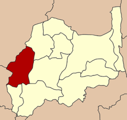 Amphoe location in Lopburi Province | |
| Coordinates: 15°2′41″N 100°32′13″E / 15.04472°N 100.53694°ECoordinates: 15°2′41″N 100°32′13″E / 15.04472°N 100.53694°E | |
| Country |
|
| Province | Lopburi |
| Area | |
| • Total | 585.7 km2 (226.1 sq mi) |
| Population (2000) | |
| • Total | 86,064 |
| • Density | 146.9/km2 (380/sq mi) |
| Time zone | THA (UTC+7) |
| Postal code | 15110 |
| Geocode | 1606 |
Ban Mi (Thai: บ้านหมี่) is a district (amphoe) in the western part Lopburi Province, central Thailand.
History
The district was created in 1883, then named Sanam Chaeng. When the district office was moved to Ban Huay Kaew, the district name was changed to Huay Kaew as well. When in 1898 the Thai Government built the Northern Railway through the district, the district center was moved to Ban Sao (Thai บ้านเซ่า) and the district name was changed back to Sanam Chaeng. In 1914 it was renamed to Ban Sao as the name of Tambon of the district center. Finally the Thai Government changed the name to Ban Mi in 1940.
The name Ban Mi is the name of an old town of Phuan people that migrated from Laos to Siam around 1870. The name originates from a hand weaving method to weave cotton or silk fabric, named Mat Mi(มัดหมี่) in Thai.
Geography
Neighboring districts are (from the northeast clockwise) Nong Muang, Khok Samrong, Mueang Lop Buri, Tha Wung of Lopburi, In Buri of Singburi Province, and Takhli of Nakhon Sawan Province.
The water resources of Ban Mi are the Bang Kham River and Khlong Anusasanan.
Climate
Climate is dominated in all months by the subtropical anticyclon, or subtropical high, with its descending air, elevated inversions, and clear skies. Such an atmospheric environment inhibits precipitation. The Köppen Climate Classification subtype for this climate is "Bwh". (Tropical and Subtropical Desert Climate).
| Climate data for Ban Mi District | |||||||||||||
|---|---|---|---|---|---|---|---|---|---|---|---|---|---|
| Month | Jan | Feb | Mar | Apr | May | Jun | Jul | Aug | Sep | Oct | Nov | Dec | Year |
| Average high °C (°F) | 32 (89) |
34 (94) |
37 (99) |
38 (100) |
36 (97) |
34 (94) |
33 (92) |
33 (91) |
32 (89) |
32 (89) |
32 (89) |
31 (88) |
33.7 (92.6) |
| Average low °C (°F) | 17 (63) |
21 (70) |
23 (74) |
25 (77) |
25 (77) |
24 (76) |
24 (76) |
24 (75) |
24 (75) |
23 (74) |
21 (70) |
18 (64) |
22.4 (72.6) |
| Average precipitation mm (inches) | 3 (0.1) |
18 (0.7) |
36 (1.4) |
86 (3.4) |
130 (5.1) |
137 (5.4) |
140 (5.5) |
160 (6.3) |
284 (11.2) |
157 (6.2) |
36 (1.4) |
3 (0.1) |
1,190 (46.8) |
| Source: Weatherbase [1] | |||||||||||||
Administration
The district is subdivided into 22 subdistricts (tambon), which are further subdivided into 157 villages (muban). The town (thesaban mueang) Ban Mi covers the whole tambon Ban Mi. There are further 21 Tambon administrative organizations (TAO).
| 1. | ไผ่ใหญ่ | Phai Yai | 12. | โพนทอง | Phon Thong | |||||||
| 2. | บ้านทราย | Ban Sai | 13. | บางขาม | Bang Kham | |||||||
| 3. | บ้านกล้วย | Ban Kluai | 14. | ดอนดึง | Don Dueng | |||||||
| 4. | ดงพลับ | Dong Phlap | 15. | ชอนม่วง | Chon Muang | |||||||
| 5. | บ้านชี | Ban Chi | 16. | หนองกระเบียน | Nong Krabian | |||||||
| 6. | พุคา | Phu Kha | 17. | สายห้วยแก้ว | Sai Huai Kaeo | |||||||
| 7. | หินปัก | Hin Pak | 18. | มหาสอน | Maha Son | |||||||
| 8. | บางพึ่ง | Bang Phueng | 19. | บ้านหมี่ | Ban Mi | |||||||
| 9. | หนองทรายขาว | Nong Sai Khao | 20. | เชียงงา | Chiang Nga | |||||||
| 10. | บางกะพี้ | Bang Kaphi | 21. | หนองเมือง | Nong Mueang | |||||||
| 11. | หนองเต่า | Nong Tao | 22. | สนามแจง | Sanam Chaeng |
References
- ↑ "Weatherbase: Historical Weather for Ban Mi District". Weatherbase. 2013. Retrieved on April 24, 2013.
| ||||||||||||||||||||||||||||