Balwyn North
| Balwyn North Melbourne, Victoria | |||||||||||||
|---|---|---|---|---|---|---|---|---|---|---|---|---|---|
|
Leafy green trees provide a canopy over Bulleen Road | |||||||||||||
 Balwyn North | |||||||||||||
| Coordinates | 37°47′37″S 145°5′11″E / 37.79361°S 145.08639°ECoordinates: 37°47′37″S 145°5′11″E / 37.79361°S 145.08639°E | ||||||||||||
| Population | 20,317 (2011 census)[1] | ||||||||||||
| • Density | 2,283/km2 (5,910/sq mi) | ||||||||||||
| Postcode(s) | 3104 | ||||||||||||
| Area | 8.9 km2 (3.4 sq mi) | ||||||||||||
| Location | 10 km (6 mi) from Melbourne | ||||||||||||
| LGA(s) | City of Boroondara | ||||||||||||
| State electorate(s) | |||||||||||||
| Federal Division(s) | Kooyong | ||||||||||||
| |||||||||||||
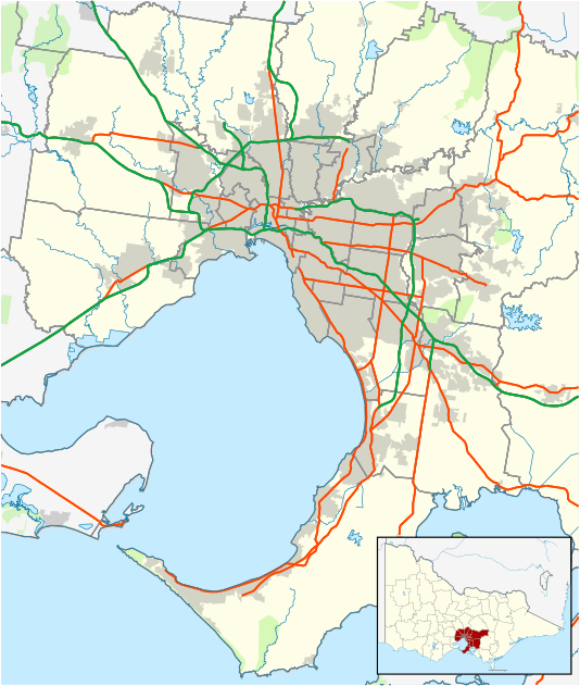
Balwyn North, also known as North Balwyn, is a suburb of Melbourne, Victoria, Australia, 10 km east of Melbourne's Central Business District. Its local government area is the City of Boroondara. At the 2011 Census, Balwyn North had a population of 20,317.
Geography
The north-west part of the suburb is known as Bellevue and the south-east part is known as Greythorn.
History
Balwyn North was one of the first Melbourne suburbs to be developed according to the pattern of postwar suburbia, with expansive, quiet residential areas designed as family homes and relatively few business districts. The original route of Bulleen Road began at the present-day corner of Kilby Road and Burke Road, but by the 1900s, its route had changed to its present-day alignment. This was a result of Elgar's Special Survey, which dragged the alignment of Burke Road further west, resulting in the surrounding road network being forced to adjust.[2]
A Balwyn North Post Office opened on 1 April 1937. This was renamed Burke Road in 1941, when a new Balwyn North office opened at its current location. The Greythorn Post Office opened in 1951.[3]
Greythorn
Greythorn was developed later than North Balwyn, but has had residents living there since the 1830s, when the Maughan and Towt families bought large tracts of land in the area. Present-day Greythorn Road was formerly known as 'Whitethorn Road', after the many whitethorn hedges that had been planted along it. To avoid confusion with Whitehorse Road, the name was changed to 'Greythorn' some time in the 1920s. The area around Greythorn Park was a wildlife sanctuary from 1938 until 1954, when the area between the park and Greythorn Road was subdivided and sold for housing.[4]
Education
Located in Balwyn North are several primary schools, such as Greythorn, Balwyn North, Boroondara Park and Bellevue. Balwyn High School is located on Buchanan Avenue, and is so highly sought after, particularly by Asian families, that property prices within its student catchment area sell for hundreds of thousands of dollars more than nearby properties not located in the area.[5][6]
Shopping
The main shopping strip is located at the intersection of Doncaster and Bulleen Roads, known as 'The Village'. There are a number of other local shopping strips, such as Greythorn Village, located further east along Doncaster Road, the East Balwyn Shopping Centre and Belmore Heights Shopping Centre.
Transport
Bicycle tracks connect with the Main Yarra Trail, along the Yarra River and the Eastern Freeway. Tram route 48 passes through Balwyn North, running along Doncaster Road and terminating at the intersection with Balwyn Road. A number of bus routes connect Balwyn North with suburbs such as Box Hill, Camberwell, Doncaster and Templestowe.[7] A number of freeway bus services have stops at the entrance of the Eastern Freeway, on the northern edge of the suburb.
In recent times, there have been numerous calls from both residents and local councils for the extension of the route 48 tram from its present terminus to either the 'Doncaster Park + Ride' facility or further along Doncaster Road to Doncaster Shoppingtown.[8][9]
Parks and gardens
Balwyn North is host to a large number of parks and reserves, which are used for both passive and active recreation. A line of parks through which Glass Creek formerly ran at surface level lies at the heart of the suburb, stretching from Jacka Street Reserve in the east, through Gordon Barnard Reserve and Hislop Park in the centre, ending with Macleay Park in the west. Other parks in the suburb include Greythorn Park, Leigh Park and Koonung Creek Reserve.
See also
- City of Camberwell - the former local government area of which Balwyn North was a part
- Balwyn
References
- ↑ Australian Bureau of Statistics (31 October 2012). "Balwyn North (State Suburb)". 2011 Census QuickStats. Retrieved 17 July 2012.
- ↑ Lay, Max (2003). Melbourne Miles: the story of Melbourne's roads. Melbourne, Australia: Australian Scholarly Publications Pty Ltd. pp. 128–129. ISBN 1 74097 019 5.
- ↑ Premier Postal History, Post Office List, retrieved 11 April 2008
- ↑ "Balwyn Historical Society Newsletter - March 2014" (PDF). Balwyn Historical Society. Retrieved 18 September 2014.
- ↑ Lindsay, Nicole. "When class conscious really means schools". The Age. Retrieved 7 April 2013.
- ↑ Zhou, Christina. "Chinese buyers in rush for Melbourne's prestige school zones". The Age. Retrieved 29 December 2013.
- ↑ "Boroondara". Public Transport Victoria. Retrieved 7 April 2013.
- ↑ Barclay, Alison. "Mayor pushes Balwyn tram extension". Boroondara Review Local. Retrieved 7 April 2013.
- ↑ "Route 48 extension". Melbourne PT. Retrieved 7 April 2013.
