Balmoral Parish, New Brunswick
| Balmoral | |
|---|---|
| Parish | |
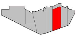 Location within Restigouche County. | |
| Coordinates: 47°41′51″N 66°33′27″W / 47.6975°N 66.5575°W | |
| Country |
|
| Province |
|
| County | Restigouche |
| Established | 1876 |
| Area[1] | |
| • Land | 1,098.32 km2 (424.06 sq mi) |
| Population (2011)[1] | |
| • Total | 602 |
| • Density | 0.5/km2 (1/sq mi) |
| • Pop 2006-2011 |
|
| • Dwellings | 251 |
| Time zone | AST (UTC-4) |
| • Summer (DST) | ADT (UTC-3) |
Balmoral is a Canadian parish in Restigouche County, New Brunswick.[2]
Delineation
Balmoral Parish lies towards the east side of Restigouche County and is bordered to the west by Addington Parish, Dalhousie Parish to the north; to the east by Colborne Parish, and Northesk Parish to the south.
Communities
Parish population total does not include incorporated municipalities (in bold).
- Balmoral including:
- Blair Athol
- Selwood
- Saint-Maure
- Upper Balmoral
- Maltais
- Ramsay Sheds
- Simpsons Field
Demographics
Population
| |||||||||||||||||||
| Historical Census Data - Balmoral Parish, New Brunswick[5] | ||||||||||||||||||||||||||
|---|---|---|---|---|---|---|---|---|---|---|---|---|---|---|---|---|---|---|---|---|---|---|---|---|---|---|
|
|
| ||||||||||||||||||||||||
Language
| Canada Census Mother Tongue - Balmoral Parish, New Brunswick[5] | ||||||||||||||||||
|---|---|---|---|---|---|---|---|---|---|---|---|---|---|---|---|---|---|---|
| Census | Total | French |
English |
French & English |
Other | |||||||||||||
| Year | Responses | Count | Trend | Pop % | Count | Trend | Pop % | Count | Trend | Pop % | Count | Trend | Pop % | |||||
| 2011 |
605 |
570 | |
94.21% | 30 | |
4.96% | 5 | |
0.83% | 0 | |
0.00% | |||||
| 2006 |
615 |
565 | |
91.87% | 40 | |
6.50% | 10 | |
1.63% | 0 | |
0.00% | |||||
| 2001 |
575 |
540 | |
93.91% | 25 | |
4.35% | 10 | |
1.74% | 0 | |
0.00% | |||||
| 1996 |
805 |
775 | n/a | 96.27% | 20 | n/a | 2.48% | 10 | n/a | 1.24% | 0 | n/a | 0.00% | |||||
Access Routes
Highways and numbered routes that run through the parish, including external routes that start or finish at the parish limits:[6]
|
|
|
|
See also
References
- ↑ 1.0 1.1 1.2 2011 Statistics Canada Census Profile: Balmoral Parish, New Brunswick
- ↑ New Brunswick Provincial Archives - Balmoral Parish
- ↑ "2006 Community Profiles". Canada 2006 Census. Statistics Canada. March 30, 2011. Retrieved 2014-03-16.
- ↑ "2001 Community Profiles". Canada 2001 Census. Statistics Canada. February 17, 2012. Retrieved 2014-03-16.
- ↑ 5.0 5.1 Statistics Canada: 1996, 2001, 2006, 2011 census
- ↑ Atlantic Canada Back Road Atlas ISBN 978-1-55368-618-7 Pages 6, 14-15
 |
Dalhousie Parish | | ||
| Addington Parish | |
Colborne Parish | ||
| ||||
| | ||||
| Northesk Parish (Northumberland County) |
| ||||||||||||||||||
Coordinates: 47°41′51″N 66°33′27″W / 47.69750°N 66.55750°W