Balgarup River
| Balgarup River | |
|---|---|
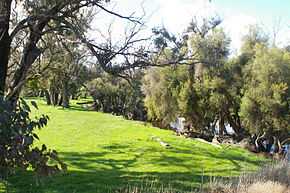 Balgarup River near Albany Highway crossing | |
| Origin | South East of Kojonup |
| Mouth | confluence with Blackwood River |
| Basin countries | Australia |
| Length | 66 kilometres (41 mi)[1] |
| Source elevation | 372 metres (1,220 ft) |
| Mouth elevation | 215 metres (705 ft)[2] |
| Avg. discharge | 3061 ML/yr |
| Basin area | 82.4 square kilometres (32 sq mi)[3] |
Balgarup River is a river in Western Australia that has its headwaters south-east of Kojonup just below Byenup Hill.
The river flows is a north-westerly direction crossing Albany Highway south of Kojonup then through the town of Muradup and continues in the north-west direction until it joins the Blackwood River of which it is a tributary.
The only tributary to the Balgarup river is Mandalup Brook.
The name originated from Aborigine language and is thought to mean place of the Blackboy trees.The first person to chart the river was surveyor Alfred Hillman in 1840.[4]
References
- ↑ Western Australian Land Information Authority. "History of river names". Retrieved 3 September 2011.
- ↑ "Bonzle Digital Atlas - Map of Balgarup River, WA". 2008. Retrieved 23 November 2008.
- ↑ "Department of Water - Water Resources Data - Streamflow Sites - Balgarup River - Mndelup pool". 2008. Retrieved 23 November 2008.
- ↑ Western Australian Land Information Authority. "History of river names". Retrieved 3 September 2011.