Baldramsdorf
| Baldramsdorf | ||
|---|---|---|
| ||
 Baldramsdorf Location within Austria | ||
| Coordinates: 46°48′N 13°27′E / 46.800°N 13.450°ECoordinates: 46°48′N 13°27′E / 46.800°N 13.450°E | ||
| Country | Austria | |
| State | Carinthia | |
| District | Spittal an der Drau | |
| Government | ||
| • Mayor | Heinrich Gerber | |
| Area | ||
| • Total | 37.95 km2 (14.65 sq mi) | |
| Elevation | 584 m (1,916 ft) | |
| Population (1 January 2014)[1] | ||
| • Total | 1,877 | |
| • Density | 49/km2 (130/sq mi) | |
| Time zone | CET (UTC+1) | |
| • Summer (DST) | CEST (UTC+2) | |
| Postal code | 9805 | |
| Area code | 04762 | |
| Website | www.baldramsdorf.at | |
Baldramsdorf is a village and municipality in the district of Spittal an der Drau in the Austrian state of Carinthia.
Geography
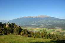
It is situated in the west of Spittal an der Drau in the southern part of the Lurnfeld valley between the Drava river and the Goldeck mountain range. The municipality consists of the Katastralgemeinden Baldramsdorf and Gschieß, which both were first mentioned in an 1166 deed.
Culture and places of interest
- Ruins of Ortenburg Castle (asphaltic road from Unterhaus)
On the slope of the Goldeck mountain in the south stand the ruins of the Ortenburg castle, built between 1093 and 1140, the former seat of the Counts of Ortenburg.
- Mansion in Rosenheim with parts of an old castle
- Paternschloss castle in Unterhaus with the first Carinthian museum of craft
Gallery
-

Burgruine Ortenburg, Goldeck mountain
-

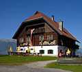
Gasthof Marhube, Goldeck mountain
-

Unterhaus Schloss
-

Baldramsdorf from Goldeck mountain
References
| Wikimedia Commons has media related to Baldramsdorf. |
