Balanga, Nigeria
| Balanga | |
|---|---|
| LGA | |
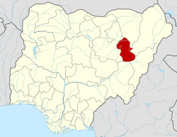
 Balanga Location in Nigeria | |
| Coordinates: 9°58′N 11°41′E / 9.967°N 11.683°ECoordinates: 9°58′N 11°41′E / 9.967°N 11.683°E | |
| Country |
|
| State | Gombe State |
| Government | |
| • Chairman | Yusuf Manu Swa |
| Area | |
| • Total | 1,626 km2 (628 sq mi) |
| Population (2006 census) | |
| • Total | 212,549 |
| Time zone | WAT (UTC+1) |
| 3-digit postal code prefix | 761 |
| ISO 3166 code | NG.GO.BA |
Balanga is a Local Government Area in the southeast of Gombe State, Nigeria, bordering Adamawa State. Its headquarters are in the town of Tallase.
It has an area of 1,626 km² and a population of 212,549 at the 2006 census.
The postal code of the area is 761.[1]
The Loojaa settlement in Balanga Local Government Area is home to the endangered Jalaa language, (autonym bàsàrə̀n dà jàlààbè̩), a language isolate also known as Centúúm or Cen Tuum.[2]
References
- ↑ "Post Offices- with map of LGA". NIPOST. Archived from the original on 7 October 2009. Retrieved 2009-10-20.
- ↑ Centúúm at Ethnologue
| |||||||||||||