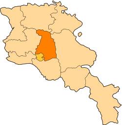
Balahovit
Coordinates: 40°15′13″N 44°36′14″E / 40.25361°N 44.60389°E
| Balahovit Բալահովիտ | |
|---|---|
 Balahovit | |
| Coordinates: 40°15′13″N 44°36′14″E / 40.25361°N 44.60389°E | |
| Country | Armenia |
| Marz (Province) | Kotayk |
| Population (2012) | |
| • Total | 3,911[1] |
| Time zone | (UTC+4) |
| • Summer (DST) | (UTC+5) |
Balahovit (Armenian: Բալահովիտ, also Romanized as Balaovit; formerly, Mgub, Mekhub, and Mehub) is a town in the Kotayk Province of Armenia.
References
- Balahovit at GEOnet Names Server
- World Gazeteer: Armenia – World-Gazetteer.com
- Report of the results of the 2001 Armenian Census, National Statistical Service of the Republic of Armenia
