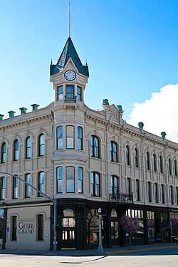
Baker Historic District
For the historic district in Denver, Colorado, see Baker, Denver.
|
Baker Historic District | |
 | |
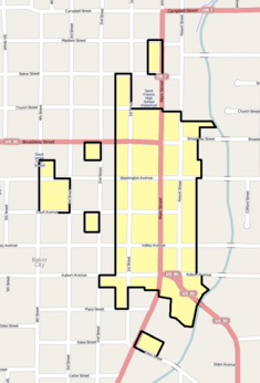 The Baker Historic District boundaries in Baker City. | |
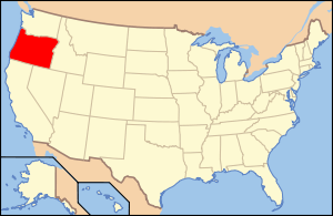
| Location | Irregular pattern along Main St. from Madison to Estes Sts., Baker, Oregon |
|---|---|
| Coordinates | 44°46′30″N 117°49′49″W / 44.77500°N 117.83028°WCoordinates: 44°46′30″N 117°49′49″W / 44.77500°N 117.83028°W |
| Area | 41.9 acres (17.0 ha) |
| Built | 1870 |
| Architect | Multiple |
| Architectural style | Late Victorian |
| Governing body | Local |
| NRHP Reference # | 78002277[1] |
| Added to NRHP | December 14, 1978 |
The Baker Historic District, located in Baker City, Oregon, is listed on the National Register of Historic Places.[2]
See also
References
- ↑ "National Register Information System". National Register of Historic Places. National Park Service. 2009-03-13.
- ↑ "Oregon National Register List" (PDF). Oregon Parks and Recreation Department. June 6, 2011. p. 1. Archived from the original on 21 July 2011. Retrieved July 20, 2011.
External links
![]() Media related to Baker Historic District at Wikimedia Commons
Media related to Baker Historic District at Wikimedia Commons