Bahía Concepción, Baja California Sur
Bahía Concepción is one of the largest bays of Baja California.[1] Lying on the Gulf of California, and less than 20 miles south of Mulegé, Bahía Concepción features over 50 miles of beaches. Some of the more popular beaches include (from north to south) Playa Los Naranjos, Playa Punta Arena, Playa Santispac, Playa Escondida, Playa Los Cocos, Playa El Coyote, Playa Buenaventure, Playa El Requeson, Playa Armenta. Entry into the sheltered bays near Playa Santispac is marked by a lighthouse on Isla Pitahaya.[1]
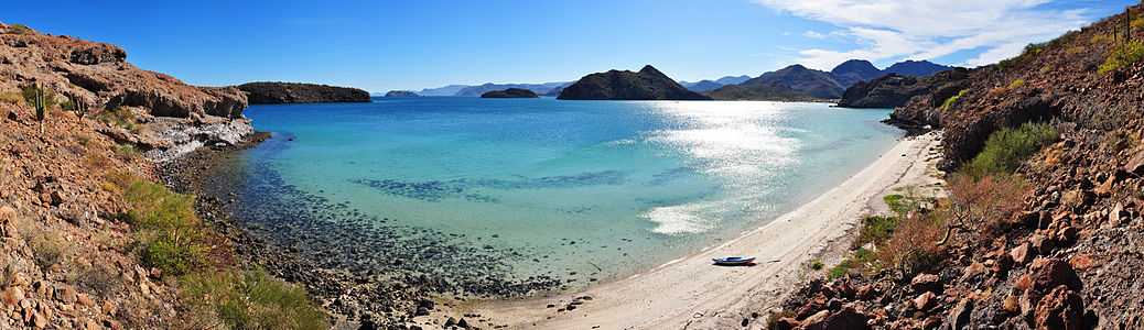
180° Panorama on Playa Santispac of Bahía Concepción, Baja California Sur. Several islands are visible in the bay: (left to right) Isla San Ramon, Isla Blanca, and Isla Coyote. On the right is Playa Concepcion with its associated developments visible.
Coordinates: 26°40′15″N 111°48′49″W / 26.67075°N 111.81359°W
References
- ↑ 1.0 1.1 "Bahia Concepcion". Retrieved 2009-12-25.