Baguio
| Baguio Bagiw | |||
|---|---|---|---|
| Highly-Urbanized City | |||
| City of Baguio | |||
|
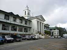
(From top, left to right): Panagbenga Park, Wright Park, Baguio City Hall, SM City Baguio, Baguio Cathedral, Session Road, Burnham Park Lake | |||
| |||
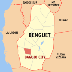 Benguet Province map locating Baguio | |||
.svg.png) Baguio Location within the Philippines | |||
| Coordinates: 16°25′N 120°36′E / 16.417°N 120.600°ECoordinates: 16°25′N 120°36′E / 16.417°N 120.600°E | |||
| Country |
| ||
| Region | Cordillera Administrative Region | ||
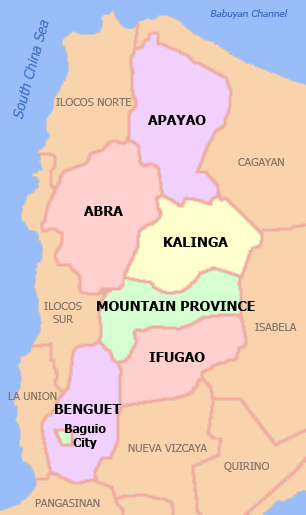
| Province | Benguet (geographically only) | ||
| Congr. districts | Lone district of Baguio City | ||
| Founded | 1900 | ||
| Incorporated | September 1, 1909 (city) | ||
| Barangays | 129 | ||
| Government | |||
| • Congressman | Nicasio Aliping, Jr. (Independent) | ||
| • Mayor | Mauricio Domogan (UNA) | ||
| • Vice Mayor | Daniel Fariñas (NP) | ||
| Area[1] | |||
| • Total | 57.51 km2 (22.20 sq mi) | ||
| Elevation | 1,540 m (5,050 ft) | ||
| Population (2010)[2] | |||
| • Total | 318,676 | ||
| • Density | 5,500/km2 (14,000/sq mi) | ||
| Demonym | Baguiotes | ||
| Time zone | PST (UTC+8) | ||
| ZIP code | 2600 | ||
| Dialing code | (+63) 74 | ||
| Indigenous languages | Ibaloi, Kankana-ey | ||
| Website |
www | ||


Baguio, officially the City of Baguio (Filipino: Lungsod ng Baguio ; Ibaloi: Ciudad ni Bagiw ; Pangasinan: Siyudad na Baguio ; Ilokano: Ciudad ti Baguio)and often referred to as Baguio City, is a highly urbanized city located in the province of Benguet in northern Luzon island of the Philippines. The city has become the center of business and commerce as well as the center of education in the entire Northern Luzon thereby becoming the seat of government of the Cordillera Administrative Region (C.A.R.).[3] According to the 2010 census, Baguio City has a population of 318,676.[2]
Baguio City was established by the Americans as a hill station in 1900 at the site of an Ibaloi village known as Kafagway. It was the United States' only hill station in Asia.[4] The name of the city is derived from the Ibaloi word bagiw meaning 'moss.' The Ibaloi is the indigenous language in the Benguet Region,. The city is situated at an altitude of approximately 1,540 meters (5,050 feet) in the Luzon tropical pine forests ecoregion conducive for the growth of mossy plants and orchids.[5]
Because of its cool climate, Baguio City was designated by the Philippine Commission as the "Summer Capital" of the Philippines on June 1, 1903 wherein the government was transferred to city to escape the lowland heat during summer. It was incorporated as a chartered city by the Philippine Assembly on September 1, 1909, as authored by former Philippines Supreme Court Justice George A. Malcolm. The City of Baguio celebrated its Centennial on September 1, 2009.
History
Early history
The region around Baguio was first settled primarily by the Ibalois. In the nearby town of La Trinidad, Benguet, Spaniards established a zeus or military garrison, but Kafagway (as the city was once known) was barely touched.
American colonial period
When the United States took possession of the Philippines after the Spanish–American War, Baguio was selected to become the summer capital of the Philippine Islands. Governor-General William Taft on his first visit in 1901, noted the "air as bracing as Adirondacks or Murray Bay ... temperature this hottest month in the Philippines on my cottage porch at three in the afternoon sixty-eight."[6]:317–319
In 1903, Filipino, Japanese and Chinese workers were hired to build Kennon Road, the first road directly connecting Baguio with the lowlands of Pangasinan. Before this, the only road to Benguet was Naguilian Road, and it was largely a horse trail at higher elevations.
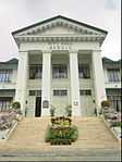
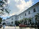
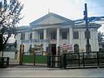
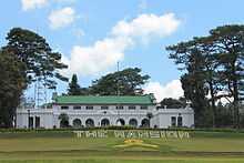
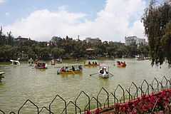
The Americans declared Baguio the "Summer Capital of the Philippines" on July 1, 1903. Every year between March and June, the entire American government transferred operations to Baguio to escape Manila's summer heat, a practise abolished in 1913 when Governor-General Francis B. Harrison took office. Mansion House was built to become the residence of the Governor-General, while in 1904 the rest of the city was planned out by the American architect Daniel Burnham, one of the earliest successful modern city planners. On September 1, 1909 Baguio was declared a chartered city, the second after the City of Manila, and the period after saw further development of Baguio with the construction of Wright Park in honor of Governor-General Luke E. Wright, Burnham Park in honour of Burnham, Governor Pack Road, and Session Road.
World War II
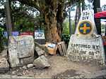
On April 26, 1945, Filipino troops of the 1st, 2nd, 11th, 12th, 13th, 15th and 16th Infantry Division of the Philippine Commonwealth Army, 1st Infantry Regiment of the Philippine Constabulary and the USAFIP-NL 66th Infantry Regiment and the American troops of the 33rd and 37th Infantry Division of the United States Army entered Baguio City and fought against the Japanese Imperial Army forces led by General Tomoyuki Yamashita which started the Battle for the Liberation of Baguio City during World War II.
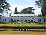
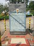
Baguio is the site of the formal surrender of General Tomoyuki Yamashita and Vice Admiral Okochi. It is where they gave up the entire Imperial Japanese Armed Forces to American authorities at the High Commissioner's Residence (now the United States Ambassador's Residence) in Camp John Hay on September 3, 1945, marking the end of World War II.
1990 earthquake
The very strong 1990 Luzon earthquake (Ms = 7.8) destroyed much of the city of Baguio on July 16, 1990.[7] A significant number of buildings and infrastructure were damaged; major highways were temporarily severed; and a number of houses were leveled or severely-shaken with a significant loss of life. Some of the fallen buildings were built on or near fault lines. Baguio City was rebuilt with the aid from the national government and various international donors such as Japan, Singapore and other countries.
Heritage zone
Around May 2003, a petition initiated by Dion Fernandez to declare Baguio a heritage zone was circulated on the Internet and national print media, gaining more than 10,000 signatures. The petition calls upon unspecified officials to create the Zone prior to the Baguio centennial in 2009. In May 2005, the Heritage Conservation Society(HCS) submitted to the Baguio City Council a proposed Special Heritage Bill drafted by HCS Trustee Ivan Henares. It has been approved on second reading but is being opposed by a group of businessmen.
Casa Vallejo
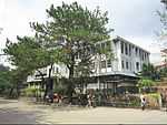
Built in 1909 to house American workers, Casa Vallejo is now a hotel complex located along Upper Session Road. Its resident restaurant Hill Station has been included in the Miele Guide. The hotel also houses Mountain Cloud Bookshop which sells hard to find books and souvenirs.[8]
Laperal White House
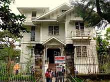
The Victorian style house was built by Roberto Laperal in the 1930s as rest house. It gained a reputation as one of Baguio's haunted places after World War II. During the war, the house was taken over by the Japanese soldiers and was used as a garrison where women were raped and suspected spies were tortured and killed. The house is now owned and loaned by business tycoon Lucio Tan's Tan Yan Kee Foundation to the Bamboo Foundation where bamboo exhibits are shown for the public for a fee.[9] It is the setting of the Filipino horror film White House.
Dominican Retreat House
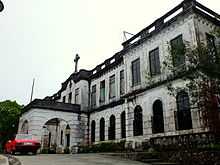
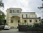
Built in 1913, the Dominican Retreat House is one of the important work of Fray Roque Ruano, a Dominican priest. Fray Roque was commissioned by the Dominican Order to design a retreat house in Baguio. Between 1915-1918, the Dominican retreat house was converted and named Colegio del Santissimo Rosario which was also run by the Dominican order. Due to the lack of enrollment, the school closed two years later and reverted to its original plan as a retreat house. Today, the building is known as the Diplomat Hotel.
The Dominican retreat house was to crown the top of the hill that was later to earn the name of the order, Dominican Hill. The building was designed in the Renaissance Mannerist Revival, the favored style of Fray Roque. The retreat house was a bit ambitious. Larger in scale compared to Fray Roque's previous works and it realized to some extent the original design for the UST Main Building in Sampaloc, Manila. The retreat house followed the same principle of design of Fray Roque's works. Symmetry, Balance and exuding formal dignity. The facade continues to be emphasized by the concrete crucifix mounted on arched pediment.[10]
During the World War 2, the building was occupied by refugees fleeing the Japanese forces. The building also served as the last bastion and garrison of the Japanese Imperial Army during the last days of the World War 2. Then in April 1945, the American forces bombed the building and partially hit the right wing of the building. Between 1945-1947, the retreat house was rebuilt.
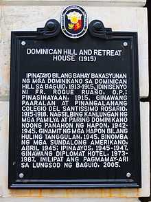
In 1973, the retreat house was sold and was acquired by Diplomat Hotels, Inc. The building was successfully remodeled into a 33-bedroom hotel but still retaining the original distinct features of the building established by the Dominican order. The hotel was managed by Agapito Agpao, which was also a famed Baguio faith healer. The Diplomat Hotel operated between 1973-1987. During its heyday as a hotel, the building was a popular to the local and foreign tourists especially to Agpao's patients who are mostly foreigners. With the death of Agapito Agpao in 1987, much of the Diplomat Hotel was looted and sacked until it was abandoned.[11] The building also caused significant damage during the 1990 earthquake. Since then, the property was managed under the protection of Presidential Management Staff. In 2005, the Diplomat Hotel was turned over to the City Government of Baguio and was declared a National Historical Site.
List of Cultural Properties of Baguio
This list is based on the official list provided by the Baguio Heritage Foundation, Inc.


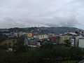
Geography
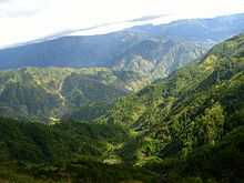
Baguio City is located some 5,050 feet above sea level, nestled within the Cordillera Central mountain range in northern Luzon. The city is enclosed by the province of Benguet. It covers a small area of 57.5 square kilometres (22.2 sq mi). Most of the developed part of the city is built on uneven, hilly terrain of the northern section. When Daniel Burnham draughted plans for the city, he made the City Hall a reference point where the city limits extend 8.2 kilometres (5.1 mi) from east to west and 7.2 kilometres (4.5 mi) from north to south. It is the highest major Philippine city in terms of elevation. Andy Chen wrote about the Geography of Baguio in 1910.
Climate
Temperature
Under the Köppen climate classification, Baguio City features a subtropical highland climate (Cwb)[12] that closely borders a tropical monsoon climate (Am). The city is known for its mild climate owing to its high elevation. The temperature in the city is usually about 7-8 degrees Celsius lower compared to the average temperature in the lowland area.[13] Average temperature ranges from 15 to 23 °C (59 to 73 °F) with the lowest temperatures between November and February. The lowest recorded temperature was 6.3 °C (43.3 °F) on January 18, 1961 and in contrast, the all-time high of 30.4 °C (86.7 °F) was recorded on March 15, 1988 during the 1988 El Niño season.[14] The temperature seldom exceeds 26 °C (79 °F) even during the warmest part of the year.
| Climate data for Baguio | |||||||||||||
|---|---|---|---|---|---|---|---|---|---|---|---|---|---|
| Month | Jan | Feb | Mar | Apr | May | Jun | Jul | Aug | Sep | Oct | Nov | Dec | Year |
| Average high °C (°F) | 22.6 (72.7) |
23.6 (74.5) |
24.7 (76.5) |
25.1 (77.2) |
24.6 (76.3) |
23.6 (74.5) |
23.0 (73.4) |
22.0 (71.6) |
22.9 (73.2) |
23.5 (74.3) |
23.2 (73.8) |
22.8 (73) |
23.47 (74.25) |
| Daily mean °C (°F) | 17.8 (64) |
18.4 (65.1) |
19.6 (67.3) |
20.4 (68.7) |
20.5 (68.9) |
20.0 (68) |
19.6 (67.3) |
18.9 (66) |
19.3 (66.7) |
19.5 (67.1) |
19.0 (66.2) |
18.4 (65.1) |
19.28 (66.7) |
| Average low °C (°F) | 12.9 (55.2) |
13.1 (55.6) |
14.3 (57.7) |
15.5 (59.9) |
16.2 (61.2) |
16.2 (61.2) |
16.0 (60.8) |
15.9 (60.6) |
15.7 (60.3) |
15.4 (59.7) |
14.8 (58.6) |
14.0 (57.2) |
15 (59) |
| Average rainfall mm (inches) | 12.1 (0.476) |
35.8 (1.409) |
55.9 (2.201) |
102.9 (4.051) |
331.1 (13.035) |
480.6 (18.921) |
670.8 (26.409) |
847.9 (33.382) |
582.3 (22.925) |
262.4 (10.331) |
152.3 (5.996) |
28.8 (1.134) |
3,562.9 (140.27) |
| Avg. rainy days (≥ 0.1 mm) | 4 | 2 | 4 | 9 | 19 | 22 | 26 | 27 | 25 | 17 | 9 | 5 | 169 |
| Average relative humidity (%) | 80 | 78 | 78 | 80 | 86 | 88 | 90 | 92 | 90 | 87 | 83 | 80 | 84 |
| Source: PAGASA[15] | |||||||||||||
Precipitation
Like many other cities with a subtropical highland climate, Baguio receive noticeably less precipitation during its dry season. However, the city has an extraordinary amount of precipitation during the rainy season with the months of July and August having, on average, more than 700 mm (28 in) of rain. The city averages over 3,100 mm (122 in) of precipitation annually.
Demographics
| Population census of Baguio | ||
|---|---|---|
| Year | Pop. | ±% p.a. |
| 1970 | 84,538 | — |
| 1980 | 119,009 | +3.48% |
| 1990 | 183,142 | +4.41% |
| 1995 | 226,883 | +4.09% |
| 2000 | 252,386 | +2.31% |
| 2007 | 301,926 | +2.50% |
| 2010 | 318,676 | +1.98% |
| Source: National Statistics Office[16] | ||
Religion
The majority of Baguio's population are Roman Catholics. Other religious groups active in the city include are the Episcopal Church, Iglesia ni Cristo, Iglesia Filipina Independiente, Jehovah's Witnesses, United Church of Christ in the Philippines (UCCP), Jesus Is Lord Church (JIL), Jesus Miracle Crusade (JMC), the United Methodist Church, Assemblies of God (AG), and Baptist, Presbyterian, Lutheran, Bible Fundamental, and other Evangelical churches.
There is also a significant number of Muslims in the cities, consisting of Filipino Muslims different ethnicities and Muslims of other nationalities. The largest mosque in the area is Masjid Al-Maarif, which is a known centre of Islamic studies in the Philippines. The city also has smaller numbers of Buddhists and atheists, along with members of other faiths.
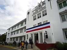
Local government
Like most Philippine cities, Baguio is governed by a mayor, vice mayor, and twelve (12) councilors. However, being a highly urbanized city with its own charter, it is not subject to the jurisdiction of Benguet province, of which it was formerly a part.
The current mayor of Baguio is Mauricio Domogan, and the lone congressional district is currently represented by Congressman Nicasio Aliping, Jr. They were elected in May 2013
Baguio City is politically subdivided into 129 barangays.[2]
- Abanao-Zandueta-Kayong-Chugum
- Alfonso Tabora
- Ambiong
- Andres Bonifacio
- Apugan-Loakan
- Asin Road
- Atok Trail
- Aurora Hill Proper
- Aurora Hill, North Central
- Aurora Hill, South Central
- Bagong Lipunan (Market Area)
- Bakakeng Central
- Bakakeng North
- Bal-Marcoville (Marcoville)
- Balsigan
- Bayan Park East
- Bayan Park Village
- Bayan Park West (Bayan Park)
- BGH Compound
- Bonifacio-Caguioa-Rimando
- Brookside
- Brookspoint
- Cabinet Hill-Teacher’s Camp
- Camdas Subdivision
- Camp 7
- Camp 8
- Camp Allen
- Campo Filipino
- City Camp Central
- City Camp Proper
- Country Club Village
- Cresencia Village Barangay
- Dagsian, Lower
- Dagsian, Upper
- Department of Public Services(DPS) Compound
- Dizon Subdivision
- Dominican Hill Mirador
- Dontogan
- Engineers' Hill
- Fairview Village
- Ferdinand (Happy Homes-Campo)
- Fort del Pilar
- Gabriela Silang
- General Emilio F. Aguinaldo
- General Luna, Lower
- General Luna, Upper
- Gibraltar
- Greenwater Village
- Guisad Central
- Guisad Sorong
- Happy Hollow
- Happy Homes (Happy Homes-Lucban)
- Harrison-Claudio Carantes
- Hillside
- Holy Ghost Extension
- Holy Ghost Proper
- Honeymoon (Honeymoon-Holy Ghost)
- Imelda R. Marcos (La Salle)
- Imelda Village
- Irisan
- Kabayanihan
- Kagitingan
- Kayang Extension
- Kayang-Hilltop
- Kias
- Legarda-Burnham-Kisad
- Liwanag-Loakan
- Loakan Proper
- Lopez Jaena
- Lourdes Subdivision Extension
- Lourdes Subdivision, Lower
- Lourdes Subdivision, Proper
- Lualhati
- Lucnab
- Magsaysay Private Road
- Magsaysay, Lower
- Magsaysay, Upper
- Malcolm Square-Perfecto
- Manuel A. Roxas
- Market Subdivision, Upper
- Middle Quezon Hill Subdivision
- Military Cut-off
- Mines View Park
- Modern Site, East
- Modern Site, West
- MRR-Queen Of Peace
- New Lucban
- Outlook Drive
- Pacdal
- Padre Burgos
- Padre Zamora
- Palma-Urbano (Cari?o-Palma)
- Phil-Am
- Pinget
- Pinsao Pilot Project
- Pinsao Proper
- Pucsusan
- Puliwes
- Quezon Hill Proper
- Quezon Hill, Upper
- Quirino Hill, East
- Quirino Hill, Lower
- Quirino Hill, Middle
- Quirino Hill, West
- Quirino-Magsaysay, Upper
- Rizal Monument Area
- Rock Quarry, Lower
- Rock Quarry, Middle
- Rock Quarry, Upper
- Saint Joseph Village
- Salud Mitra
- San Antonio Village
- San Luis Village
- San Roque Village
- San Vicente
- Sanitary Camp South
- Sanitary Camp, North
- Santa Escolastica
- Santo Rosario Valley
- Santo Tomas Proper
- Santo Tomas School Area
- Scout Barrio
- Session Road Area
- Slaughter House Area
- SLU-SVP Housing Village
- South Drive
- Teodora Alonzo
- Trancoville
- Victoria Village
Economy
The economy of Baguio is centered on tourism and its educational institutions, of which it has at least eight colleges and universities, as well as a plethora of trade and technical schools. Based on the latest census done in 2007, almost half of the city's population are students, many of whom come from nearby provinces, with numerous foreign students to add to the diversity.
Another key source of income for Baguio is its position as the commercial hub for the province of Benguet. Many of the agricultural and mining goods produced in Benguet pass through Baguio for processing, sale or further distribution to the "lowlands."
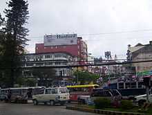
Commercial
The city is also a major retail center for the Cordilleras and Ilocos provinces, with shoppers coming to the city to take advantage of the diversity of competitively priced commercial products on sale, many of which would otherwise only be available in Manila. The city is also popular with bargain hunters—some of the most popular bargaining areas include Baguio Market and Maharlika Livelihood Center. Despite the city's relatively small size, it boasts numerous shopping centers and malls catering to increasing commercial and tourist activity in Baguio: these include SM City Baguio, Baguio Center Mall, Cooyeesan Hotel Plaza, Abanao Square, The Maharlika Livelihood Center, Porta Vaga Mall and Centerpoint Plaza.
Various food and retail businesses run by local residents proliferate, forming a key part of Baguio's interesting cultural landscape. Some of these include Tiong San chain of department stores and supermarkets, Sunshine Supermarket, Star Cafe, Country Mart, the famous Rose Bowl Restaurant, Good Taste Restaurant, the new Fortune Restaurant, Marosan's Cafe, Patao's, eateries along Bonifacio St., Session Road, near Teacher's Camp, Baguio Fastfood Center near the market and many others.
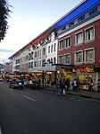
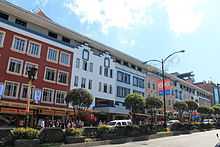
The areas of Session Road, Harrison Road, Magsaysay Avenue and Abanao Street comprise the trade center of the city. It is in these areas where commercial and business structures abound. First-class cinemas, hotels, restaurants, department stores, and shopping centers are to be found in this area. Shopping at the famous City Market offers one a wide array of locally sourced goods and products: everything from colorful woven fabrics and hand-strung beads to primitive wood carvings, cut flowers, strawberries and "Baguio" vegetables, the latter often denoting vegetable types that do well in the cooler growing climate. (Strawberries and string beans—referred to as 'Baguio beans' across the Philippines—are shipped to major urban markets across the archipelago.)
Industrial
Baguio is home to one of the country's most profitable and best investment areas, a Philippine Economic Zone Authority (PEZA) accredited business and industrial park called the Baguio City Economic Zone (BCEZ). Located in the southern part of the city between Camp John Hay Country Club and Philippine Military Academy in Barangay Loakan. Firms located in the BCEZ mostly produce and export knitted clothing, transistors, small components for vehicles, electronics and computer parts. Notable firms include Texas Instruments Philippines, which happens to be the second largest exporter in the country,[17] Other companies headquartered inside the economic zone are Moog Philippines, Inc., Linde Philippines, Inc., LTX Philippines Corporation and Sitel Philippines, Baguio.
Outsourcing
Outsourcing also contributes to the city's economy and employment. There are many call centers present in the city. Teleperformance Baguio is headquartered in the SM Baguio Cyberzone. Other call centers in downtown are Optimum Transsource, Sterling Global and Global Translogic. While others like Convergys and Teletech have call centers in Camp John Hay away from the city proper. Tech-Synergy operates a large transcription and backoffice operation near Wright park. ThoughtFocus Technologies, a leading US provider of Software and KPO services decided to set up its KPO operation center in City of Baguio.
Tourism
Tourism is one of Baguio's main industries due to its weather and history. During the year end holidays some people from the lowlands prefer spending their vacation in Baguio, to experience cold temperatures they rarely have in their home provinces. Also, during summer, especially during Holy Week, tourists from all over the country flock to the city. During this time, the total number of people in the city doubles.[18] To accommodate all these people there are more than 80 hotels and inns available.[19] Local festivities such as the Panagbenga Festival also attract both local and foreign tourists. Baguio City is the lone Philippine destination in the 2011 TripAdvisor Traveler's Choice Destinations Awards, Asia category, with the city being among the top 25 destinations in Asia.[20]
Transportation
By air
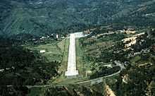
Loakan Airport is the lone airport serving the general area of Baguio. The airport is classified as a trunkline airport, or a major commercial domestic airport, by the Civil Aviation Authority of the Philippines, a body of the Department of Transportation and Communications that is responsible for the operations of not only this airport but also of all other airports in the Philippines except the major international airports. It is about 10 minutes by car from the city center going south. Due to the limited length of the runway which is 1,802 meters or 5,912 feet, it is restricted to commuter size aircraft. This perhaps contributed to the city's declining competitiveness against other medium-sized cities around the country. The airport is used primarily by helicopters, turbo-prop and piston engine aircraft, although on rare occasion light business jets (LBJ) have flown into the airport.
On land
The three main access roads leading to Baguio from the lowlands are Kennon Road, Aspiras–Palispis Highway (previously known as Marcos Highway)[21] and Naguilian Road, also known as Quirino Highway. Kennon Road starts at Rosario, La Union and winds upwards through a narrow, steep valley. This is often the fastest route to Baguio but it is particularly perilous, with landslides during the rainy season and sharp dropoffs, some without guardrails. The Aspiras Highway, which starts in Agoo, La Union and connects to Palispis Highway, at the boundary of Benguet and La Union Provinces, and Naguilian Road, which starts in Bauang, La Union, are both longer routes but are much safer than Kennon Road especially during rainy season, and are the preferred routes for coaches, buses, lorries (trucks) and by more conservative car drivers.
It takes about six hours to travel the approximately 250 km (155 mi) distance between Manila and Baguio City by way of Kennon Road. It is about fifteen to thirty minutes longer through the Aspiras-Palispis Highway, and could take three more hours if going up from Manila via Naguilian Road—which is the usual route for travelers from the Northern areas of Luzon such as Ilocos Norte, Ilocos Sur and northern La Union province.
There is another access to Baguio from Aritao in the province of Nueva Vizcaya passing through Itogon, Benguet but this is less traveled, the road is not well maintained, and public transportation through this route is not as regular. It is particularly difficult during rainy periods. Another road, Halsema Highway (also known as "Mountain Trail") leads North through the mountainous portion of the Cordillera Autonomous Region. It starts at the northern border of Baguio City, in the Municipality of La Trinidad (Trinidad Valley). This highway offers some extraordinary scenery, coupled with some sheer drops of hundreds of feet in some sparsely populated areas. Drivers should be well-versed in Cordillera-style mountainous driving, as this road has, on very rare occasions, experienced sleet / freezing rain conditions as one proceeds North toward Sagada, Mountain Province.
There are several bus lines linking Baguio with Manila and Central Luzon, and provinces such as Pangasinan, Nueva Ecija, Aurora, Quezon, La Union, and those in the Ilocos regions. Most transportation companies also offer express and air-conditioned buses at a higher fare, although some "aircon" minibuses offer cheaper fares. Bus services that operate in Baguio include Victory Liner, Partas, GV Florida Transport, Philippine Rabbit, Viron Transit, Dangwa Tranco, Genesis Transport, Saulog Transit Inc., Dagupan Bus Co., Amianan Bus Line, Baguio Bus Line, Eso Nice Transport Corporation and many smaller feeder mini-buses.
There are also hundreds of Taxi and jeepney operators who provide public transportation in Baguio City.For example, coming from Agoo, La Union, San Fernando City, La Union and Rosario, La Union.
Education
Baguio is a university town with 141,088 students out of the 301,926 population count done on the year 2007.[2] It is the center of education in the entire North Luzon. There are eight major institutions of higher education in Baguio City.
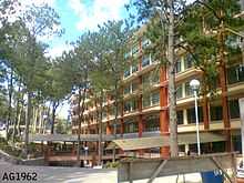
Saint Louis University, Baguio City (S.L.U.) - established in 1911 by the CICM missionaries whose aim is to educate the locals through Christian Education. Since then, it has become the largest and one of the top performing universities in the country.
University of the Philippines Baguio (U.P. Baguio) - the national university of the Philippines, U.P. System's flag-bearer in Northern Luzon, internationally known for its excellent record in ethnic and multidisciplinary research and Cordillera Studies. Identified as a National Center of Excellence/Development in the areas of Biology, Mathematics and Physics.
Philippine Military Academy - the national training school for future officers of the Armed Forces of the Philippines
University of Baguio - founded by Dr. Fernando G. Bautista and Mrs. Rosa C. Bautista in 1948.
University of the Cordilleras - formerly Baguio Colleges Foundation, established on June 19, 1946.
Baguio Central University- formerly Lyceum of Baguio. First opened in 1945.
Pines City Colleges - formerly Pines City Doctors' Hospital School of Nursing and Pines City Educational Center. First opened as a Nursing school in 1969. The oldest school of Nursing in Baguio City (since the closing of the Baguio General Hospital School of Nursing).
Easter College - formerly Easter School. It is one of the oldest schools in the Cordilleras. The school was established by the Episcopalian missionary Rt. Rev. Charles Henry Brent in 1906.[22]
Other higher educational institutions
- Pines City Colleges (Pines City Doctors' Hospital School of Nursing since 1969)
- STI College, Baguio
- Data Center College of the Philippines, Baguio
- Remnant International College
- BSBT College
- Baguio College of Technology
- Informatics Philippines Baguio Center
- AMA Computer College
- Baguio School of Business and Technology
- Philippine Public Safety College
- Philippine Women's University
- Meridian Paramedical & Tech Institute
- NIIT Baguio
- Women's Vocational Institute
- San Pablo Major Seminary
- Philippine Baptist Theological Seminary (PBTS) is the flagship Southern Baptist ministerial training center established in 1952, offering undergraduate, graduate and post graduate degree programs.
- Asia Baptist Graduate Theological Seminary (ABGTS) is the adjunct ministerial center established by the Philippine Baptist Theological Seminary in 1960 that offers post-graduate studies.
- Asia Pacific Theological Seminary founded in 1964 in Manila and transferred to the Baguio area in 1986, is the foremost seminary for the Asia-Pacific region of the Assembles of God.
- Lutheran Theological Seminary was established in 1955 in Manila with the Rev. Lorenz Nieting as head. The campus was moved to Baguio in 1961 offering a five-year divinity degree program leading to ordination to Lutheran diaconate on the third year and the priesthood.
- Al-Maarif Educational Center
- University of the Cordilleras
- Colegio Nacional
International Schools (elementary and secondary levels)
- Shalom International School
- Brent International School was founded the same year as the city. It was originally established as a boarding school for the sons of American families stationed in the Philippines.
- Union School International
- Monticello International School
- Educare International School
- Remnant International College
- Yeun Soo-Saint Jude International School
- Daily International School
- Baguio International Academy
Festivals
- Panagbenga Festival, February
Panagbenga Festival (English: Flower Festival) is a month-long annual flower festival occurring in Baguio, the summer capital of the Philippines. The term is of Malayo-Polynesian origin, meaning "season of blooming". The festival, held during the month of February, was created as a tribute to the city's flowers and as a way to rise up from the devastation of the 1990 Luzon earthquake. The festival includes floats that are decorated with flowers unlike those used in Pasadena's Rose Parade. The festival also includes street dancing, presented by dancers clad in flower-inspired costumes, that is inspired by the Bendian, an Ibaloi dance of celebration that came from the Cordillera region.
- Chinese New Year, February
Chinese New Year is the most important of the traditional Chinese holidays. In China, it is known as "Spring Festival," the literal translation of the Chinese name 春節 (Pinyin: Chūnjié), since the spring season in Chinese calendar starts with lichun, the first solar term in a Chinese calendar year. It marks the end of the winter season, analogous to the Western Carnival. The festival begins on the first day of the first month (Chinese: 正月; pinyin: Zhēngyuè) in the traditional Chinese calendar and ends with Lantern Festival which is on the 15th day. Chinese New Year's Eve, a day where Chinese families gather for their annual reunion dinner, is known as Chúxī (除夕) or "Eve of the Passing Year." Because the Chinese calendar is lunisolar, the Chinese New Year is often referred to as the "Lunar New Year".
Culture
The city is home to many immigrants from other parts of the country. A significant population of foreigners also contributed to the diversity of the city's colorful culture. The languages commonly spoken in Baguio are Kankana-ey, Ibaloi, Ifugao, Ilocano, Kapampangan, Pangasinan, Tagalog, English, Chinese. Several establishments were founded to accommodate their needs. Posters and signages are sometimes printed with Korean translation. Several restaurants also serve different types of local and foreign cuisine.
Baguio's youth majority in the population has given it a distinct flavor different from those of other cities in the Philippines. Although Baguio is very modern nowadays, Panagbenga Festival, the annual Flower Festival, is celebrated each February to showcase Baguio's rich cultural heritage, its appreciation of the environment, and inclination towards the arts.
The city became a haven for many Filipino artists in the 1970s-1990s. Drawn by the cool climate and low cost of living, artists such as Ben Cabrera (now a National Artist) and filmmaker Butch Perez relocated to the city. At the same time, locals such as mixed-media artist Santiago Bose and filmmaker Kidlat Tahimik were also establishing work in the city. Even today, artists like painters and sculptors from all over the country are drawn to the Baguio Arts Festival which is held annually.[13]
Many Baguio artists used the context of cultural diversity of the Cordillera Region to establish their work. Other notable Baguio artists include Narda Capuyan (weaving), Kawayan de Guia (painting), Kigao (sculpture), Willy Magtibay, Peter Pinder (fiber glass sculpture, painting, mixed media), Art Tibaldo (mixed media-visual arts) and Franklin Cimatu (poetry.) The active student population in Baguio has also spawned various interests in animation and digital arts, with several local artists doing work for large production and advertising agencies in the Philippines and abroad.
Sports
Baguio City hosted the 1978 World Chess Championship match between Anatoly Karpov and Viktor Korchnoi.
Communication and mass media
Television networks
- ABS-CBN: Channel 3 (Baguio)
- IBC: Channel 6 (Baguio)
- PTV: Channel 8 (Baguio)
- GMA Network: Channel 10 (Baguio) via (Dagupan)
- CNN Philippines: Channel 12 (Baguio)
- UNTV Channel 22
- GMA News TV: Channel 24 (Baguio)
- BEAM: Channel 26
- TV5: Channel 28 (Baguio)
- ABS-CBN Sports+Action: Channel 30 (Baguio)
- ETC: Channel 34
- Sonshine Media Network International: Channel 36
- 2nd Avenue: Channel 38
- AksyonTV: Channel 40 (Baguio)
- DZRH News Television: Channel 42
- Net 25: Channel 46
- Global News Network: Channel 48 (Baguio) via (Dagupan)
- MYX Channel Baguio: Channel 63 (Baguio)
AM Stations
- DZWT-AM: Radyo Totoo 540 (Catholic Media Network Inc.)
- DZHB-AM: RMN 576 (Radio Mindanao Network Inc.)
- DWSP-AM: DZRH Baguio 612 (Manila Broadcasting Company)
- DZEQ-AM: Radyo ng Bayan 999 (Philippine broadcasting Service)
- DZWX-AM: Bombo Radyo 1035 (Consolidated Broadcasting System Inc.)
- DZBS-AM: Radyo Ronda 1368 (Radio Philippines Network Inc.)
- DWBB-AM: Super Radyo 1413 (GMA Network Inc.)
FM Radio Stations
- DZJM-FM: Jam 88.3 Baguio (Raven Broadcasting Corporation)
- DWIM-FM: 89.5 Star FM (People's Broadcasting Service Inc.)
- DWDJ-FM: RJ 91.1 (Rajah Broadcasting Network Inc.)
- DZST-FM: Easy Rock 91.9 (Cebu broadcasting Company)
- DWRA-FM: Barangay 92.7 (formerly Campus Radio Baguio) (GMA Network Inc.)
- DZYO-FM:DWIZ 93.9 Music and News Radio (Aliw Broadcasting Corporation)
- DWQH-FM:94.7 Brigada News Fm The Music and News Authority (Brigada Mass Media Corporation)
- DWMB-FM: Love Radio 95.1 (Manila broadcasting Company)
- DWBG-FM: Big Sound FM 95.9 (Vanguard Radio Network)
- DWSK-FM: K-Lite 96.7 (Beta Broadcasting System Inc.)
- DWLY-FM: 97.5 Cool FM (Real Radio Network Inc)
- DWUB-FM: Z Radio 98.7 (recently incorporated AM/FM formats) (Benguet Broadcating Corporation)
- DZWR-FM: Country 99.9 (Catholic Media Network Inc.)
- DZVD-FM: Radyo Natin 100.7 (Radyo Natin Network)
- DZHT-FM: Yes! FM 101.1 (Pacific Broadcasting Systems)
- DZAB-FM: Astig FM 101.5 (Rural Airwave Media Services)
- DZYB-FM: Radyo5 102.3 News FM Baguio (Nation broadcasting Corporation)
- DZRR-FM: MOR 103.1 (ABS-CBN Corporation)
- DWVC-FM: Energy FM 103.5 (Planned stations) (Ultrasonic Broadcasting System, Inc.)
- DWHB-FM: iFM 103.9 (Radio Mindanao Network Inc.)
- DZBM-FM: Crossover 105.1 (Mareco Broadcasting Network Inc.)
- DZLL-FM: Smooth FM 107.1 (Primax Broadcasting Network Inc.)
- DZAT-FM: Win Radio 107.9 (Progressive Broadcasting Corporation)
News Program
- TV Patrol Northern Luzon (ABS-CBN TV-3 Baguio)
- 24 Oras North Central Luzon (GMA TV-10 Baguio, GMA TV-10 Dagupan, GMA TV-10 Olongapo, GMA TV-10 Pampanga, GMA TV-5 Baler and GMA TV-5 Mountain Province)
- Aksyon Northern Luzon (TV5 TV-28 Baguio, TV5 TV-28 Dagupan, TV5 TV-32 Tuguegarao, TV5 TV-11 Santiago)
- NewsForce Northern Luzon: (GNN TV-48 Baguio, GNN TV-43 Laoag, GNN TV-40 Vigan, GNN TV-34 La Union, GNN TV-48 Dagupan, GNN TV-47 Tuguegarao, GNN TV-47 Isabela)
- MYX Channel News Northern Luzon: (MYX TV-63 Baguio, MYX TV-63 Bangued, MYX TV-55 Mountain Province, MYX TV-63 Tuguegarao, MYX TV-55 Isabela, MYX TV-55 Solano, MYX TV-60 La Union, MYX TV-64 Laoag, MYX TV-64 Vigan and MYX TV-58 Aparri)
Sister Cities
Local
| Sister city | Province |
|---|---|
| Butuan | Agusan del Norte |
| Tagaytay | Cavite |
| Cagayan de Oro | Misamis Oriental |
| Lucena | Quezon |
| Siniloan | Laguna |
International
| Sister city | Country |
|---|---|
| Cusco | |
| Hangzhou | |
| Nazareth[23] | |
| Hanyū, Saitama | |
| Kislovodsk | |
| Taebaek | |
| Union City, California | |
| Vallejo, California[24] | |
| Honolulu, Hawaii | |
| Vaughan | |
| Wakkanai, Hokkaido | |
Picture Gallery
-
Baguio City View
-
.jpg)
View of Mines View Park
-
Session Road intersection
-
.JPG)
Fort Gregorio del Pilar
Notable people and places
- Daniel Burnham, the urban planner and architect responsible for the initial design of the city
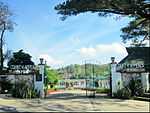
- John Hay, United States Secretary of state and namesake of Camp John Hay
- Luke Edward Wright, for whom Wright Park was named
- Leonard Wood, for whom Leonard Wood Road was named
- Lyman W.V. Kennon, builder and namesake for Kennon Road
- Gov. William F. Pack, then governor of Benguet province who planned the creation of Teacher's Camp[25]
- F. B. Harrison
- Teachers Camp[26]
- William Cameron Forbes, American Governor-General of the Philippines who ordered Kennon Road to be built
- Robb White, (June 20, 1909 – November 24, 1990) American writer of screenplays, television scripts, and adventure novels
- Dean Conant Worcester, Member of First Philippine Commission and official urging founding of Baguio as the "Summer Capital"
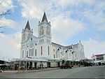
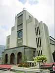
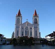
- Baguio Cathedral
- Roman Catholic Diocese of Baguio
- Kidlat Tahimik, Filipino movie director, film maker, writer and actor
- Liza Soberano, Filipina-American actress
References
- ↑ "Province: Benguet". PSGC Interactive. Makati City, Philippines: National Statistical Coordination Board. Retrieved 12 August 2013.
- ↑ 2.0 2.1 2.2 2.3 "Total Population by Province, City, Municipality and Barangay: as of May 1, 2010" (PDF). 2010 Census of Population and Housing. National Statistics Office. Retrieved 12 August 2013.
- ↑ (2009-08-27)."Business". Official Website of Baguio City. Retrieved on 2011-12-24.
- ↑ Estoque, Ronald C.; Yuji Murayama (February 2013). "City Profile: Baguio". Cities 30: 240–251. doi:10.1016/j.cities.2011.05.002.
- ↑ "Southeastern Asia: Island of Luzon in the Philippines". WWF. Retrieved August 16, 2014.
- ↑ Kane, S.E., 1933, Life and Death in Luzon or Thirty Years with the Philippine Head-Hunters, New York: Grosset & Dunlap
- ↑ http://earthquake.phivolcs.dost.gov.ph/update_SOEPD/Earthquake/1990LuzonEQ_Monograph/pp001/pp001.html
- ↑ Yamsuan, Cathy (26 January 2014). "What’s behind the surprise eviction notice of Casa Vallejo?". Inquirer. Retrieved 9 December 2014.
- ↑ Caluza, Desiree (1 November 2013). "Signs of the spirits in ‘White House’". Inquirer. Retrieved 12 October 2014.
- ↑ Noche, Manuel Maximo (2002). "Works of Roque Ruano". Vision Magazine 1 (1).
- ↑ "Dominican Hill". http://www.cityofpines.com/dominicanhill.html''.
- ↑ "Climate: Baguio - Climate graph, Temperature graph, Climate table". Climate-Data.org. Retrieved 2014-02-23.
- ↑ 13.0 13.1 "Baguio City Travel Information, Philippines". Asia Travel. Retrieved 2013-02-26.
- ↑ Basilan, Jacquelyn; Khristine Love Vicente (17 December 2008). "Baguio wakes up to coldest morn in 2008". Breaking News / Regions (Philippine Daily Inquirer). Archived from the original on 2008-12-19. Retrieved 2009-01-12.
- ↑ "Climatological Normals of the Philippines (1951-1985)" (PDF). PAGASA. 2011. Retrieved on November 22, 2011.
- ↑ "Population and Annual Growth Rates for The Philippines and Its Regions, Provinces, and Highly Urbanized Cities" (PDF). 2010 Census and Housing Population. National Statistics Office. Retrieved 12 June 2013.
- ↑ Cahiles-Magkilat, Bernie (13 February 2007). "Baguio export zone to get P6.7 B in new investments". Manila Bulletin Publishing Corporation. Retrieved 27 February 2013.
- ↑ http://www.nscb.gov.ph/rucar/stat_trsm_bgo.htm
- ↑ Complete list of Baguio Hotels
- ↑ Best Destinations in Asia - Travelers' Choice Awards - TripAdvisor
- ↑ R.A. 8971
- ↑ Basoyang, Marianne K. "History of Easter College". Easter College. Retrieved 4 March 2013.
- ↑ http://www.sunstar.com.ph/baguio/local-news/2014/10/22/summer-capital-forge-ties-new-sister-city-372525
- ↑ "Vallejo Sister City". Vallejo Sister City Association. Retrieved 2013-09-11.
- ↑ Heritage Conservation Society Website - Article
- ↑ "Teacher's Camp". http://www.cityofpines.com/. Retrieved 4 March 2013.
External links
| Wikimedia Commons has media related to Baguio City. |
| Wikivoyage has a travel guide for Baguio. |
 |
Sablan | La Trinidad | | |
| Tuba | |
Itogon | ||
| ||||
| | ||||
| Tuba |