Bagherpara Upazila
| Bagherpara বাঘারপাড়া | |
|---|---|
| Upazila | |
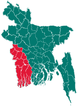
 Bagherpara Location in Bangladesh | |
| Coordinates: 23°13′N 89°21′E / 23.217°N 89.350°ECoordinates: 23°13′N 89°21′E / 23.217°N 89.350°E | |
| Country |
|
| Division | Khulna Division |
| District | Jessore District |
| Area | |
| • Total | 308.29 km2 (119.03 sq mi) |
| Population (2011) | |
| • Total | 216,897 |
| • Density | 700/km2 (1,800/sq mi) |
| Time zone | BST (UTC+6) |
| Website | Official Map of Bagherpara |
Bagherpara (Bengali: বাঘারপাড়া) is an Upazila of Jessore District in the Division of Khulna, Bangladesh.
Geography
Bagherpara is located at 23°13′00″N 89°21′00″E / 23.2167°N 89.3500°E. It has a total area of 308.29 km².
Demographics
As of the 2011 Bangladesh census, Bagherpara has a population of 216,897. In 1991 males constituted 51.21% of the population, and females 48.79%; this Upazila's eighteen-up population was 84303. Bagherpara has an average literacy rate of 34.5% (7+ years), and the national average of 32.4% literate.[1]
Administrative
Bagherpara has 9 Unions/Wards, 156 Mauzas/Mahallas, and 191 villages. Unions Name
- Johorpur
- Bandobila
- Raipur
- Dohakula
- Dorajhat
- Narikelbaria
- Dholgrum
- Jumdia
- Basuria
Education
@ Kayal Khaly Govt. Primary School, Established 2004; Founder,Muhammad Hafizur Rahman, USA.
- Raipur Govt.Primary School
- East Paikpara Govt. Model Primary School
- Dohakula Govt. Primary School
- Bagherpara Pilot Model High School
- Bagherpara Pilot Girls High School
- Bagherpara Degree College
- Bagherpara Mohilla College
- Raipur School & College
- Selumpur High school
- Karimpur High School
- Bagherpara saiddikya fszil madrasha
- Azempur islamia alim madrasa
- Narikelbariya degree college
- Narikelbariya high school
- Inra primary school
- Inra high school
- Dayarampur Siddikya Senior Madrasha.
- Dayarampur Primary School,
- Borvagh high school.
- Borvagh primary school.
- MD. ABU HURIRA.
See also
References
- ↑ "Population Census Wing, BBS.". Archived from the original on 2005-03-27. Retrieved November 10, 2006.
| ||||||||