Baggao, Cagayan
| Baggao | ||
|---|---|---|
| Municipality | ||
| ||
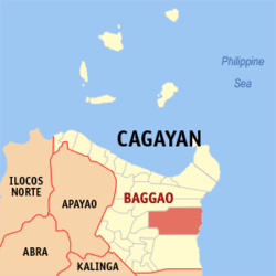 Map of Cagayan showing the location of Baggao | ||
.svg.png) Baggao Location within the Philippines | ||
| Coordinates: 17°55′N 121°58′E / 17.917°N 121.967°ECoordinates: 17°55′N 121°58′E / 17.917°N 121.967°E | ||
| Country | Philippines | |
| Region | Cagayan Valley (Region II) | |
| Province | Cagayan | |
| District | 1st District | |
| Barangays | 48 | |
| Government[1] | ||
| • Mayor | Leonardo C. Pattung | |
| Area[2] | ||
| • Total | 920.60 km2 (355.45 sq mi) | |
| Population (2010)[3] | ||
| • Total | 78,188 | |
| • Density | 85/km2 (220/sq mi) | |
| Time zone | PST (UTC+8) | |
| ZIP code | 3506 | |
| Dialing code | 78 | |
| Income class | 1st class | |

Baggao is a first class municipality in the province of Cagayan, Philippines. According to the 2010 census, it has a population of 78,188 people.[3]
Barangays
Baggao is politically subdivided into 48 barangays.[2]
- Adaoag
- Agaman (Proper)
- Alba
- Annayatan
- Asassi
- Asinga-Via
- Awallan
- Bacagan
- Bagunot
- Barsat East
- Barsat West
- Bitag Grande
- Bitag Pequeño
- Bunugan
- Canagatan
- Carupian
- Catugay
- Poblacion (Centro)
- Dabbac Grande
- Dalin
- Dalla
- Hacienda Intal
- Ibulo
- Immurung
- J. Pallagao
- Lasilat
- Masical
- Mocag
- Nangalinan
- Remus
- San Antonio
- San Francisco
- San Isidro
- San Jose
- San Miguel
- San Vicente
- Santa Margarita
- Santor
- Taguing
- Taguntungan
- Tallang
- Temblique
- Taytay
- Tungel
- Mabini
- Agaman Norte
- Agaman Sur
- C. Verzosa (Valley Cove)
Demographics
| Population census of Baggao | ||
|---|---|---|
| Year | Pop. | ±% p.a. |
| 1990 | 55,264 | — |
| 1995 | 60,060 | +1.57% |
| 2000 | 66,264 | +2.13% |
| 2007 | 73,048 | +1.35% |
| 2010 | 78,188 | +2.51% |
| Source: National Statistics Office[3] | ||
References
- ↑ "Official City/Municipal 2013 Election Results". Intramuros, Manila, Philippines: Commission on Elections (COMELEC). 11 September 2013. Retrieved 24 January 2014.
- ↑ 2.0 2.1 "Province: CAGAYAN". PSGC Interactive. Makati City, Philippines: National Statistical Coordination Board. Retrieved 24 January 2014.
- ↑ 3.0 3.1 3.2 "Total Population by Province, City, Municipality and Barangay: as of May 1, 2010". 2010 Census of Population and Housing. National Statistics Office. Retrieved 24 January 2014.
External links
 |
Gattaran | | ||
| Alcala | |
Philippine Sea | ||
| ||||
| | ||||
| Amulung | Peñablanca |
| ||||||||||||||||||