Badr City
| Badr City مدينة بدر | |
|---|---|
| suburb | |
|
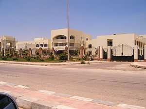
Badr City | |
 Badr City Location in Egypt | |
| Coordinates: 30°08′09″N 31°43′54″E / 30.135923°N 31.731552°E | |
| Country |
|
| Governorate | Al-Qahirah |
| Time zone | EST (UTC+2) |
Badr City (Arabic: مدينة بدر Madīnet Badr pronounced [mæˈdiːnɪt ˈbædɾ], "City of Full Moon") is a suburb in north eastern Cairo Governorate, Egypt.
Planning
Badr City is one of the promising industry cities, which may penetrate and obtain an essential category worldwide. It includes 129 factory working in varied types of industries very special with high quality, in addition to 350 factory is still under construction. Most of Badr factories aim to export their products to Arabian, African, world markets. This settlement tries to attract local, Arabian, Foreign investments by determining 1600 Fedden located in the east side of rubiky to establish a free zone. And recently Badr started to be considered as a suburb of Greater Cairo
Description
It has 3 universities: the Egyptian-Russian University, Future University (planned) and EELU (under construction)
It is the nearest industrial city to Cairo International Airport, Suez Port, it is also near to Delta, Suez Canal, Red Sea, Sinai.
Many projects have been established in Badr City in fields such as, water, streets, electrical networks, telephones, etc.
Badr city can be considered as an integrated industrial city which includes: medical, touristic, sporting clubs and green lands.
Projects in Badr City are to be exempted from taxes for up to 10 years from the date at which their operation commenced.
There is a proposal to establish a new national capital for Egypt near Badr City.
Climate
Köppen-Geiger climate classification system classifies its climate as hot desert (BWh),[1] as the rest of Egypt.
| Climate data for Badr City | |||||||||||||
|---|---|---|---|---|---|---|---|---|---|---|---|---|---|
| Month | Jan | Feb | Mar | Apr | May | Jun | Jul | Aug | Sep | Oct | Nov | Dec | Year |
| Average high °C (°F) | 18.1 (64.6) |
19.8 (67.6) |
23.2 (73.8) |
27.8 (82) |
32 (90) |
34.4 (93.9) |
34.9 (94.8) |
34.6 (94.3) |
31.8 (89.2) |
29.8 (85.6) |
24.9 (76.8) |
20.1 (68.2) |
27.62 (81.73) |
| Daily mean °C (°F) | 12.8 (55) |
14 (57) |
16.7 (62.1) |
20.3 (68.5) |
24.2 (75.6) |
26.9 (80.4) |
27.8 (82) |
27.9 (82.2) |
25.4 (77.7) |
23.5 (74.3) |
19.4 (66.9) |
14.7 (58.5) |
21.13 (70.02) |
| Average low °C (°F) | 7.6 (45.7) |
8.2 (46.8) |
10.2 (50.4) |
12.9 (55.2) |
16.4 (61.5) |
19.4 (66.9) |
20.8 (69.4) |
21.2 (70.2) |
19.1 (66.4) |
17.2 (63) |
13.9 (57) |
9.4 (48.9) |
14.69 (58.45) |
| Average precipitation mm (inches) | 6 (0.24) |
4 (0.16) |
4 (0.16) |
2 (0.08) |
0 (0) |
0 (0) |
0 (0) |
0 (0) |
0 (0) |
1 (0.04) |
4 (0.16) |
5 (0.2) |
26 (1.04) |
| Source: Climate-Data.org (altitude: 216m)[1] | |||||||||||||
See also
References
- ↑ 1.0 1.1 "Climate: Badr City - Climate graph, Temperature graph, Climate table". Climate-Data.org. Retrieved 2013-12-14.
| ||||||||||||||||||||||||||||||||||||||||||||||||||