Baden Hill
| Baden Hills | |
|---|---|
|
CKCO Baden Tower Ontario | |
| Highest point | |
| Peak | eastmost hill |
| Elevation | 354 m (1,161 ft) |
| Coordinates | 43°24′17″N 80°38′05″W / 43.40472°N 80.63472°W |
| Dimensions | |
| Area | 32.4 km2 (12.5 sq mi) |
| Geography | |
|
<div style="padding:2px 2px 5px 2px;>  Location of Baden Hills in Ontario. | |
| Location | Baden |
| Country | Canada |
| Province | Ontario |
| Regional Municipality | Waterloo |
| Range coordinates | 43°24′13″N 80°38′17″W / 43.4036°N 80.6381°WCoordinates: 43°24′13″N 80°38′17″W / 43.4036°N 80.6381°W |
| Geology | |
| Orogeny | Laurentide ice sheet |
| Period | Pleistocene - Last glacial period |
| Type of rock |
kame hills in a sand plain and kame moraine complex Mesic, sandy-loam upland forest soils |
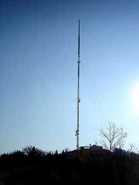
The Baden Hills are four glacier-made kames near the community of Baden in the Township of Wilmot, Ontario, Canada. Because of their elevation, up to 434 metres (1,424 ft), they have been used for radio and TV transmission towers, most notably Baden Tower on the highest and eastmost hill that hosts the antennas for Kitchener's CKCO-TV. They can be seen from practically anywhere in Wilmot Township.
References
- "Natural Areas Report: Baden Hills". Natural Heritage Information Centre. Ontario Ministry of Natural Resources. 2008-06-27. Retrieved 2010-06-24.
- "Baden Hills". Geographical Names Data Base. Natural Resources Canada. Retrieved 2010-06-24.
- "Toporama - Topographic Map Sheet 40P7". Atlas of Canada. Natural Resources Canada. Retrieved 2010-06-24.