Bad Kissingen (district)
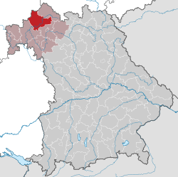
Bad Kissingen is a district in Bavaria, Germany. It is bounded by (from the northwest and clockwise) the district Main-Kinzig and Fulda in Hesse, and the districts of Rhön-Grabfeld, Schweinfurt and Main-Spessart.
History
The district was established in 1972 by merging the former districts of Bad Kissingen, Bad Brückenau and Hammelburg.
Geography
The district is located in the southern portion of the Rhön Mountains. The Fränkische Saale river (an affluent of the Main) enters the district in the north and leaves to the southwest.
Coat of arms
 |
The coat of arms displays:
- top: three icons symbolising the three spas of the district
- left: the eagle as well as the red and white pattern are from the arms of the county of Henneberg, which ruled the territory in the Middle Ages
- right: the cross from the arms of Fulda
|
Towns and municipalities
References
External links
|
|---|
| Urban
districts | |
|---|
| Rural
districts | |
|---|
|
Coordinates: 50°15′N 10°00′E / 50.25°N 10.00°E / 50.25; 10.00